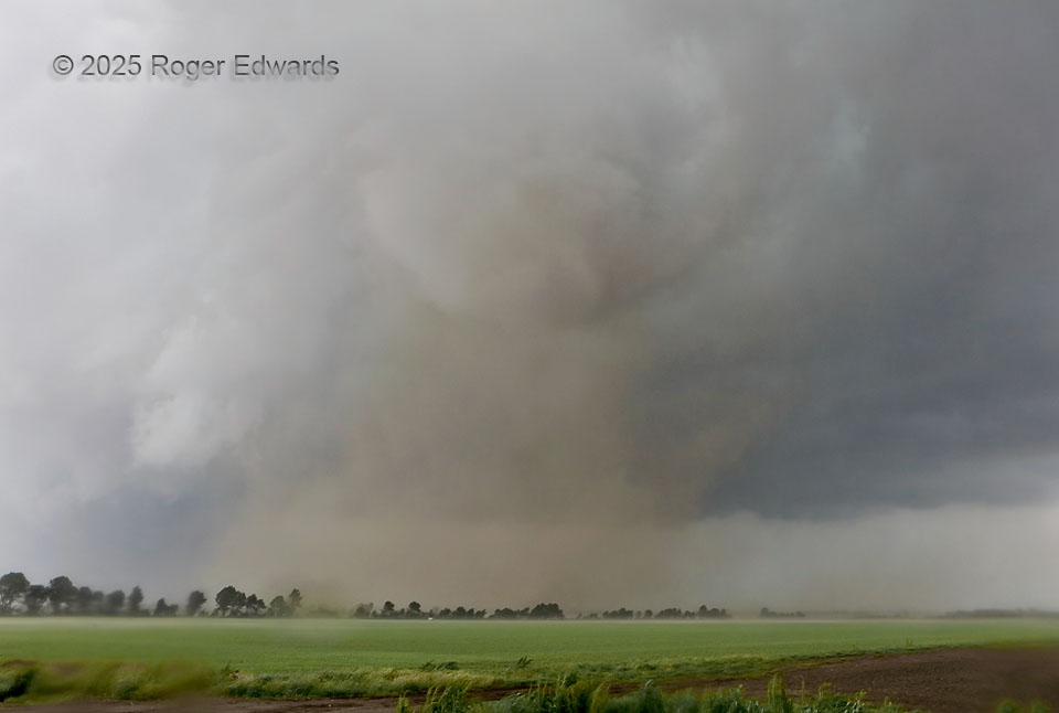
The first tornado from the future London, KY supercell formed just to our WNW in southeastern Missouri, whereupon we got out of the way and let it cross the road behind us. The roar continued, as did the hook rain and unavoidable few more drops on the lens filter, as it sped eastward through somewhat wet, somewhat dusty fields, remarkably refusing to condense a funnel below the cloud-base condensation bowl, despite the moist inflow (dewpoints around 70 F) and obvious full continuity of the vortex from ground through cloud base and beyond.
3 WSW Crowder MO (16 May 25) Looking NE
36.9465, -89.7433