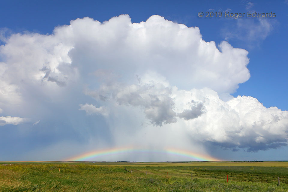
 After sweeping across the road just to my northeast with blustery force, this fast-moving, outflow-surfing, post-cold-frontal supercell emerged into sunlight with spectacular effect, flashing a brilliant mid-afternoon rainbow for a long time and many miles, near to far. Post-cold-frontal? Yes, supercells can happen in any environment where enough lift, moisture, instability, and shear exist, sometimes even behind a cold front. This was the second supercell I saw on the day, after the front nocturnally passed through the area. In this case, the storm fired in a convergence zone east of the Black Hills, with enough residual moisture to support it. Strong flow aloft offsetting the low-level northwesterlies enough that deep-layer shear still was favorable, so…voila! A supercell this was, leaving a swath of severe hail across a long stretch of southern South Dakota to near Valentine, Nebraska. This was about midway through the storm’s lifespan, and with no roads suitable for keeping up, I simply let it race away in the surrounding clean, blue sky.
7 NE Martin SD (9 Jul 19) Looking E
43.2098, -101.6147
After sweeping across the road just to my northeast with blustery force, this fast-moving, outflow-surfing, post-cold-frontal supercell emerged into sunlight with spectacular effect, flashing a brilliant mid-afternoon rainbow for a long time and many miles, near to far. Post-cold-frontal? Yes, supercells can happen in any environment where enough lift, moisture, instability, and shear exist, sometimes even behind a cold front. This was the second supercell I saw on the day, after the front nocturnally passed through the area. In this case, the storm fired in a convergence zone east of the Black Hills, with enough residual moisture to support it. Strong flow aloft offsetting the low-level northwesterlies enough that deep-layer shear still was favorable, so…voila! A supercell this was, leaving a swath of severe hail across a long stretch of southern South Dakota to near Valentine, Nebraska. This was about midway through the storm’s lifespan, and with no roads suitable for keeping up, I simply let it race away in the surrounding clean, blue sky.
7 NE Martin SD (9 Jul 19) Looking E
43.2098, -101.6147Refractive Retreat
 After sweeping across the road just to my northeast with blustery force, this fast-moving, outflow-surfing, post-cold-frontal supercell emerged into sunlight with spectacular effect, flashing a brilliant mid-afternoon rainbow for a long time and many miles, near to far. Post-cold-frontal? Yes, supercells can happen in any environment where enough lift, moisture, instability, and shear exist, sometimes even behind a cold front. This was the second supercell I saw on the day, after the front nocturnally passed through the area. In this case, the storm fired in a convergence zone east of the Black Hills, with enough residual moisture to support it. Strong flow aloft offsetting the low-level northwesterlies enough that deep-layer shear still was favorable, so…voila! A supercell this was, leaving a swath of severe hail across a long stretch of southern South Dakota to near Valentine, Nebraska. This was about midway through the storm’s lifespan, and with no roads suitable for keeping up, I simply let it race away in the surrounding clean, blue sky.
7 NE Martin SD (9 Jul 19) Looking E
43.2098, -101.6147