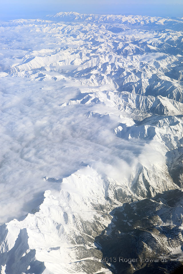
 Without looking at any surface observations for the eastern Pyrenees region, winds obviously were northeasterly at and near the surface, except where locally diverted by mountains. How could I tell? The highest topography in this area—the ridge zigzagging from foreground to background—is the border between France and Spain. Cold, moist, post-frontal air off the North Sea heads upslope across western France and forms stratus that banks up against the high Pyrenees, either evaporating very near the tallest ridge or a short distance downslope to the southwest. Between the fascinating physical processes and the striking beauty of the scene, I almost did not remember to shoot!
over France/Spain border (25 Nov 13) Looking SE
Without looking at any surface observations for the eastern Pyrenees region, winds obviously were northeasterly at and near the surface, except where locally diverted by mountains. How could I tell? The highest topography in this area—the ridge zigzagging from foreground to background—is the border between France and Spain. Cold, moist, post-frontal air off the North Sea heads upslope across western France and forms stratus that banks up against the high Pyrenees, either evaporating very near the tallest ridge or a short distance downslope to the southwest. Between the fascinating physical processes and the striking beauty of the scene, I almost did not remember to shoot!
over France/Spain border (25 Nov 13) Looking SEPyrenees Cloud Flow
Without looking at any surface observations for the eastern Pyrenees region, winds obviously were northeasterly at and near the surface, except where locally diverted by mountains. How could I tell? The highest topography in this area—the ridge zigzagging from foreground to background—is the border between France and Spain. Cold, moist, post-frontal air off the North Sea heads upslope across western France and forms stratus that banks up against the high Pyrenees, either evaporating very near the tallest ridge or a short distance downslope to the southwest. Between the fascinating physical processes and the striking beauty of the scene, I almost did not remember to shoot!
over France/Spain border (25 Nov 13) Looking SE