SkyPix

A digital photographic storybook of clouds, weather and water by Roger Edwards.

  • Home
  • Newest Posts
  • Galleries (Menu)
    • Aerial
    • All Hail
    • Burnscapes
    • Daytime Lightning
    • Floods
    • Fog and Mist
    • Gallery of Outflow
    • Hurricane Andrew
    • Mini Cloud Atlas
    • Night Lightning
    • Mostly Okie Winters
    • Panoramics
    • Sunsets and Sunrises
    • The Majestic Supercell
    • Tornadoes
    • Unusual Weather Damage
    • Visual Effects
    • Wall Cloud Wall
    • Water Works
  • About
  • F.A.Q.
  • Contact

Pretornadic Supercell

2025-07-22 By Roger Edwards

Pretornadic Supercell
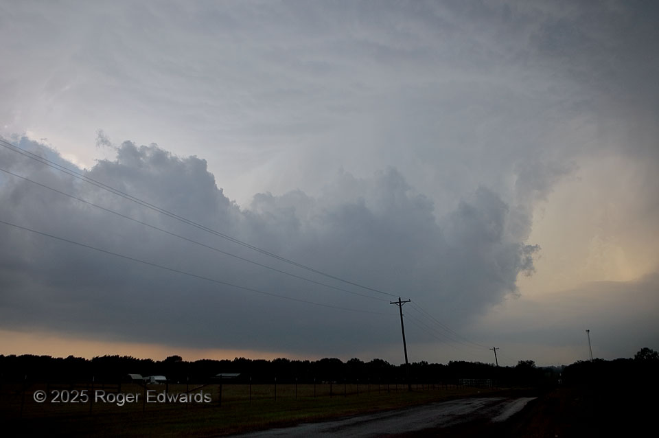
When someone asks me what I look for in a maturing supercell before it produces a tornado, I’ll describe something much like this:  a very wide, but well-tilted updraft, large and low base, juicy moist environment (preferably along a diurnally baked baroclinic boundary for added low-level vorticity, as this was), not excessive precip behind (W or SW of) the updraft, a well-formed tail extending under or in front of the vault, and no other storms nearby to interfere.  We had seen tornadoes the day before in the Missouri Bootheel region, then woke up soon after sunrise to drive 535 miles pretty much on the shortest possible route from Blytheville, AR, to here, just a county south of home.  Still, we didn’t arrive in time for storm genesis, and given the large-buoyancy environment, I was concerned this supercell could go tornadic within less than an hour after it formed (we got here about then).  Given the low LCL, high CAPE and strong low-level shear along the boundary, the “significant tornado parameter” (which I helped to develop) was increasing and in the 4 to 5 range already.  I actually thought the storm underperformed its apparent environment, and was surprised that it took another half hour or so to produce only one small tornado!

1 E Paoli OK (17 May 25) Looking SW
34.8261, -97.235

Filed Under: The Majestic Supercell Tagged With: clouds, convection, landscapes, Oklahoma, Paoli, storms, supercells, tail cloud, thunderstorms, weather

Previous: Tiered Arcus over Cornfield
Next: Furrow Flooding

About

Welcome to SkyPix, an online photo book of clouds, weather and water by Roger Edwards. As in a printed coffee-table book, every image has its own page with a unique story. After all, meaningful photography is much more than just picture-taking; it is visually rendering a moment in place and time from a perspective like none other. As a scientist and an artist, I hope my deep passion for the power and splendor of our skies and waters shines through in these pages. If you are a cloud and weather aficionado, outdoor enthusiast, outdoor or nature photographer, art lover, or anyone who craves learning, enjoy...

More

Further images from this photographer may be found at:
Roger Edwards Image of the Week
Roger Edwards Digital Galleries
Storms Observed Chase BLOG

Copyright © 2026 ROGER EDWARDS SKYPIX.PHOTOGRAPHY ALL RIGHTS RESERVED. · Design by INSOJOURN Design and Images · WordPress · Log in