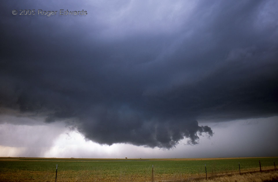
 After the lightning barrage abated, the previous wall cloud‘s mesocyclone occluded quickly and passed the rotational baton to this one, which didn’t rotate as fast but which lasted a little longer. Accordingly, we jumped east a few miles to set up the next shoot. During much of its lifespan, this peculiar supercell moved only during occlusions, jumping eastward 3-4 miles in steps instead of continuously, a pattern that repeated itself several times. When a wall cloud was forming and maturing, the storm as a whole stayed put as the mesocyclone slowly drifted N then NNW, deeper into the notch between rear-flank and forward-flank cores. Then a new circulation would form a few miles farther E, displacing (more accurately, stepping in front of) the older updraft. Notice the increase in rain behind and left of the wall cloud (to its W). This cyclic supercell, as many do, would get messier and more precip-filled with time…
9 NE Tulia TX (11 Jun 5) Looking NW
34.6466, -101.67
After the lightning barrage abated, the previous wall cloud‘s mesocyclone occluded quickly and passed the rotational baton to this one, which didn’t rotate as fast but which lasted a little longer. Accordingly, we jumped east a few miles to set up the next shoot. During much of its lifespan, this peculiar supercell moved only during occlusions, jumping eastward 3-4 miles in steps instead of continuously, a pattern that repeated itself several times. When a wall cloud was forming and maturing, the storm as a whole stayed put as the mesocyclone slowly drifted N then NNW, deeper into the notch between rear-flank and forward-flank cores. Then a new circulation would form a few miles farther E, displacing (more accurately, stepping in front of) the older updraft. Notice the increase in rain behind and left of the wall cloud (to its W). This cyclic supercell, as many do, would get messier and more precip-filled with time…
9 NE Tulia TX (11 Jun 5) Looking NW
34.6466, -101.67Panhandle Wall Cloud
 After the lightning barrage abated, the previous wall cloud‘s mesocyclone occluded quickly and passed the rotational baton to this one, which didn’t rotate as fast but which lasted a little longer. Accordingly, we jumped east a few miles to set up the next shoot. During much of its lifespan, this peculiar supercell moved only during occlusions, jumping eastward 3-4 miles in steps instead of continuously, a pattern that repeated itself several times. When a wall cloud was forming and maturing, the storm as a whole stayed put as the mesocyclone slowly drifted N then NNW, deeper into the notch between rear-flank and forward-flank cores. Then a new circulation would form a few miles farther E, displacing (more accurately, stepping in front of) the older updraft. Notice the increase in rain behind and left of the wall cloud (to its W). This cyclic supercell, as many do, would get messier and more precip-filled with time…
9 NE Tulia TX (11 Jun 5) Looking NW
34.6466, -101.67