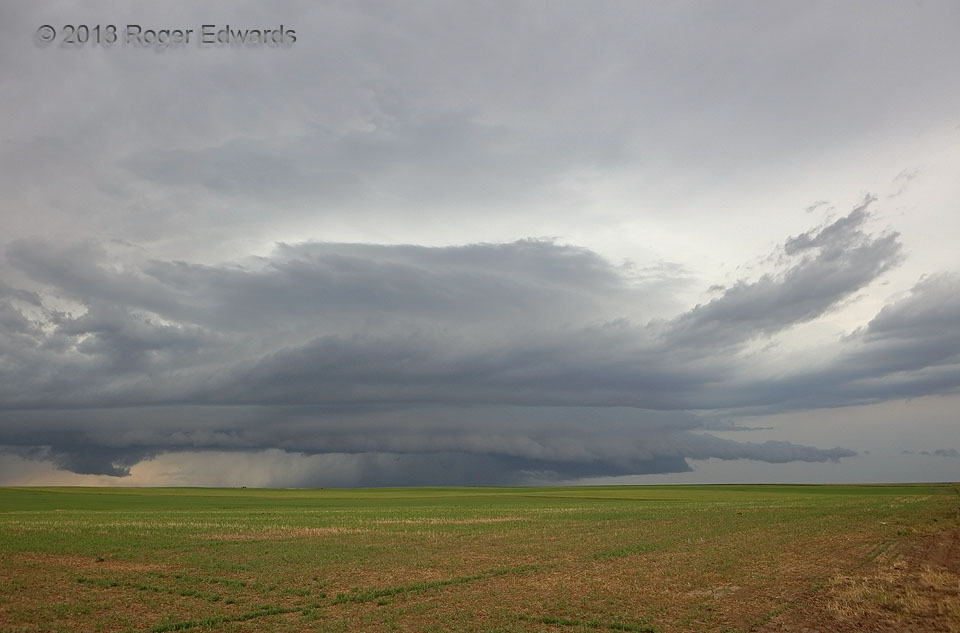
 Beneath the anvil of a broader area of earlier and ongoing convection, a pocket of residual, unstable air lay, unperturbed by all the activity around. When two outflow boundaries merged in that unstable patch, a supercell was born. Alas, the storm was in an environment of decent deep shear but weak low/middle-level flow. Despite developing a healthy midlevel mesocyclone with inflow tails, this beautiful but self-destructive storm heaved forth a little too much outflow to maintain a well-developed low-level circulation. Some storm enthusiasts don’t like the term “outflow-dominant”, but I don’t care; I call a spade a spade, and that’s exactly how this storm behaved its entire lifespan. That characteristic certainly made the storm no less amazing to behold! Multiple tiers of inflow of varying stability, above the outflow pool, created a fantastic layer cake of moving cloud material.
7 SE Harrisburg NE (16 Jun 18) Looking SW
41.466, -103.6615
Beneath the anvil of a broader area of earlier and ongoing convection, a pocket of residual, unstable air lay, unperturbed by all the activity around. When two outflow boundaries merged in that unstable patch, a supercell was born. Alas, the storm was in an environment of decent deep shear but weak low/middle-level flow. Despite developing a healthy midlevel mesocyclone with inflow tails, this beautiful but self-destructive storm heaved forth a little too much outflow to maintain a well-developed low-level circulation. Some storm enthusiasts don’t like the term “outflow-dominant”, but I don’t care; I call a spade a spade, and that’s exactly how this storm behaved its entire lifespan. That characteristic certainly made the storm no less amazing to behold! Multiple tiers of inflow of varying stability, above the outflow pool, created a fantastic layer cake of moving cloud material.
7 SE Harrisburg NE (16 Jun 18) Looking SW
41.466, -103.6615Outflow-Dominant Supercell
 Beneath the anvil of a broader area of earlier and ongoing convection, a pocket of residual, unstable air lay, unperturbed by all the activity around. When two outflow boundaries merged in that unstable patch, a supercell was born. Alas, the storm was in an environment of decent deep shear but weak low/middle-level flow. Despite developing a healthy midlevel mesocyclone with inflow tails, this beautiful but self-destructive storm heaved forth a little too much outflow to maintain a well-developed low-level circulation. Some storm enthusiasts don’t like the term “outflow-dominant”, but I don’t care; I call a spade a spade, and that’s exactly how this storm behaved its entire lifespan. That characteristic certainly made the storm no less amazing to behold! Multiple tiers of inflow of varying stability, above the outflow pool, created a fantastic layer cake of moving cloud material.
7 SE Harrisburg NE (16 Jun 18) Looking SW
41.466, -103.6615