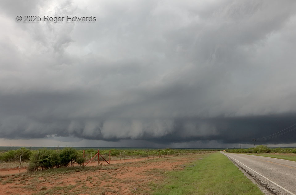
A very large, strongly rotating wall cloud could not tighten up enough to produce a tornado. This mesocyclone cycle ultimately would be undercut by its own rear-flank downdraft. The supercell’s underside was so dark partly because it was deep and strongly precip-loaded, but also, because other cells were forming immediately to the southwest and casing progressively thicker anvil material over this storm’s backside. The storml would become outflow dominant but also maintain its intense low/middle-level mesocyclone and become extremely severe, producing over 100-mph measured gusts west of Seymour within an hour.
11 NNE Swenson TX (29 Apr 25) Looking WSW
33.3525, -100.2222