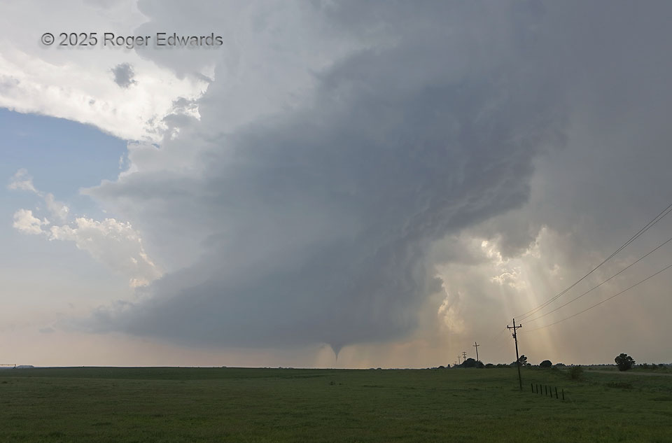
For every devoted severe-weather enthusiast, a whole-supercell tornadic scene like this is the stuff of dreams, the pinnacle of appreciative storm observing, and the reason for the thousands of miles traveled before ever beholding such a grand spectacle. Little did I know I would get another one the very next month and two states to the north. Clean, wide-angle, structure-plus-tornado views like this are rare; my only other very good one before these two was just six years before. This storm was not an LP (low-precip) supercell on radar or visually, since it had a substantial amount of rear-and forward-flank precip, including rain and sporadic hail up to two inches diameter falling from the overhead forward-flank core. Instead I would call this a skeletal classic, since the cores were still translucent and no intervening cloud deck blocked the view.
6 E Arnett OK (18 May 25) Looking W
36.1369, -99.6679