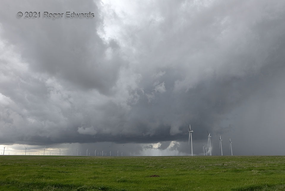
[Part 1 of 3] I could have titled this short series, “Lessons in Uncertainty in Storm Spotting”, but that sounds too long, more like the title of a research paper or PowerPoint presentation. On an uncommon “10% tornado enhanced risk” day for the High Plains of northeastern Colorado, many ingredients came together for a potential multiple-tornado event, including an anomalously rich fetch of low-level moisture underlying strong southerly flow aloft. Sometimes in these meridional-flow regimes, convection can move fast and be somewhat messy. Such was the case with this complex and scuddy supercell, looking more like a storm you’d see in Alabama instead of out here. It already had traveled about 90 miles in two hours, with a couple unproductive tornado warnings southwest of Limon. The bulk of chasers’ “red dots” were either farther south, in and south of Limon (the storm was getting away from them) or still to the north and northeast, approaching. Few others had this view, none at my spot. Here, about halfway between Limon and Last Chance, its main updraft area in the foreground was flanked by two dense cores (forward and rear flanks). This supercell ultimately did yield a stripe of reports of brief tornadoes, beginning about half an hour after this view. Perhaps the tornadic stage was beginning even sooner…as in here? The strong forward-flank core region at right kicked out quite the pronounced rain foot, seen near the bottom middle of the turbine set at lower right. Lo, what’s that immediately left of the rain foot, and behind the north side of the main updraft region? At a minimum, that was a rapidly developing, rotating wall cloud, partly rain-wrapped, likely in a “bent-back” occlusion area, and not visible to me until the forward-flank core shifted northward enough to get out of the way. It would get still more suspicious… [Go to Part 2]
16 NNE Limon CO (23 May 21) Looking SW
39.5127, -103.6218