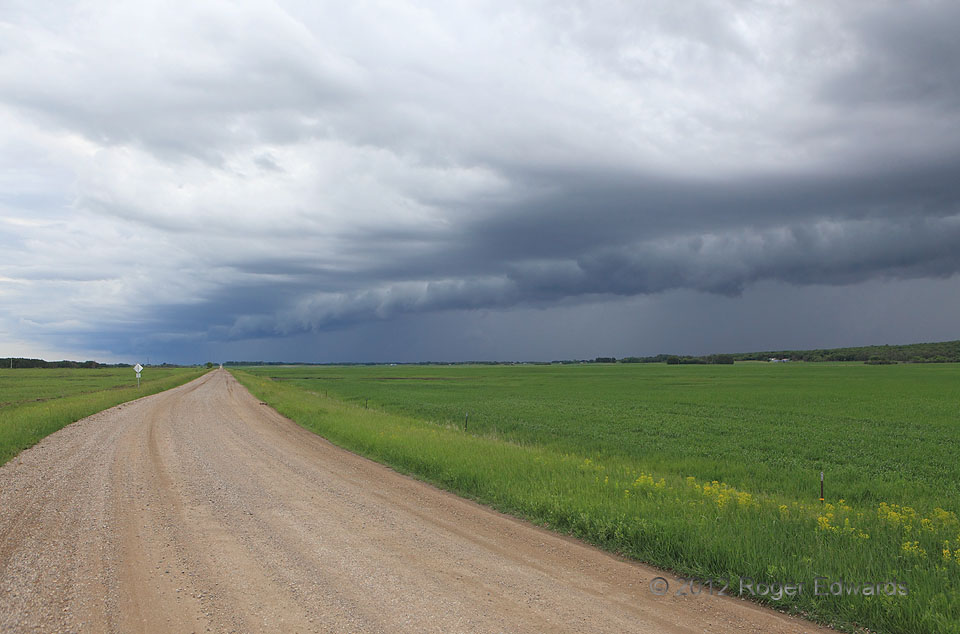
 Bringing replenishing rains to the many lakes of the “Turtle Mountains”—the wooded terrain rise visible at distant right—a band of low-topped storms churned ever closer. At this point, the tip of the arcus cloud passed due S of us, offering a fine compositional symmetry with the curvature of the roadway. This is very nearly the farthest north one can intercept a storm in the continental United States–merely 7 miles S of the Canadian border!
3 NW Rolla ND (10 Jun 12) looking S
48.8915, -99.6571
Bringing replenishing rains to the many lakes of the “Turtle Mountains”—the wooded terrain rise visible at distant right—a band of low-topped storms churned ever closer. At this point, the tip of the arcus cloud passed due S of us, offering a fine compositional symmetry with the curvature of the roadway. This is very nearly the farthest north one can intercept a storm in the continental United States–merely 7 miles S of the Canadian border!
3 NW Rolla ND (10 Jun 12) looking S
48.8915, -99.6571Northern Borderland Squall Line
 Bringing replenishing rains to the many lakes of the “Turtle Mountains”—the wooded terrain rise visible at distant right—a band of low-topped storms churned ever closer. At this point, the tip of the arcus cloud passed due S of us, offering a fine compositional symmetry with the curvature of the roadway. This is very nearly the farthest north one can intercept a storm in the continental United States–merely 7 miles S of the Canadian border!
3 NW Rolla ND (10 Jun 12) looking S
48.8915, -99.6571