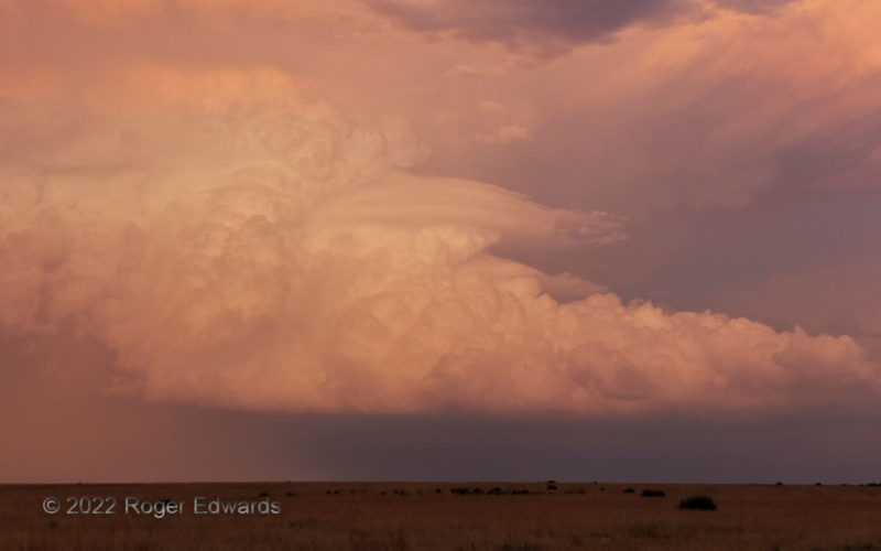
Sunset light warmed and deepened, casting its last rays on a showy supercell's flanking line of cumulus congestus towers. Meanwhile, a pronounced crown of pileus formed atop the middle towers, briefly providing a spectacular scene when viewed through a zoom. 3 NW Campo CO (7 Jun 22) Looking E 37.1484, -102.6149 … [Read more...]
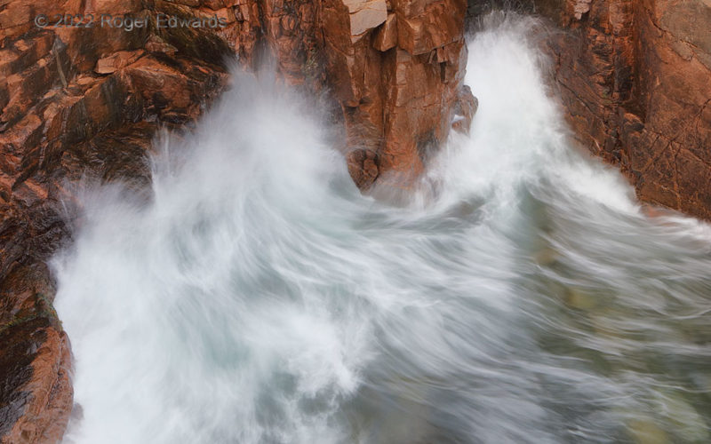
Cliff-Crashing Surf, Acadia
Riding swells on an incoming tide, bursts of heavy surf slam up cliffs along the rugged coastline of southeastern Mount Desert Island. A tight aperture with very short time exposure (1-3 seconds) is enough to streak the salty froths of foam into fluidly feathery artistry, with patterns reminiscent of longhair cat fur or "mare's tail" cirrus. 5 SSE Bar Harbor ME (2 Oct 22) Looking NNW 44.3195, … [Read more...]
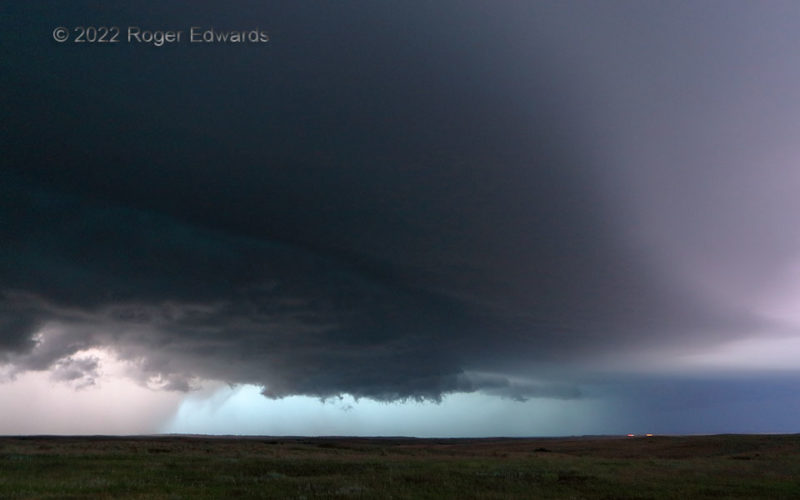
Twilight Supercell Tints
A weird storm sky flashed before us in deepening twilight. A large, late-developing supercell's main updraft area and shallow wall cloud (lower middle) spun decently but never tightened to tornadic strength, while in-cloud and in-core lightning flashes faintly illuminated the cloudscape from within. Meanwhile, what was left of high-level sunset color somehow found its way down through the dense, … [Read more...]
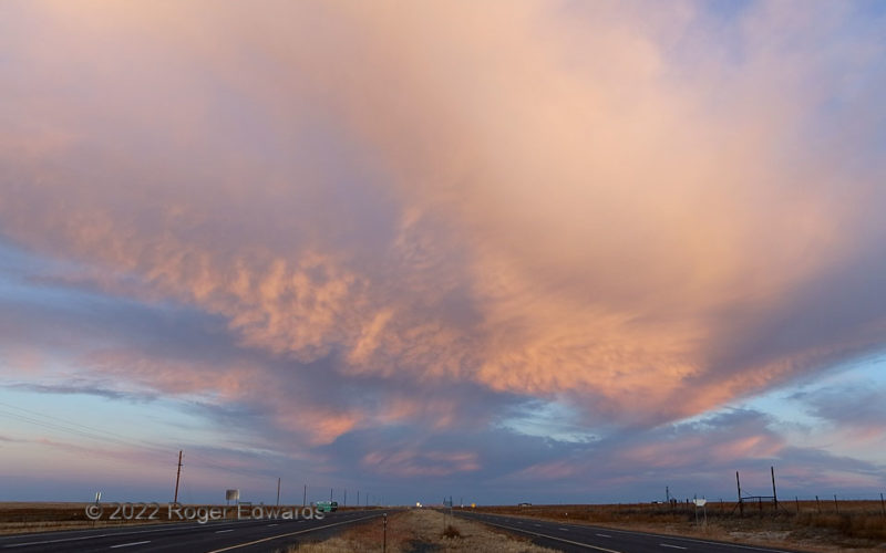
High Plains Sunrise, Clayton
On the way back from a conference and post-meeting mountain exploration, we awoke on the outskirts of Clayton to a fine sunrise, also revealed in the western (opposite) sky this time. Midlevel convection produced anvil material festooned with small mammatus formations (yet another example of "thunderless mammatus"). Texas and Oklahoma drivers starting the day here or in Dalhart, and headed to … [Read more...]
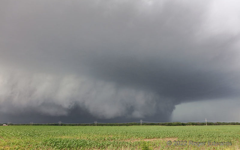
Southern Kansas Stormzilla
Though north Texas seems to be the hotbed for big, dark, dense, heavy-precip "stormzilla" supercells, you can find them elsewhere on the Plains too, including southern Kansas. They have a menacing beauty all their own, but for conscientious observers, such a storm mostly is a nasty, low-reward/large-risk mess. True to form, the "Potwin HP" churned along, accelerated by its own massive load of … [Read more...]
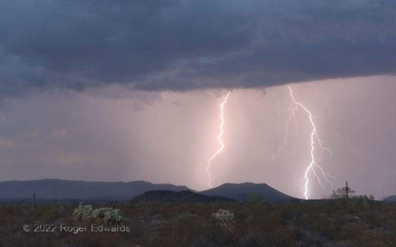
Desert Mountain Flashes
From the thunderstorm where there was just one flash, came two more. Hence, the admittedly and unashamedly unimaginative two-letter addition to the title of this follow-up! Evening travels southwest of Tucson yielded only weak, small thunderstorms, but they did spit some sparks to make the day's journey worthwhile, and truly appreciated. Foreground plants whipped back and forth in outflow … [Read more...]
- « Previous Page
- 1
- …
- 79
- 80
- 81
- 82
- 83
- …
- 413
- Next Page »