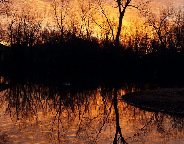
Yet another in a long series of excellent shows at the "Sunrise Tree" splashed the sky with splendor, and the water with its rippled reflection. This time the spectacle assumed the form of a broad sheet of shallow, high, finely textured, and closely spaced altocumulus clouds, exquisitely illuminated. Norman OK (18 Feb 23) Looking ESE 35.2079, -97.3767 … [Read more...]
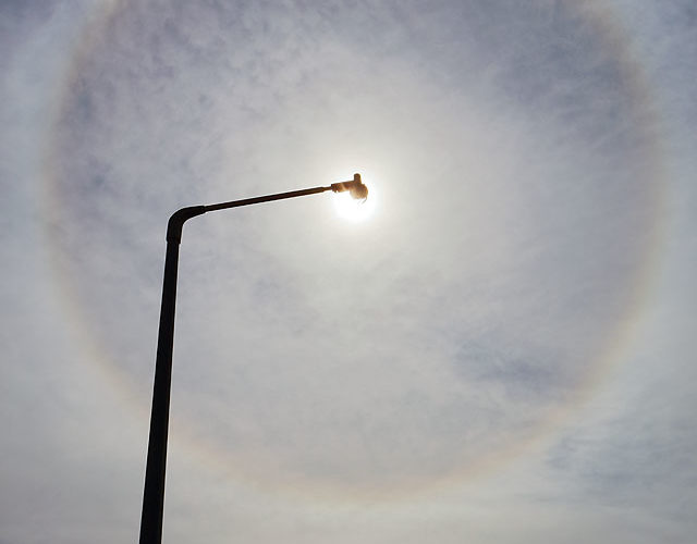
Another 22-Degree Halo
Five years and a winter after one of the finest 22-degree haloes I've seen, along came another at the same place, a few hours later in the day. This time, I decided to go vertical on the view, and to lower the exposure a bit to get more cloud detail, since the cirrus elements were more granular and textured this time. The page for the previous halo offers an explanation for this common,, yet … [Read more...]
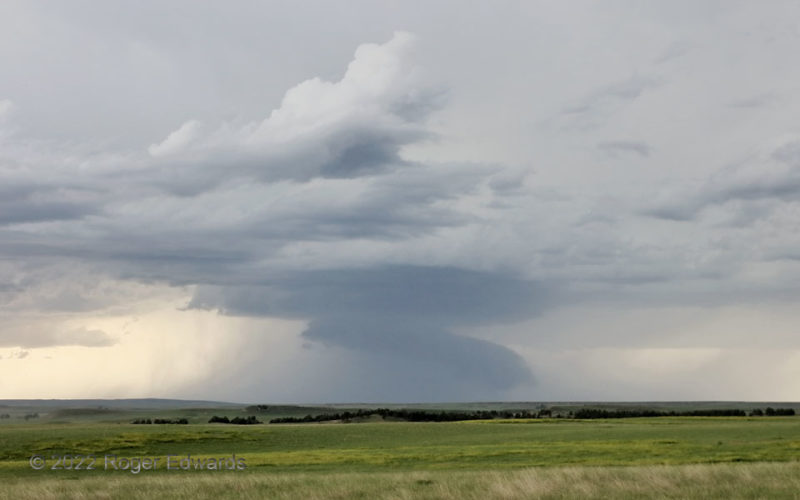
Sock Wall
The first I encountered in a chain of western South Dakota supercells, and positionally the third up from the back (south) end, passed by in increasingly rain-wrapped and high-based form. Its wall cloud elongated into a socked-foot shape before the storm moved north-northeast up the line and lose definition. The wall cloud had been more blocky and higher, but as precip increased all around, it … [Read more...]
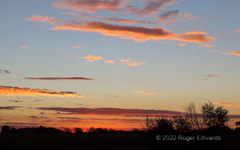
Sunrise Leaving the Land of Enchantment
Within an hour, we would leave northern New Mexico and our weeklong experience in the state behind, but in the meantime, it was well worth awakening early to step into the nippy morning air and appreciate a wonderful High Plains dawn. This was taken right from the back lawn of our motel, on the outskirts of town. The other side of the sunrise, to the west-northwest, tossed its own unique blanket … [Read more...]
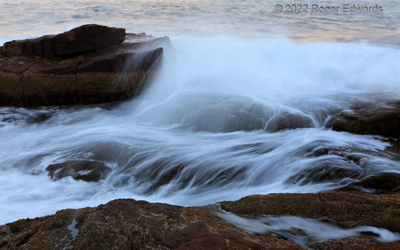
Headland Surf Exposure
Many ways exist to shoot surf, and I enjoy trying them all, from freeze-frame peeks at their crashing complexity, to wide-view scenes day or night, or in between, to the abstract, or to longer, waterfall-like, feathered exposures in the blue hour, such as this. I'd like to say it's all about the art and craft of photography, but honestly, it's also about a more primordial yet cherished … [Read more...]
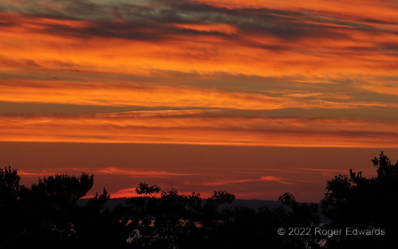
Sunrise Stripes of Acadia
Between indirect and direct sunrise colors' brilliantly illuminating a nearer field of midlevel clouds, distant cirrus bands started catching some of the earliest rays of sunshine at higher altitudes (and lower longitudes). A deep-zoom peek into their lair brings them out nicely. With all this action going on in the east, and even a little later in the west, this splendid sunrise on Mount Desert … [Read more...]
- « Previous Page
- 1
- …
- 73
- 74
- 75
- 76
- 77
- …
- 413
- Next Page »