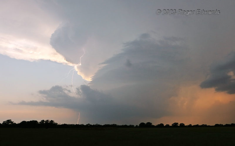
Spectacular supercell in central Texas…in mid June? You bet! The weather pattern was highly unusual to place strong, supercell-favoring flow over the Hill Country at this time of year, but there we were. This booming barber pole of swirling vapors was the second supercell in the Brady/Mason area in the span of just a couple hours, both furiously flinging electricity from their upper reaches on … [Read more...]
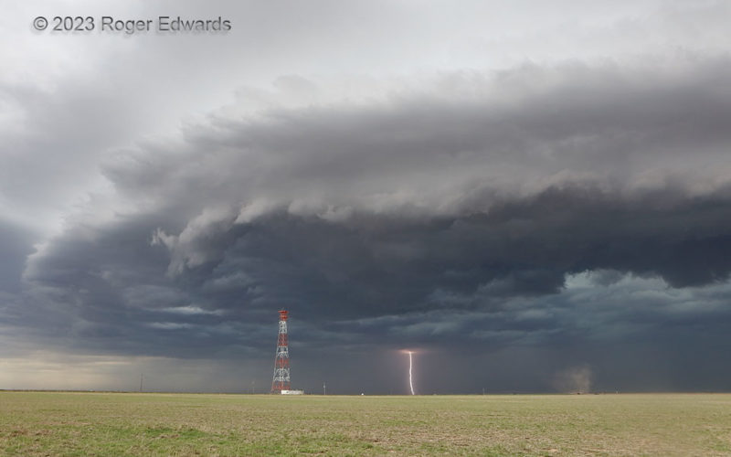
Panhandle Shelf, CG and Gustnado
The Texas Panhandle earns a well-deserved reputation for intense weather—not just from tornadoes, blizzards, heat, and hailstorms, but other severe and dangerous conditions as well. Here, a spectacular shelf cloud formed atop a tilted slab of cold, severe thunderstorm wind. A dagger of lightning for emphasis, and the rotating dust cloud of a gustnado as the bonus, completed the wild scene and … [Read more...]
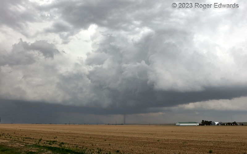
Flanking-Line Landspout: Wide Angle
Here is a "nonsupercell" tornado, a.k.a. "landspout", from a supercell. How is this possible? The seeming self-contradiction involves a common name for a non-mesocyclonic tornado, which this was, under the flanking line of a young, intensifying supercell. One of the flanking towers, despite being under heavy overcast from a large collective anvil shield, still was vigorous enough to stretch … [Read more...]
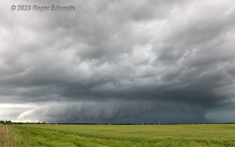
Tuttle Tempest
A few days before, I had lost a cherished storm-observing vehicle to a huge buck in eastern Colorado. Unhurt from the wreck, but more than a little sore at having missed a couple nice Great Plains tornado days while stuck in the cold rain of Denver waiting for a rental to become available, I trudged home on this day...just in time to catch this consolation prize: heavy-precipitation (HP) … [Read more...]
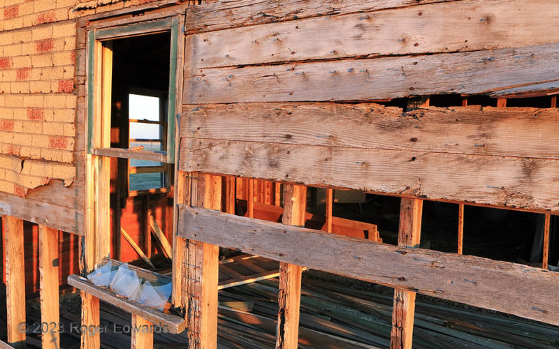
Two Windows past Grainfield
Near-sunset light streamed through all of many gaps in the main house of a long-abandoned northwestern Kansas homestead. Where children sang along to the early days of radio, or their dad whistled or mom hummed a tune while doing their chores, the only music heard today is rhythmic hymns of the prairie breezes through the walls and windows, singing an epitaph for a difficult yet determined way of … [Read more...]
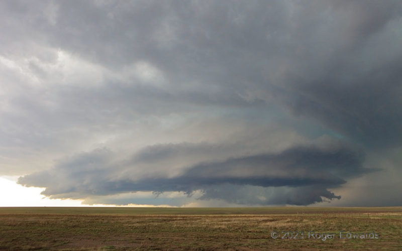
Panhandle Plates
Nowhere else but the High Plains renders even the seasoned the observer of great storms open, unsheltered, vulnerable, and compelled to awe in the moment at forces far larger and more powerful than self, and yet, inspired and awestruck in directly confronting their imposing, compelling, fluid beauty. This storm actually was two supercells: an older, leading one responsible for most of the … [Read more...]
- « Previous Page
- 1
- …
- 67
- 68
- 69
- 70
- 71
- …
- 413
- Next Page »