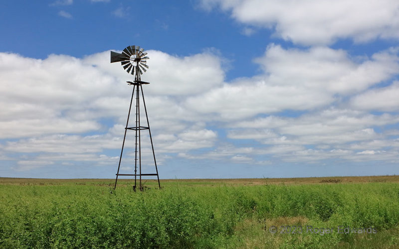
My return home from the last trip of 2023 chase season featured a scene you’ll seldom see: a verdant Oklahoma Panhandle in July, beneath a clean, blue sky full of soft stratocumulus. Multiple shots of heavy rain from thunderstorm complexes preceded this, including the one that left behind cool outflow earlier the same morning. The purity and serenity of this view made it seem if somebody … [Read more...]
Traveler’s Twilight
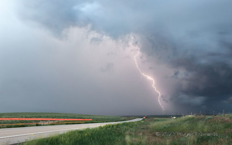
And we meet again! I observed and photographed this storm in three High Plains states. The same supercell that formed in Wyoming, and became spectacularly tornadic in Nebraska just outside Colorado, would end up in Nebraska again after crossing northeastern Colorado. Along the way, I caught up once more, northeast of Sterling, for a brief but brilliant show of rain-shrouded pyrotechnics in its … [Read more...]
Energized by Menacing Sky
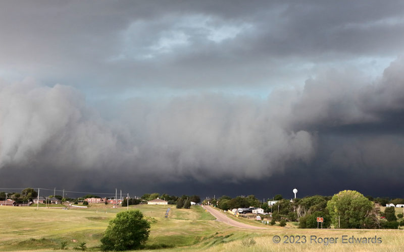
The bowing, eastward-racing cluster of severe thunderstorms battered town after town strung along I-70, then US-24, from Goodland to Colby to here: Hoxie, and beyond. Incoming wicked sky of dark, ominous character fills most citizens with dread, fright and foreboding, and understandably so. Regardless, I love this look, this experience, and have since infancy. It makes me feel energized, and … [Read more...]
Making Hay
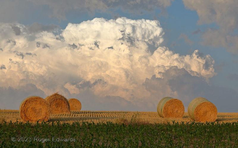
This storm-observing day threatened to end as a bust, with supercells distant north and south, and the intervening, nearby target sputtering unsuccessfully for hours. Finally, soon before sunset, a beautiful eruption of multicell storms painted the Sandhills sky to the east, while a wonderful foreground of corn and hay caught the warm light of the magic hour. How symbolically appropriate, then, … [Read more...]
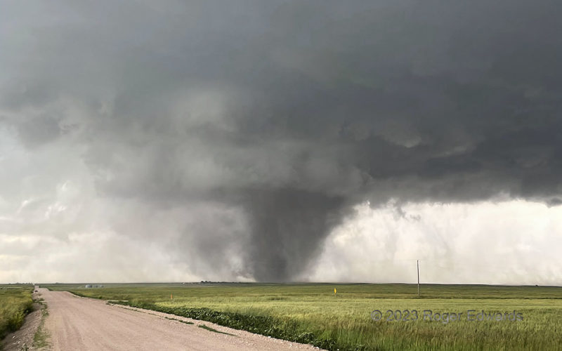
Dusty High Plains Tornado
Rather like a puffer fish, this tall High Plains tornado (best manifest by the darkest, somewhat tilted column within the dust mass) made itself look much bigger than it was. It lofted enormous volumes of dirt from a plowed field, centrifuging much of the soil outside the radius of maximum winds, then into the surrounding, subcloud mesocyclone and rear-flank downdraft. Such behavior gave it an … [Read more...]
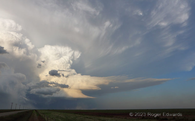
Happy Sky
Deep and crisply defined convective towers of a Texas Panhandle supercell rolled up from laminar low-level plates, pumping mass into the delicately fibrous ice-crystal anvil plume festooned with streaky mammatus. The skeletal rear-flank downdraft's precipitation plunge (lower left) still had enough thrust to launch a rain foot, and enough outflow to kick dust (lower middle) ahead of it. Though … [Read more...]
- « Previous Page
- 1
- …
- 66
- 67
- 68
- 69
- 70
- …
- 413
- Next Page »