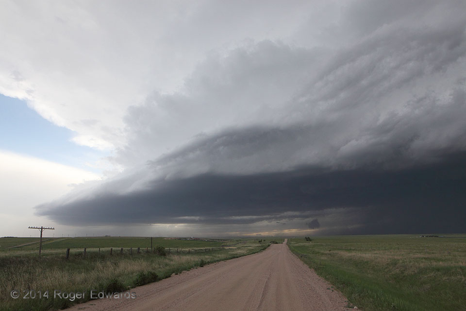
One supercell formed in the immediate lee of the Front Range, over Denver, then headed eastward across the Plains, growing and adding new cells as it went. By this time, about a hundred miles to the east, it had grown into a photogenic, outflow-dominant complex of storms with the supercell embedded, moving eastward at least 50 mph. We had very little time to stay at this spot and appreciate the … [Read more...]
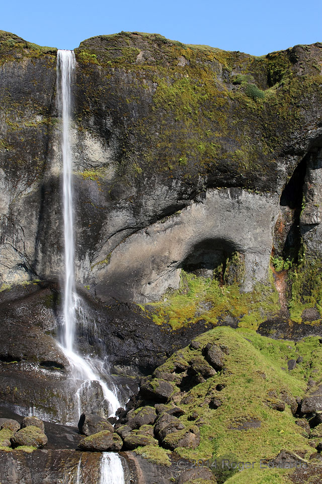
Fine Day at Krossarfoss
Krossarfoss (a.k.a. Foss á Síðu) tumbles in a tall, thin, delicate ribbon off a face of dense tuff near Iceland's southern coast, right next to a small cave. Too bad the cave is apparently on private property and its floor so tilted. Can you imagine the relaxing lullaby of the continual rushing cascade to a camper going to sleep there? Simply viewing this image, much less thinking back to the … [Read more...]
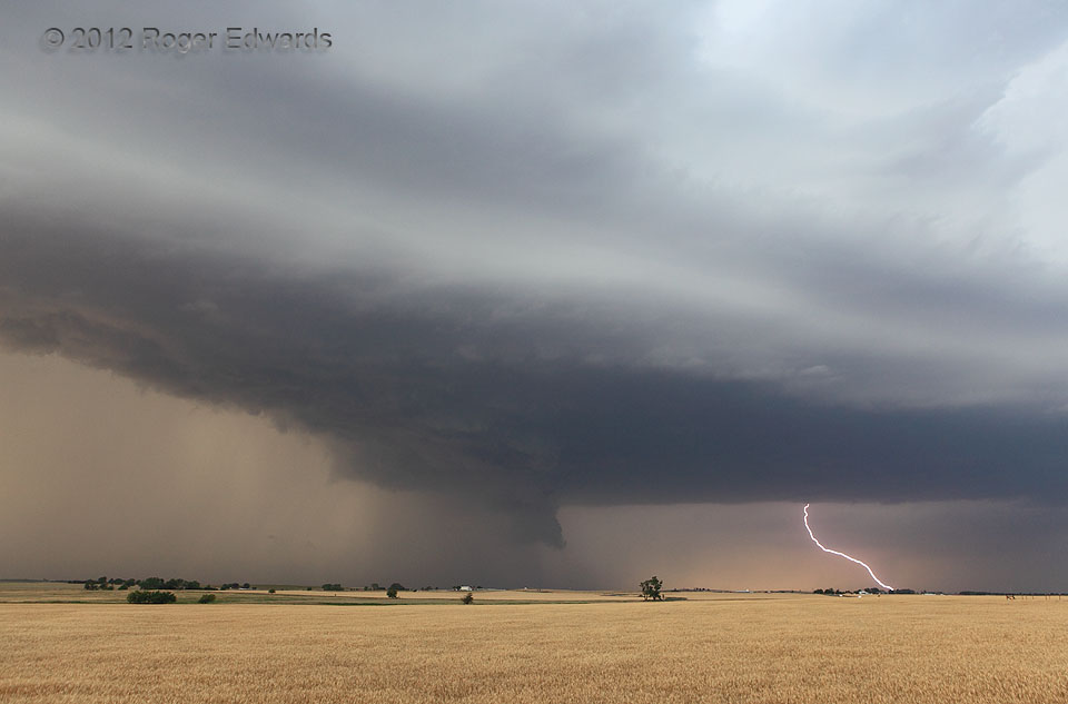
Severe Storm beyond Oklahoma Wheat
As a supercell transitioned from classic to heavy-precip in character, it blasted forth numerous cloud-to-ground strokes, both from its and the downshear area, as with this bolt. Precipitation and related outflow surges placed cold gobs of stable air beneath the wall cloud at center, ensuring this storm never was a serious tornado threat. Regardless, it was a wondrous storm to behold beyond … [Read more...]
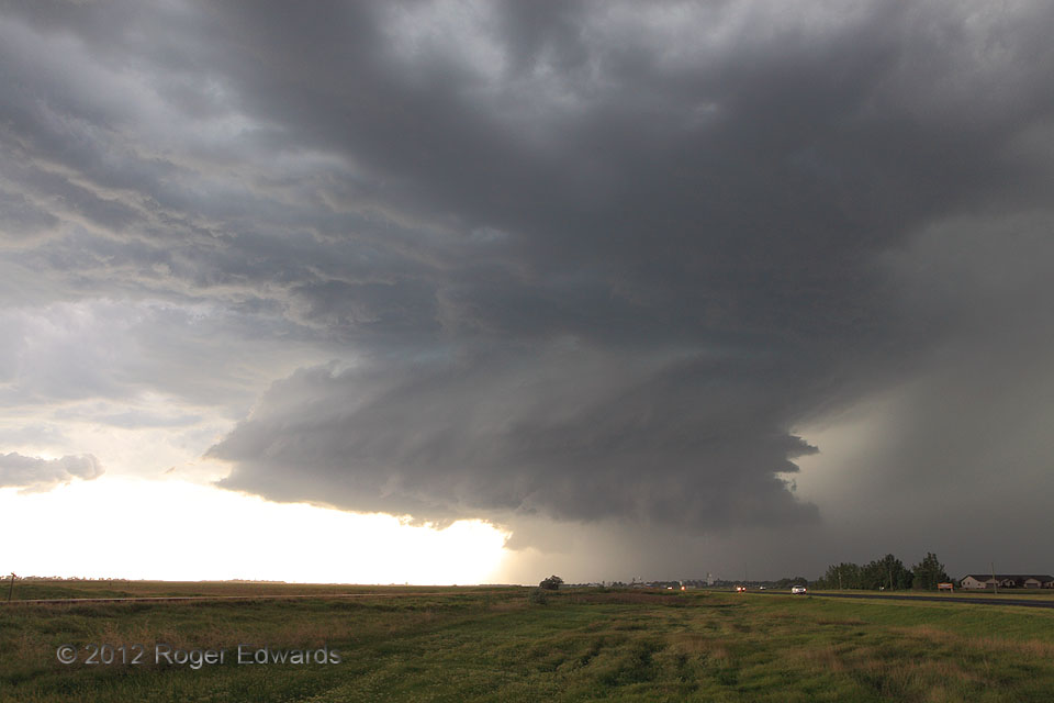
US-12 Supercell
Shortly after constructing a very well-defined but somewhat rain-wrapped wall cloud, the supercell's main updraft region actually shed much of its precipitation cloak and reorganized. The result: a brief but dazzling spectacular, directly astride US-12 in northeastern South Dakota. This sublimely stacked structure didn't last long, however. Within an hour, the storm heaved forth a large load … [Read more...]
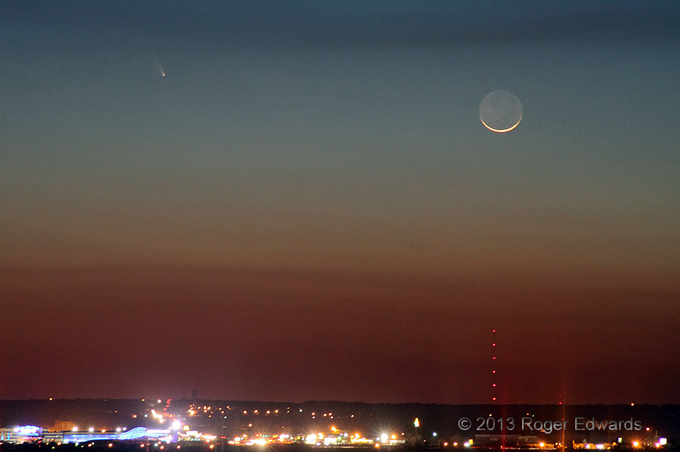
Comet Pan-STARRS, Okie Smoke and a Crescent Moon
In late twilight sky, the faint Pan-STARRS comet lines up near a very newly waxing crescent moon, the shaded side nicely bathed in earthshine, all behind assorted layers of smoke from several wildfires burning across portions of Oklahoma, reddened before the horizon's twilight glow. The comet was unusual enough, but the combination of all these elements was downright bizarre, as seen from high … [Read more...]
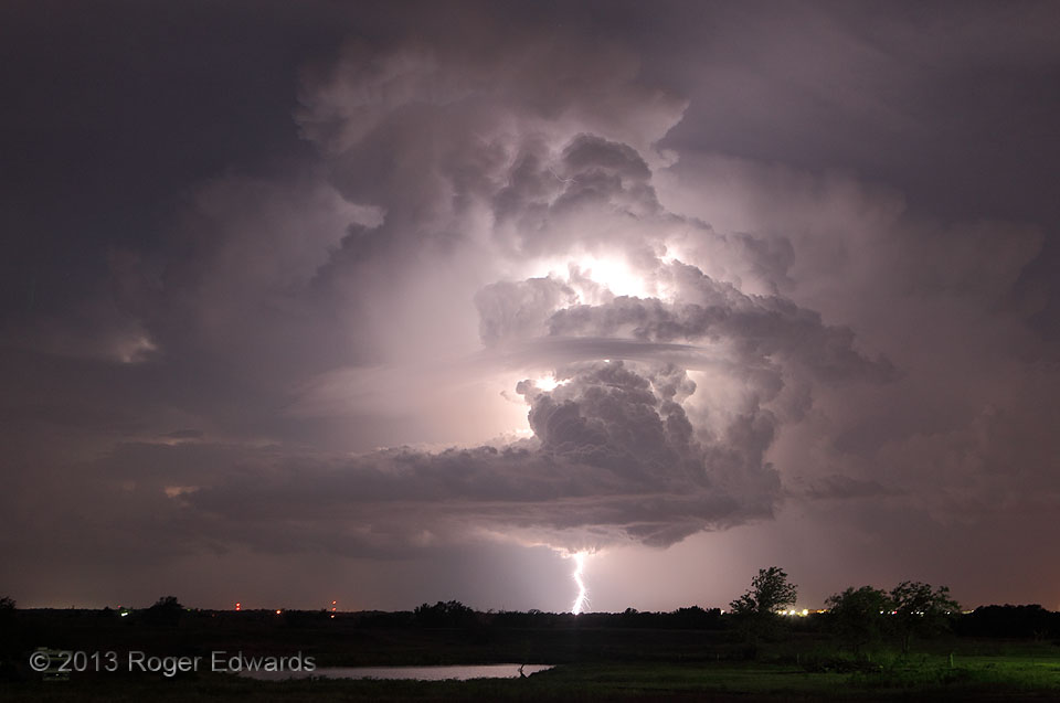
7-11 Lightning: Strike Four
Four strikes aren't allowed in baseball, but they most certainly are from any spectacular thunderstorm I'm photographing! Actually, this was just the fourth decent discharge I caught. This storm was flinging 'em fast and hot—including several I was unable to catch with an open shutter. In this brief respite from its profuse production of miles-long lateral discharges from high aloft, the … [Read more...]
- « Previous Page
- 1
- …
- 379
- 380
- 381
- 382
- 383
- …
- 413
- Next Page »