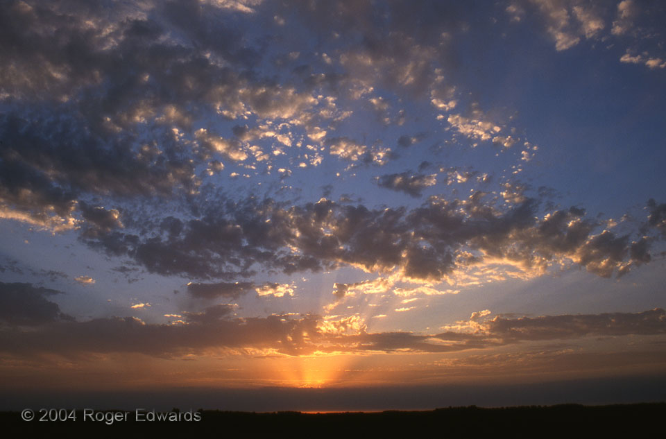
Crepuscular rays of the setting sun bathe altocumulus castellanus (ACCAS) clouds in their golden glow, as another spring day ends on the Minnesota glacial prairie. ACCAS is a sure sign of an unstable layer aloft, whether or not any deeper and lower convection ever takes advantage. In the distance, a low stratus band signals the approach of a cold front. 4 N Clarkfield MN (7 Jun 4) Looking … [Read more...]
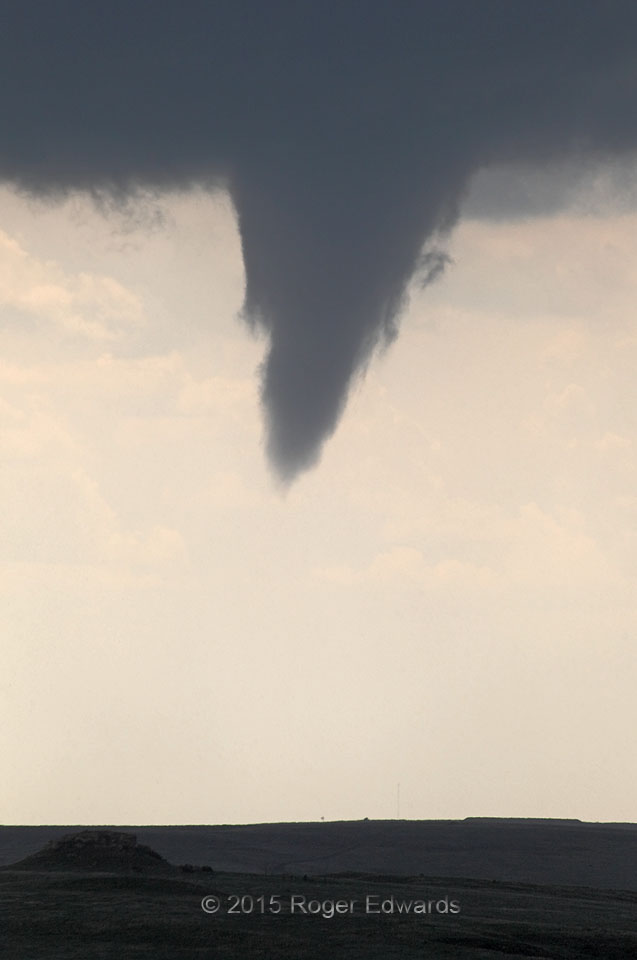
Funnel Cloud Zoom
Zooming in on a later stage of the first well-developed Canadian (Texas) funnel cloud, we see filamentous scud that, in motion, rose helically around the edges as one might expect. When a funnel cloud is evident this close to ground level, chances are that some form of its circulation exists at the surface, even if it is too weak to raise dust or to be called a tornado with certainty. Put … [Read more...]
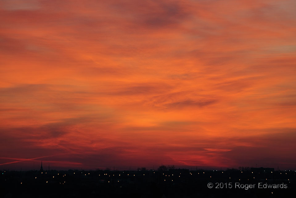
Sunrise Service
Above the twinkling lights of the end of night, a richly textured orange glow rose in the eastern sky, as if forming a painting of light reshaped by the minute. When alone with such a beautiful spectacle, high above the ground, a secular observation deck can become a temporary temple, evoking a measure of worship for the Creator who made this possible. Norman OK (4 Apr 15) Looking ENE 35.1814, … [Read more...]
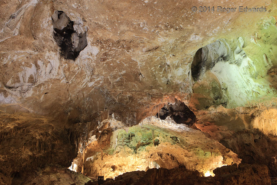
Alien Cave Form
The fossil reef holding Carlsbad Caverns dates from the Permian period, about 250 million years, with the caves less than a tenth as old. these caves formed and grew as the surrounding land rose well above sea level and mildly acidic rainwater percolated through natural faults and fissures, slowly dissolving and expanding the gaps. Around every turn a wonder of water works appears on scales … [Read more...]

High Plains Vista
During an unusually moist springtime, and especially after prolonged drought, relatively undisturbed parts of the American Great Plains erupt in carpets of color. Here, a dark-sky background from a stormy core and indirect sunlight through a thin spot in clouds above helped to accentuate the gaudy show of Texas Panhandle wildflowers, including vast carpets of Plains hymenoxys (Tetraneuris … [Read more...]
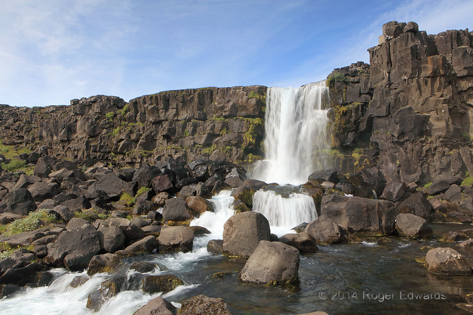
Morning at Öxarárfoss
Any morning spent at a big waterfall is a great use of the forenoon hours. This beautiful cascade tumbles over columnar basalt in Thingvellir National Park of western Iceland, a marvelous delight for all the senses and for the geologically curious mind. Photographing waterfalls in the daylight, with feathering, is a challenge—the key (as done here) being to maximize exposure time through some … [Read more...]
- « Previous Page
- 1
- …
- 365
- 366
- 367
- 368
- 369
- …
- 413
- Next Page »