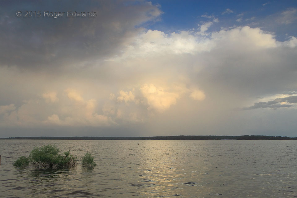
A tumultuous Independence Day afternoon of thunderstorms and heavy rain ended with this tranquil and relaxing moment. A marvelously chaotic yet calming convective sky, bathed in illumination of the approaching sunset, reflected off a flood-swollen lake whose waves gently lapped on the sandy shore. Occasional thunder rode gentle southeast breezes flowing from the cool side of the storm complex, … [Read more...]
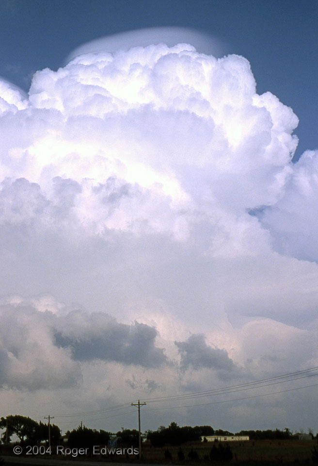
Pileus Cloud
Pileus caps are made of ice crystals high in the troposphere. They form as a slab of air is shoved upward, in the shape of a dome or cap, just above a rapidly rising convective tower. Moisture in the dome condenses directly into an ice fog as the air rises and cools, forming the pileus. Next, the convection shoots right through the newly minted cloud layer. The lifted layer above the … [Read more...]
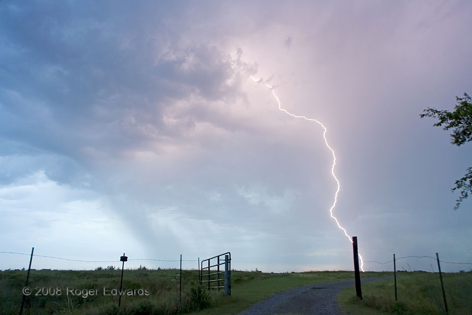
Six a.m. Strike
Normally I'm not awake at this hour, unless up all night. Fortunately, a set of overnight shifts ending at 5 a.m. left me an opportunity to shoot lightning around dawn, when a small cluster of elevated thunderstorms formed over the eastern countryside of Norman. The CGs were fairly close, but confined to a small area. Still, practical prudence dictated remaining in the car and trying for the … [Read more...]

Dry Lake Bed
Near-record low lake levels, brought about by drought, left the dessicated red-clay sediments of its bottom exposed for months and months. The result was a broad, flat, parched landscape of dried mud, riddled far and wide with deepening fissures. Normally this surface is submerged to a depth of at least eight feet. 6 WSW Little Axe OK (14 Oct 6) Looking WSW 35.2132, -97.3054 … [Read more...]
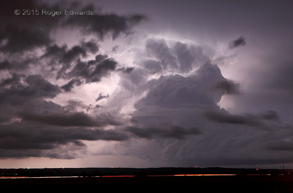
Active Night Sky
An elevated cumulonimbus drifted off to the north hauling its flank of deep cumulus congestus, spitting lightning filaments every which way as as an intervening armada of scud clouds further textured the chaotic scene. This fascinatingly busy sky offered a strobing aerial light show to travelers on Interstate 80 in the foreground. 1 SE Ogallala NE (15 May 15) Looking NNE 41.1057, -101.7 … [Read more...]
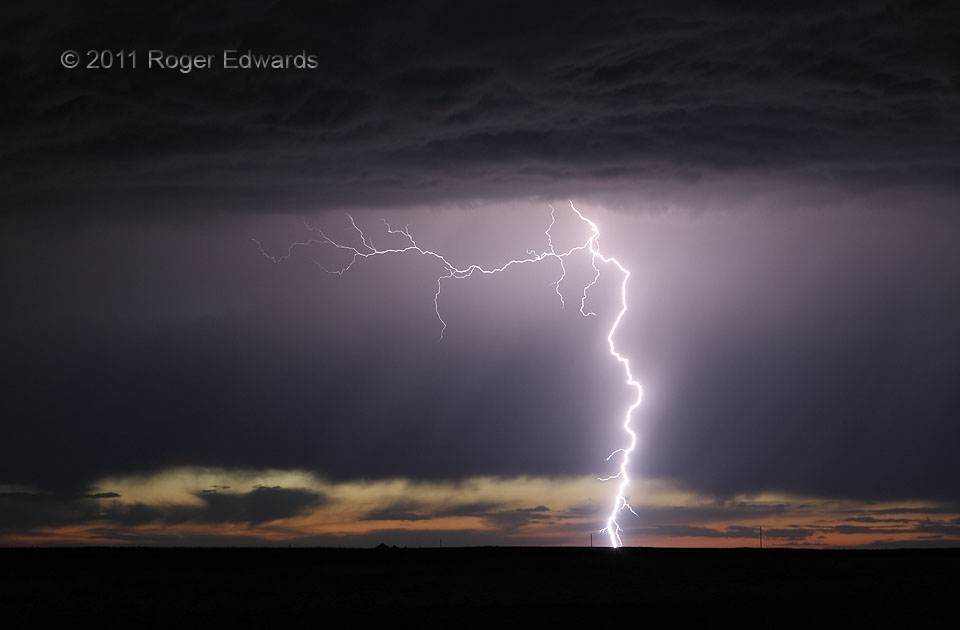
Down and Out
This high-based and elevated thunderstorm was part of a short line that fired in Wyoming, where the Plains meet the mountains. The line rumbled to the southeast, fueling itself on residual moisture and instability found above an outflow pool from earlier, dissipated storms. The electrical display it offered was spectacular, as often is the case for any twilight to nocturnal storms on the High … [Read more...]
- « Previous Page
- 1
- …
- 363
- 364
- 365
- 366
- 367
- …
- 413
- Next Page »