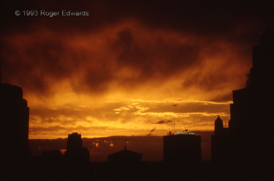
From deep in the archive of film slides comes this jewel that I finally scanned in 2011, nearly 18 years after clicking the shutter. The downtown skyline of Kansas City, as seen from the 17th floor of the Federal building, framed another splendid sunset. Thunderstorms from late afternoon had weakened and moved east, leaving behind a plethora of middle- and high-level clouds, some of them … [Read more...]
Unsanitary Abstraction
From the image alone, try to guess what is being shown, without reading past this sentence. The setting is a flood near record levels on Lake Thunderbird, east of Norman—thus, the reddish hue of the water in shadows. The green wall is that of a dumpster floating in the lake, catching beams of late-afternoon sunlight between trees located behind me. All manner of loose trash and debris washed … [Read more...]
Striped Mammatus
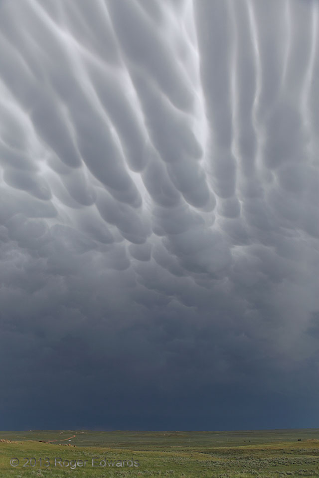
As a complex of severe thunderstorms receded south-southeastward across the appropriately named Thunder Basin National Grassland, surfing its own outflow while spewing severe hail and wind, it left behind an extensive field of mammatus. This formation, however, represented an elongated and striking form that occasionally resembled closely swimming dolphins or can-packed sardines. 28 WSW … [Read more...]
Quintessential Great Plains
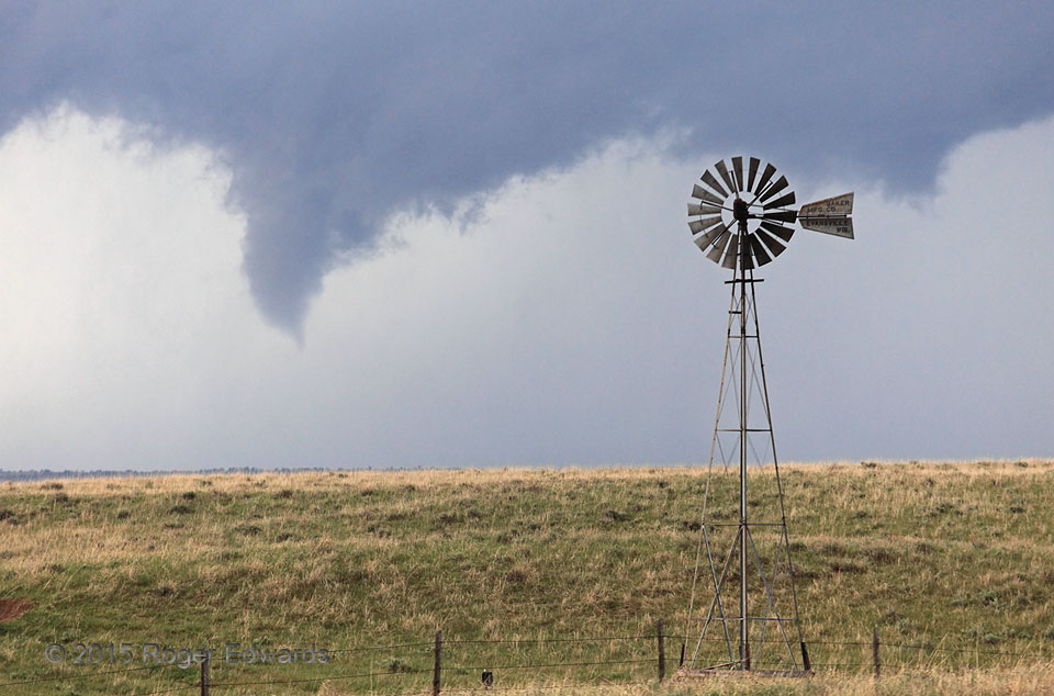
What can be more evocative of the Great Plains ideal than rolling shortgrass prairie, a windmill, and of course, a funnel cloud? Fortunately for a few locusts and jackrabbits in the projected path, the circulation producing the persistent but only modestly spinning funnel never intensified into a tornado, as far as we could tell. 8 SE Bridgeport NE (15 May 15) Looking WSW 41.587, -102.984 … [Read more...]
Iced Pecans
Still held fast to their formative limbs, pecans dangle encased in ice after a bout of freezing rain. Normally 15–20 feet or more above ground, the branches sagged severely from the weight of the ice, bringing them down at or below eye level. In this case, they didn't snap, and within a few days after the ice melted, resumed essentially their former positions. Thousands of other limbs and even … [Read more...]
Striations over Funnel
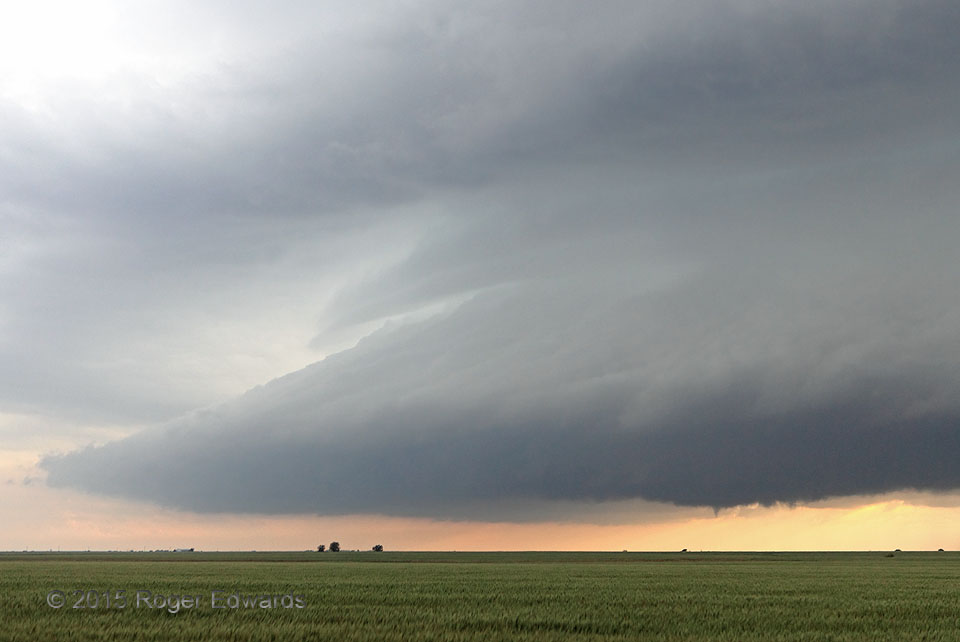
After intercepting a small, singularly tornadic supercell in southern Kansas, attention turned to a much larger storm in northern Oklahoma that tried very hard a few times but couldn't spawn a surefire tube. Storm size isn't everything! The funnel cloud at lower right was one such attempt, but overshadowed by the dramatic fluid sculpture of the supercellular cloud form itself. 2 NW Renfrow, OK … [Read more...]
- « Previous Page
- 1
- …
- 362
- 363
- 364
- 365
- 366
- …
- 413
- Next Page »


