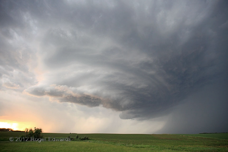
We already had seen two fantastic supercells on this day near South Dakota's run of US-12: one looming over the highway near Aberdeen and another with rings-of-Saturn striations closer to the Minnesota border. That just wasn't enough! Even though this young, clearly spinning storm was becoming elevated over rain-cooled air from an earlier gob of storms, its internal dynamics maintained … [Read more...]
Apricot Light
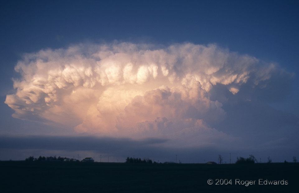
The fading day's rays shone fruitfully upon convectively sculpted cloud towers of a supercell receding away from us and across the northwestern outskirts of the Oklahoma City area. We had intercepted a briefly tornadic supercell farther north, watched it disintegrate, then headed over to this, the succeeding storm. That move was well worth the effort! This supercell followed us eastward for … [Read more...]
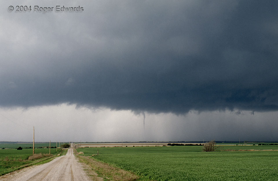
Custer City Spinup
This short-lived, slender tornado danced across the verdant springtime prairies of western Oklahoma for just a couple of minutes, kicking up some thin puffs of dust, but otherwise causing no damage and doing nothing noteworthy besides posing briefly for the lens. The parent supercell didn't produce any tornadoes until after another storm to its SW had merged with it, resulting in a short line of … [Read more...]
Sunlit Funnel Tip
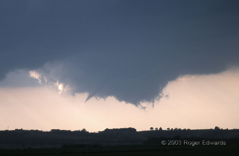
After the long and determined drive directly across hundreds of miles of the Great Plains, we watched this wall cloud and funnel develop in classical fashion. The tapered tip, here brightened by sunlight streaming through the clear slot, soon would grow groundward (through pressure drop) to greet the invisible, tornadic inflow. 10 SSW Sargent NE (9 Jun 3) Looking NW 41.4962, -99.3896 RADAR … [Read more...]
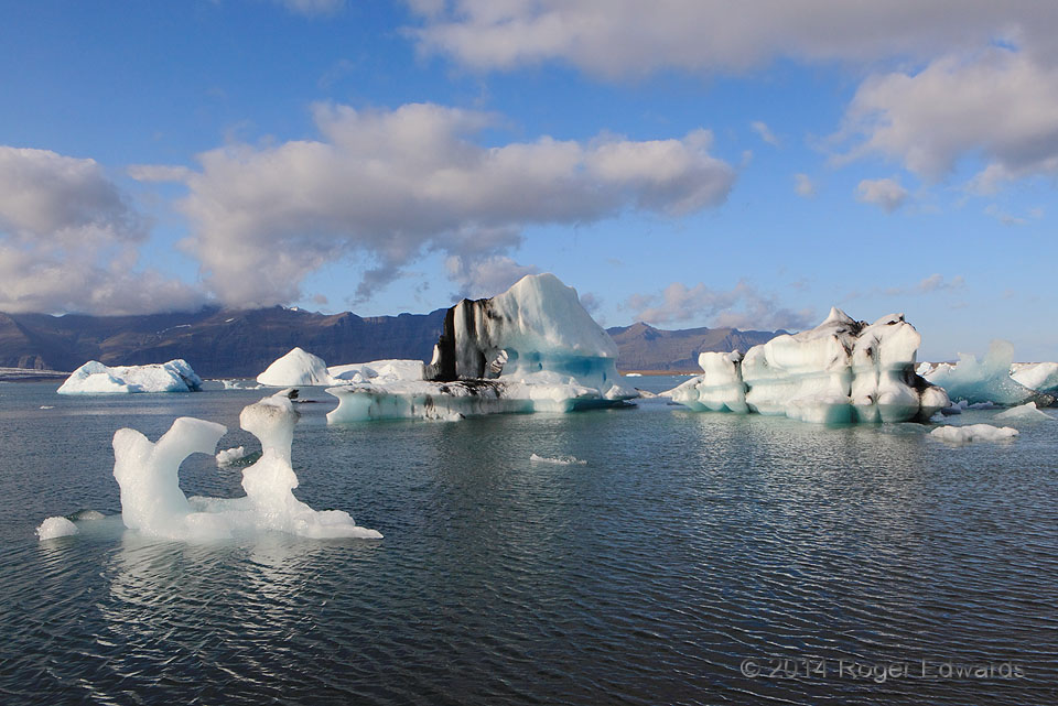
Shades of Blue
In the ubiquitous lists of the world's most beautiful natural places to see in a lifetime, Iceland's Jökulsárlón appears as often as anything. This is but a brief glimpse of why. The 3,000-foot-deep Vatnajökull sheet glacier has an arm with an even bigger mouthful of a name, Breiðamerkurjökull, dropping icebergs into the lake on a daily basis. Each berg is a unique piece of natural art, turning … [Read more...]
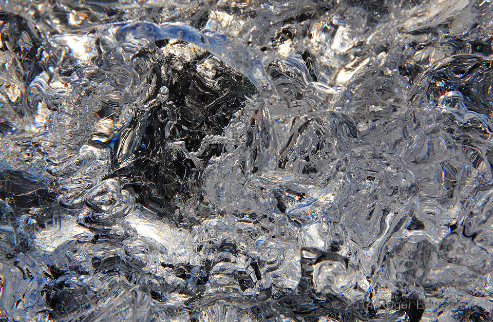
Jokulsarlon Ice Abstraction
Folks travel from all over our globe to visit the natural wonder of Jökulsárlón ice lagoon, with its sweeping vistas of blue and curiously shaped icebergs. Whither the macro perspective too? One can get mesmerized peering into beached glacial ice, especially in sunlight when refractions and reflections maximize and intermingle, affording exquisitely complex, abstract, distinct and sparkling … [Read more...]
- « Previous Page
- 1
- …
- 350
- 351
- 352
- 353
- 354
- …
- 413
- Next Page »