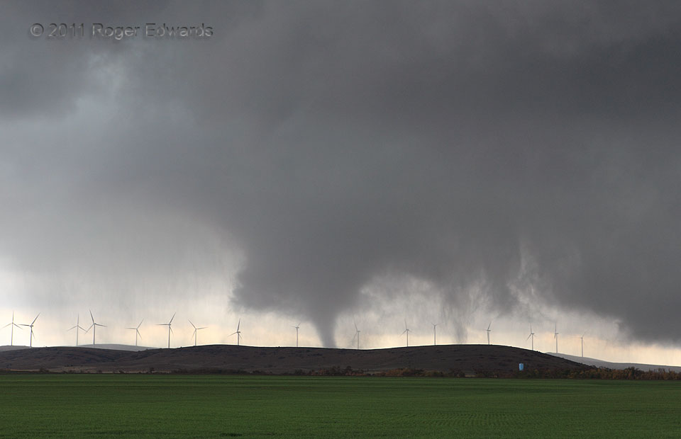
For a brief time, the "Wind Farm tornado" bore two distinctly visible tubes, as main vortex reorganized and one of the western subvortices tightened and condensed better. Chances are, however, other unseen swirls were happening in this broad, chaotic and rapidly evolving tornadic circulation. In the storm-scale environment, including the broader mesocyclone, the blades' rotational planes pivoted … [Read more...]
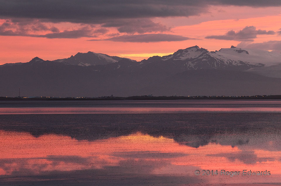
Sunset over Skardsfjordur
Just moments after another uniquely wondrous and ethereal scene just a few hundred yards away, magnificence blossomed across the Skardsfjordur fjord, beyond the lights of Hofn, and over the distant, snow-capped peaks of southern Iceland. A deep zoom lens allowed me to capture this most intensely colored part of a splendid scene this bountifully majestic northern landscape. 6 E Hofn, Iceland … [Read more...]
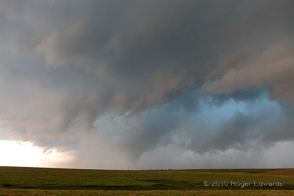
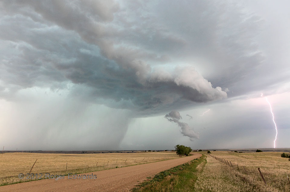
Slapout Start
The messy, seemingly outflow-dominant supercell already had been colorful, with turquoise-toned cloud chasms from which copious rain and hail cascaded all around the old, previously tornadic mesocyclone. It just didn't look like the storm would produce another tornado, at least up to about 30 seconds before this photo. We just had finished photographing an abandoned house and were heading E on … [Read more...]
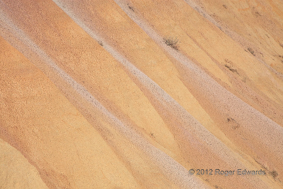
Wavy Clay Slopes
Despite being many hundreds of miles from today's ocean waters, the South Dakota Badlands are full of waves! Differential erosion, drainage and deposition are the five-dollar terms for the water-flow processes that lead to undulating surfaces of different kinds of clay. With their source being horizontal, multicolored clay, ash and silt deposits, the kind of sorting done in heavy rains and … [Read more...]

Draining Hoffelsjokull
Deep blue reflections of sky on a meltwater stream punctuate the textured gray landscape of outwash gravels, draining the Hoffelsjokull glacier arm in southeastern Iceland. The scene was abstract, yet real—an exercise in stillness and listening to only two sounds: that running water and a gentle, cool breeze. It was tempting to sit there with eyes closed for a very long time... 1 NW … [Read more...]
Elm Springs Blast 1
The word "blast" here can have two meanings: the intense gusts of outflow soon to hit the filming location, or the electrical discharge brightening the afternoon sky downshear from the main precipitation area of the storm. In this case, as in the next shot, both interpretations were valid! This storm had been a weakly organized supercell, but was too high-based to avoid being undercut by its own … [Read more...]
- « Previous Page
- 1
- …
- 346
- 347
- 348
- 349
- 350
- …
- 413
- Next Page »