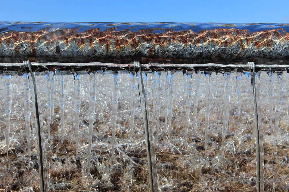
An armada of icicles dangled from an ice-encrusted, rusty steel pipe that held up a farm fence. I placed the horizon behind the pipe so that it could act as a visual transition or barrier between sky and icy, grassy landscape, lending a somewhat offbeat and unfamiliar tempo to the image. Norman OK (24 Dec 13) Looking W 35.232, -97.3707 … [Read more...]
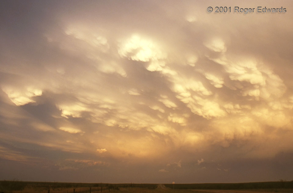
Shadowy Mammatus
Cool clumps of mammatus, dangling beneath a retreating anvil canopy, cast sharply defined shadows through the golden glow just before sunset. During intercept activities, this storm hadn't done much besides drop 1 to 1.5 inch hail. It treated a train of fellow storm observers to a splendid West Texas sunset. A storm that never had a chance of producing a tornado became a great memory for … [Read more...]
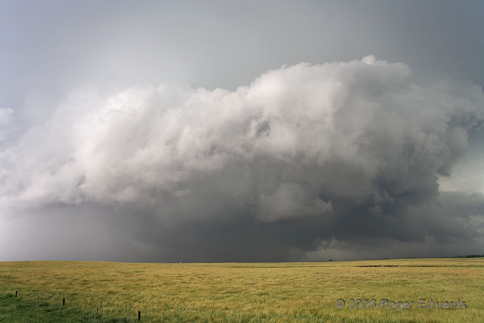
Whirling Dervish
This storm probably never had much chance to be sharply sculpted; it was too turbulent and rotating too fast! For about half an hour, what had been a rather nondescript, high-based, marginal supercell began to spin furiously and turned sharply southeastward in classical right-moving fashion. Ragged cloud material whipped rapidly around an intense low level circulation that was tornadic at … [Read more...]
Geothermal Ephemerality
Hot springs all across Yellowstone National Park, including here in the Norris Geyser Basin, exude odd hues, thanks to combinations of heat-loving aquatic bacteria and both suspended and precipitated minerals. The result is a nearly endless variety of abstract forms of tint and texture, especially at the level of zooms into parts of a given spring's pool. These shapes and colors change over … [Read more...]
Rusty Pelicans
Vintage, rust-encrusted metal pilings from the 19th century obviously serve as popular perches for pelicans in the Dry Tortugas. There, safe places to rest above ground, within sight of food fish, and away from the reach of people, are not common. I didn't notice this scene until playing with zoom settings, scanning left and right, when a composition that I found immediately unique and … [Read more...]
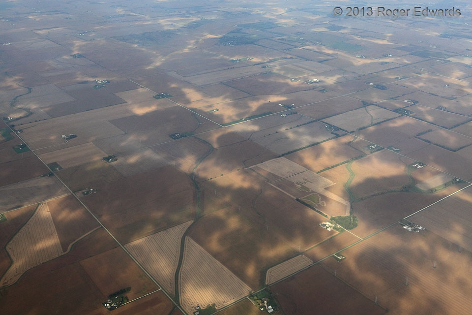
Shadows of Stratocumuli
After descending through a deck of stratocumulus clouds that had a rather uniform and nondescript appearance topside, this marvelous abstract artwork of shadow and light wriggled across the Corn Belt landscape of farms, mostly harvested fields and township-range road grids. over northern IL (11 Oct 13) Looking NW … [Read more...]
- « Previous Page
- 1
- …
- 324
- 325
- 326
- 327
- 328
- …
- 413
- Next Page »


