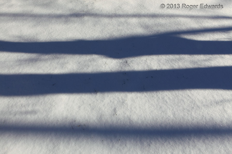
Textures of snow, crossed by tree shadows, create a sparkling, banded wintertime landscape. Wintertime in the snowy woods is one of the quietest experiences, the silence broken only by the occasional, lonesome call of a cold and hungry bird, or soft puff of snow cascading off a branch. Norman OK (6 Dec 13) Looking NW … [Read more...]
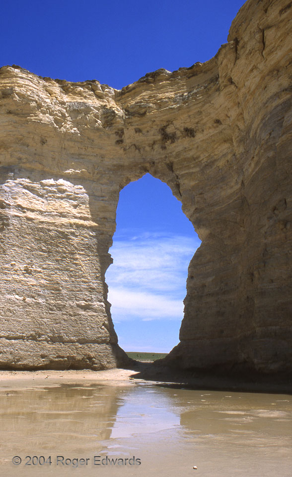
The Window
One of the great places of the Great Plains, "The Window" or "Keyhole" of Monument Rocks offers a peek not only through an eroded butte, but into the power of water—drops at a time. Once, around a million years ago, a blanket of High Plains sediments, washed by streams from the Rockies, covered this area much deeper than any of the Cretaceous chalk which forms the buttes here. Water carried … [Read more...]
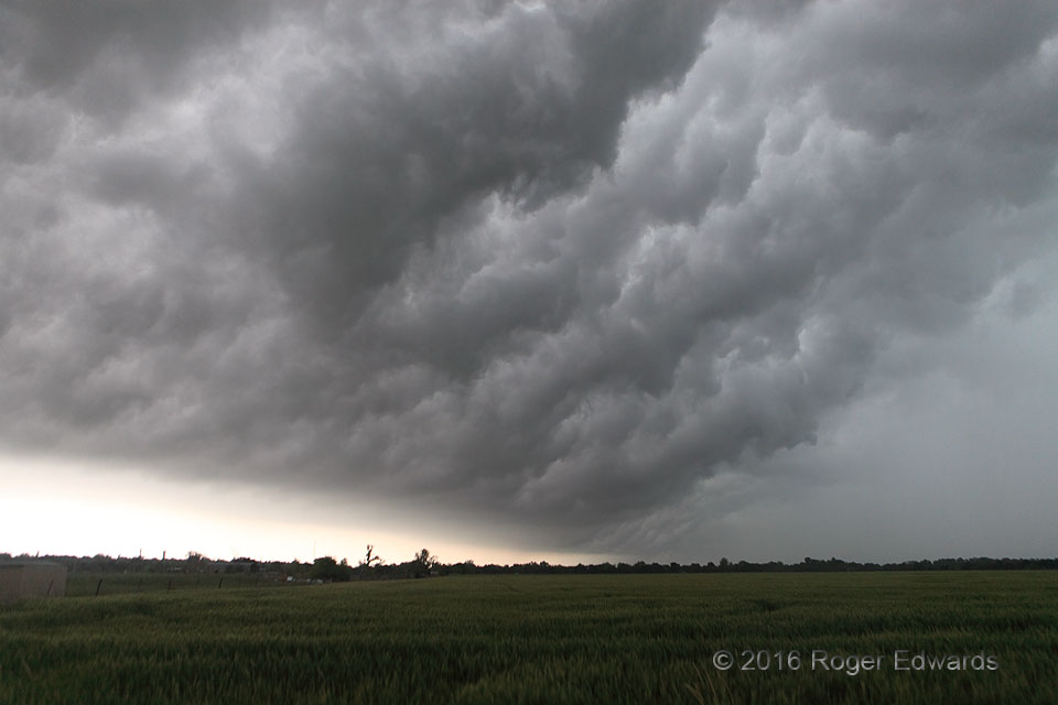
Turbulent Underslope
Rib-like cloud formations rose up the slope of the inside of a shelf cloud, also known as the "whale's mouth", turbulently ascending atop the cold density current extruded from a line of severe thunderstorms. Simply staring at the chaotic motions of such clouds can be mesmerizing, almost hypnotic, such that one must not lose awareness that a wall of wind and rain soon will hit. Nine years … [Read more...]
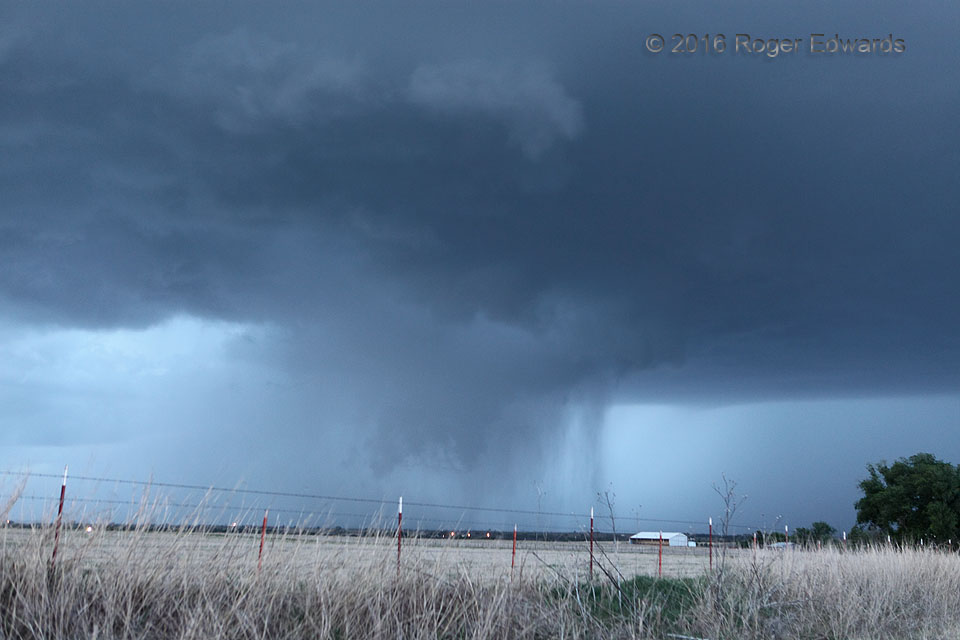
Rain-Wrapped “Pseudonado”
In the deepening darkness of twilight, a scene such as this is lower in contrast and dimmer to the eyeballs than to a camera set to long exposure and low f-stop. Spotters need to concentrate intently on suspicious features, particularly when they are persistent and "in the right place", such as the conical lowering shown here. A fortuitously positioned rain shaft appeared to connect the lowering … [Read more...]
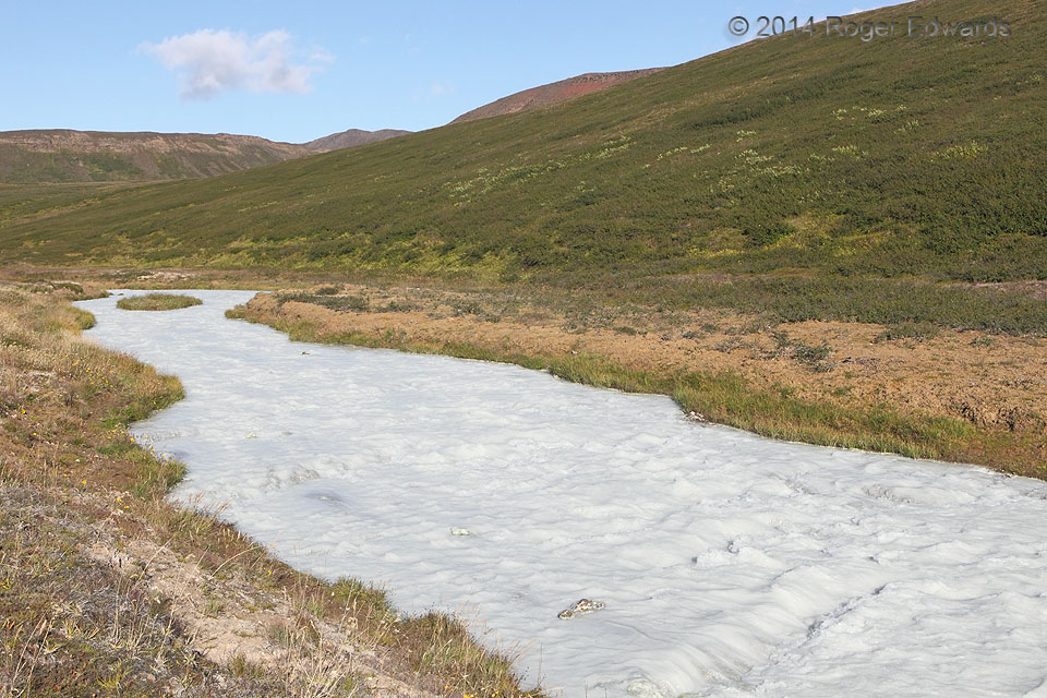
Krafla Milk
For the jaded, this scene might bring to mind some frightening documentary on egregious industrial pollution. Instead, the milky appearance of this creek, draining the Krafla volcanic caldera of northeastern Iceland, comes from turbulently stirred natural sediments. Ultimately, this stream empties into beautiful Lake Myvatn, a clear body of water where the load of suspended particles settles … [Read more...]
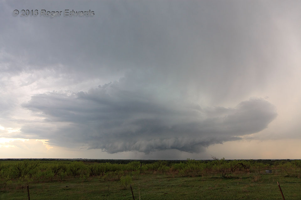
Supercellular Resurrection
Every year of storm observing, I see amazing new things in the sky, despite hundreds and hundreds of supercells experienced over the decades. The atmosphere almost always succeeds in teaching a fresh lesson and offering a novel experience. On this day, a big, messy multicell briefly became a supercell, then lost the mesocyclone and enlarged into an even more swollen, clustered mess. From that … [Read more...]
- « Previous Page
- 1
- …
- 309
- 310
- 311
- 312
- 313
- …
- 413
- Next Page »