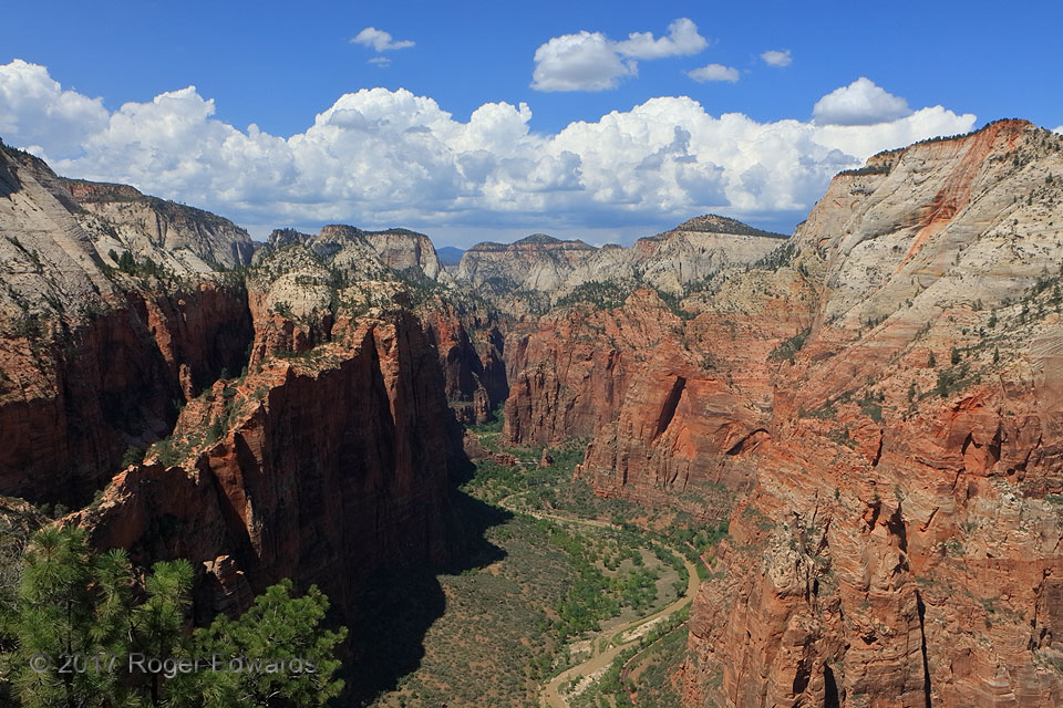
To arrive here, one must hike a series of switchbacks adding up to 2.5 miles and 1500 vertical feet each way from the Virgin River, or a total of 5 miles and 3,000 vertical feet. Parts of the hike ain't easy, traversing slick, tilted, sand-covered rock slopes bracketed by thousand-foot dropoffs within just a few feet distance on either side (or sometimes both sides at once). Needless to say, the … [Read more...]
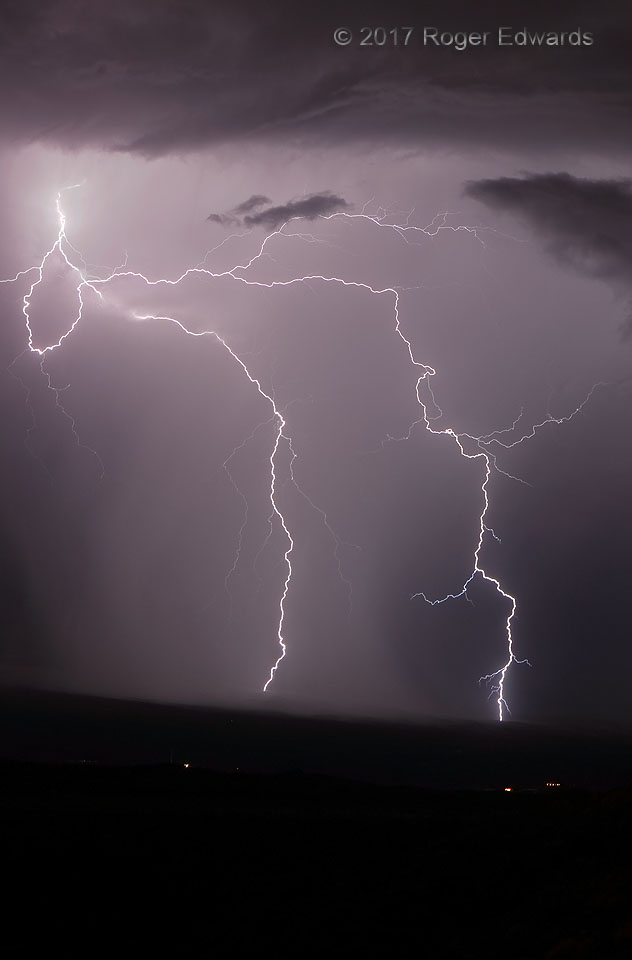
Mountainside Jolts
Surrounded on three sides by intermittently sparky thunderstorms but with none decisively better, I had a pick of possibilities for capturing lightning. After turning camera attention toward a fresh core dump starting to sweep across the mountainsides to the south, the storm temporarily and inexplicably quietened. It was hard to keep aiming this way while teaser flashes kept blasting forth to … [Read more...]
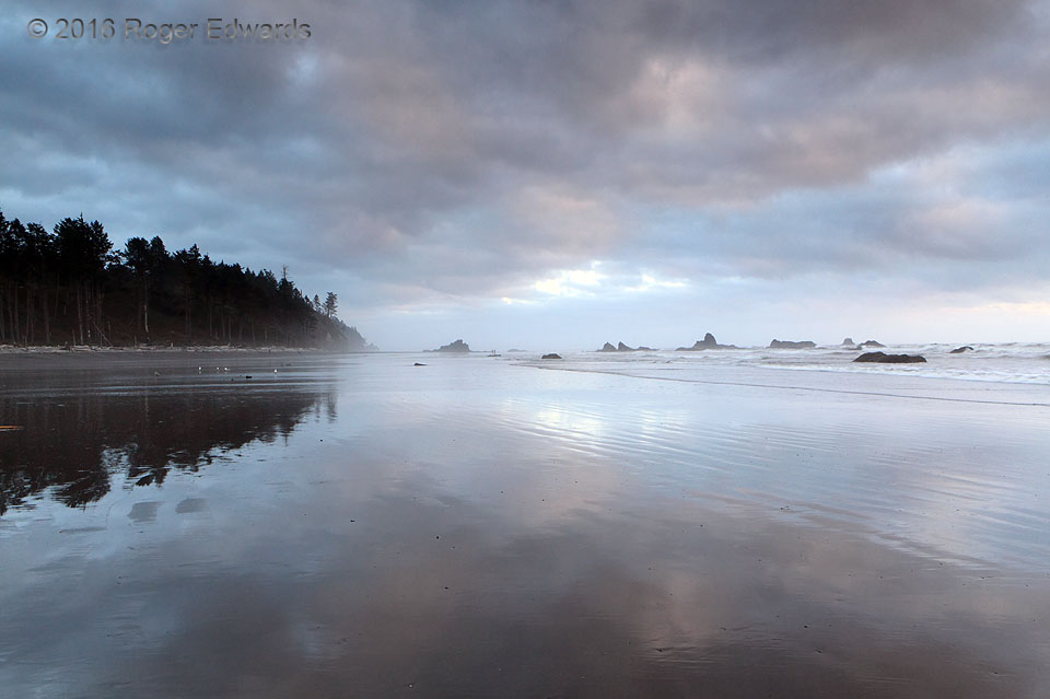
One Pacific Evening
One Pacific evening, in the cool and still ocean air, uncommonly gentle ocean waters slowly overlapped a long and broad shoreline at low tide, smoothly coating the sand and reflecting the subtle hues of the sunset hour, as a thin and shallow marine fog floated across the distance. It was a moment both ephemeral and indelibly preserved in image and memory. 17 S Forks WA (21 Aug 16) Looking … [Read more...]
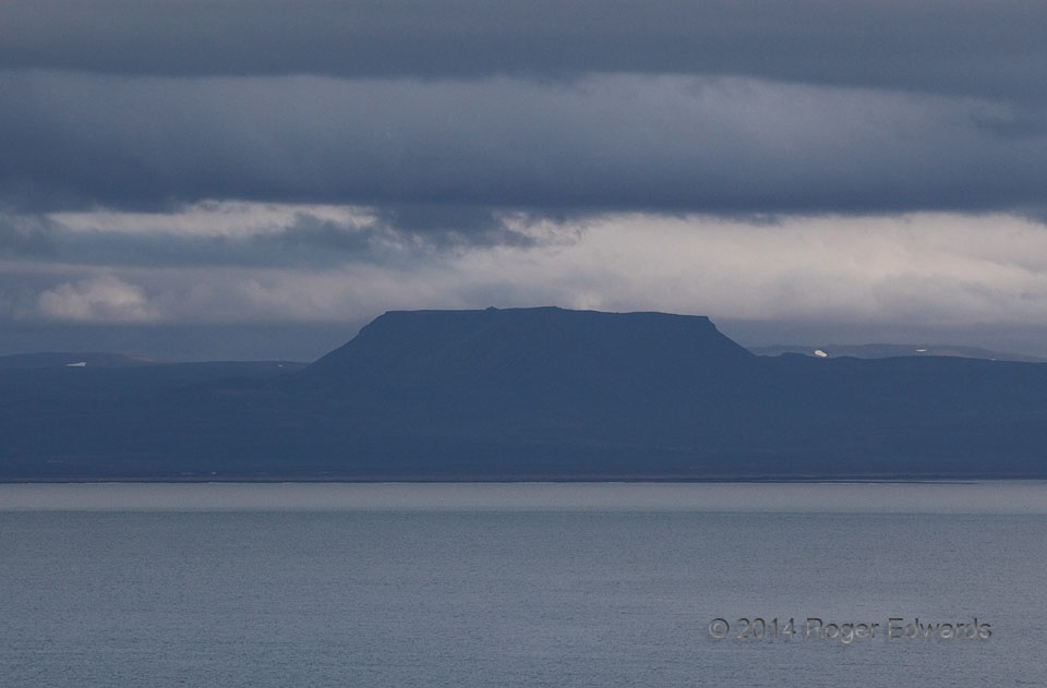
Somber Icelandic Stormscape
Just several miles below the Arctic Circle itself, the closest one will see there to a "dark day" stormy convective regime follows a convergence boundary across Iceland's deeply incised northern (Arctic Ocean) coast. Somber, textured, slate-colored skies, and the ominous shadows they cast upon landscapes, have captivated me since earliest childhood, and this moody scene was hard to leave behind. … [Read more...]
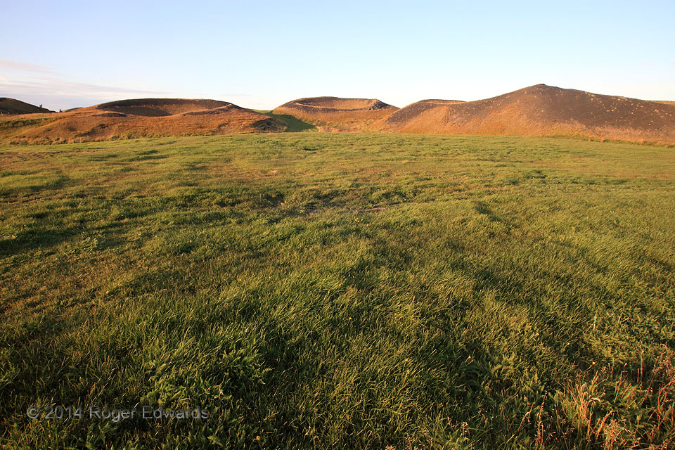
The Skutustadir Pseudocraters
What does this formation of craters have to do with water works? The key to the answer is in the origin. Lava flowed over wetlands or shallow lake-bottom sediments near present-day Myvatn Lake in Iceland. The resulting steam pressure built up and blasted holes repeatedly through the same weaknesses in the overlying lava deck. The resulting flying plumes of rock built craters that look like … [Read more...]
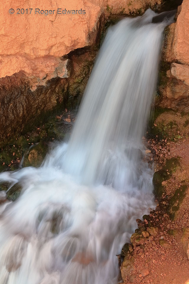
Cascade from Orange Rock
On the highest parts of southern Utah's plateau country, characteristically orange desert rock layers have been uplifted thousands of feet into altitudes where lakes and forests cover them. Water draining Navajo Lake has tunneled a conduit through the ochre-toned sediments, rushing out of this rock wall before plunging stepwise for miles through the Dixie National Forest as the North Fork of the … [Read more...]
- « Previous Page
- 1
- …
- 276
- 277
- 278
- 279
- 280
- …
- 413
- Next Page »