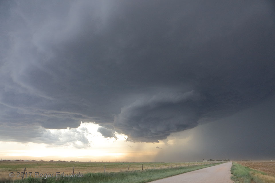
After producing baseball-sized hail near Four Way, a few other wall clouds and even funnels, this marvelous, high-based supercell turned almost due southward across the High Plains of the Panhandle, in a defiantly rightward display of deviant motion. Here it moved directly over the east side of Amarillo, whose downtown can be seen at distant middle left of this wide-angle view, producing hail … [Read more...]
Rain-Wrapped CG
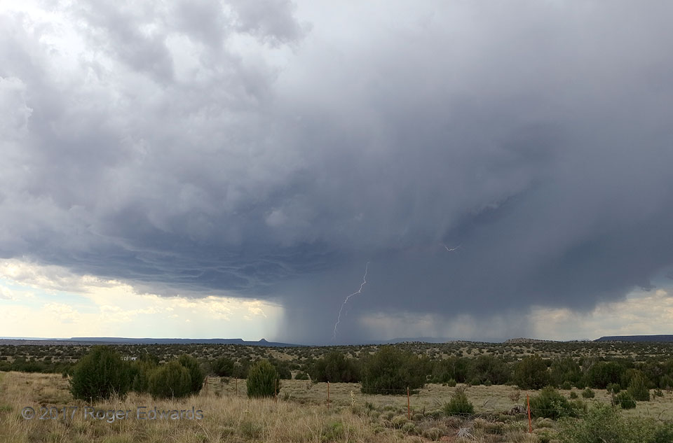
A young supercell, freshly cast off the formative southern end of the Sangre de Cristo Mountains, made its way southeastward across the scrublands of eastern New Mexico, with nearly continual rumbles of thunder aloft and an occasional distant boom from cloud-to-ground strokes. As with this one, most of the CGs were buried in the main core adjacent to the updraft, though we certainly were vigilant … [Read more...]
Horseshoe Vortex on Supercell Inflow Band
We were admiring a fine-enough supercell in the western sky when—lo and behold!—I spied out of the left peripheral vision a sight not seen before. Riding along the top of the westward-feeding low-level inflow band was a horseshoe vortex (far middle left), a slowly rotating cloud tube formed from shear-induced stretching of vortex lines. Vorticity already is relatively maximized in these bands, … [Read more...]
Keystone Shelf
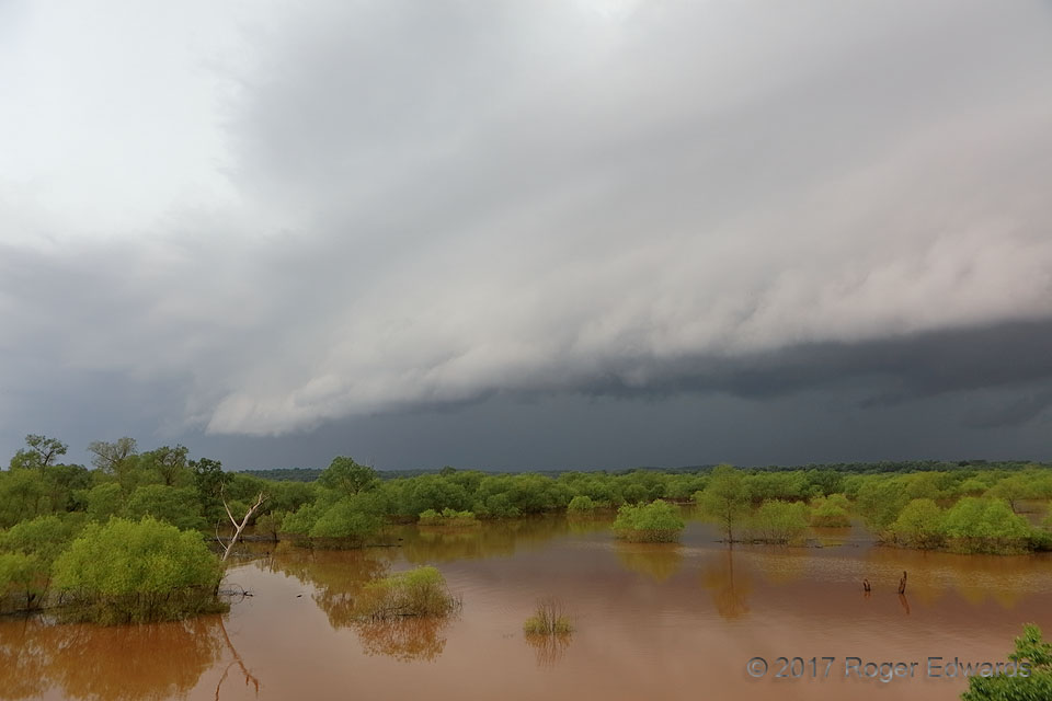
It was no time for casual crappie jiggin' in the flooded trees. Formerly a supercell, this storm was overtaken by the southern end of a strengthening squall line as its outflow and shelf cloud surged toward the western reaches of an overfilled, muddy Keystone Lake. The spring-green forest, flooded by water laden with red-brown clay, and the ominous slate-gray hues of the approaching storm, … [Read more...]
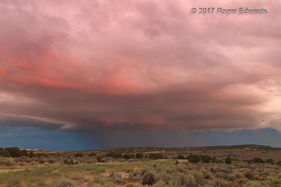
Sherbet Sky
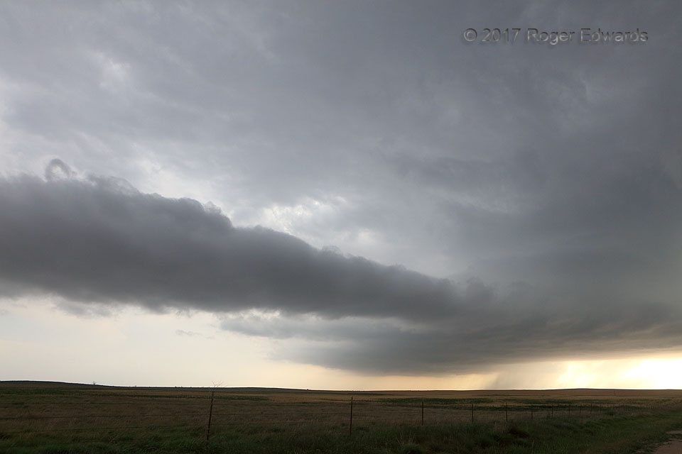
A small, soft-looking storm over the high desert (6,700-ft ground elevation) didn't promise much photogenic action—until sunset! Enough low clouds were in the way that when the hidden mid and upper levels of the storm's convective cloud plume started to light up with sunset color, it diffused downward in pastel through much of the sky and onto the surrounding landscape. Then, for a fleeting … [Read more...]
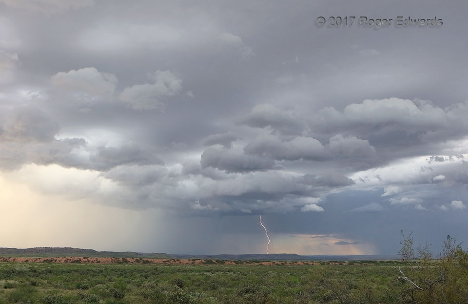
Outflow Spark
Most of my first-ever "monsoon chase" trip in 2017 was inactive storm-wise, save the first three and last three days. However, the storms that did happen and the days between, spent in the amazing Utah and northern Arizona national parks, made it all worthwhile. This final storm of the trip had been a photogenic supercell that became elevated atop outflow from a complex to the northeast. That … [Read more...]
- « Previous Page
- 1
- …
- 275
- 276
- 277
- 278
- 279
- …
- 413
- Next Page »