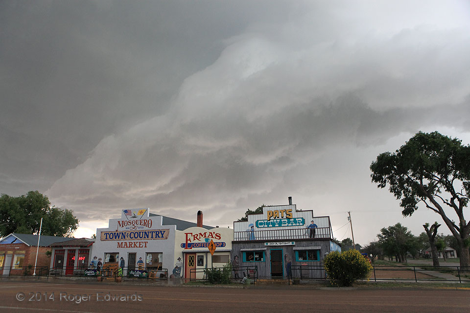
Quaint and quirky, the friendly old High Plains burg of Mosquero, NM, temporarily hosted a supercell on this tumultuous late-spring afternoon, a storm that had sported a classical wall cloud and mesocyclone region shortly before the outflow-dominant phase seen here entering town. A profuse, vegetation-shredding hail dump soon would follow, leaving eerie scenes in its wake rather uncharacteristic … [Read more...]
Altus Crawlers
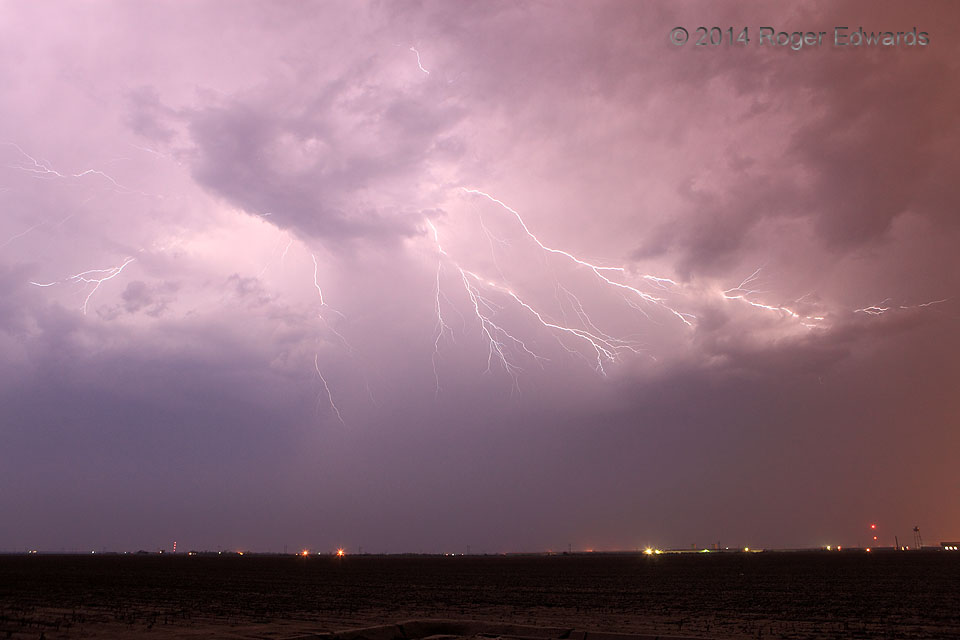
Darkness ruled the night. Then, for just a second or two, from one node of intense charge separation high in the sky, and hidden behind an intervening chunk of midlevel clouds, filaments of electricity erupted in several directions at once, crawling at lightning speed along the underside of the storm's anvil. Back into the dark we stood, until the next fleeting burst of atmospheric pyrotechnics … [Read more...]
Winter Wonderland, Oklahoma
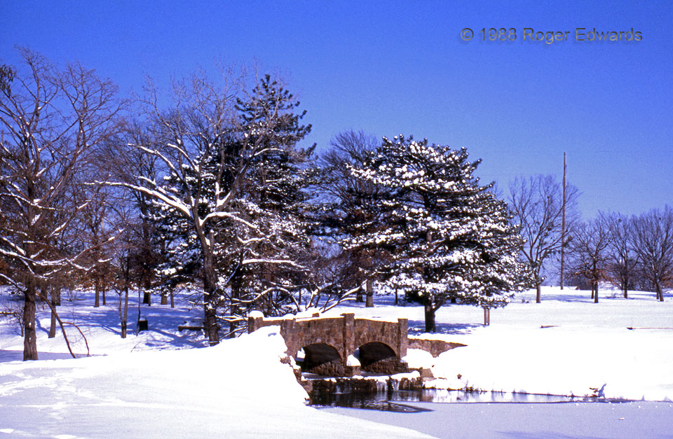
The winter of 1987–1988 was notable in Norman for several heavy snowfalls of around a foot. Being a man of the lower latitudes, I only remember such otherwise miserable cold-weather events for their occasionally beautiful results, like this shot of the duck pond at Brandt Park. Who says Oklahoma doesn't have major winter weather? Norman OK (Jan 88) Looking ENE 35.2059, -97.4364 … [Read more...]
Nebraska Arcus: West
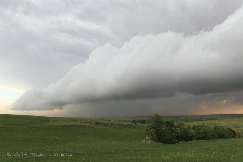
Some arcus or shelf clouds have laminar, smooth banding that occurs when the cold pool forces upward a layer of relatively stable air at that level. Others, such as this one, are more convective, or bubbly and rolling in character, the lifted air being unstable. [Here is a view of the east side of the same formation.] Scientifically and aesthetically, this was a marvelous process to behold. … [Read more...]
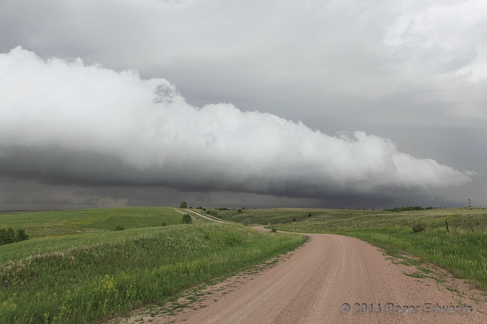
Nebraska Arcus: East
An earlier, fast-moving supercell sent out an intense, multi-county-scale gust front, reinforced by assorted mainly elevated storms that formed in the warm-advection area atop the cold pool. While that ended the chase day early, it graced us with the opportunity for some good times with friends out on the Great Plains while enjoying some blasts of cool outflow, and of course this splendid shelf … [Read more...]
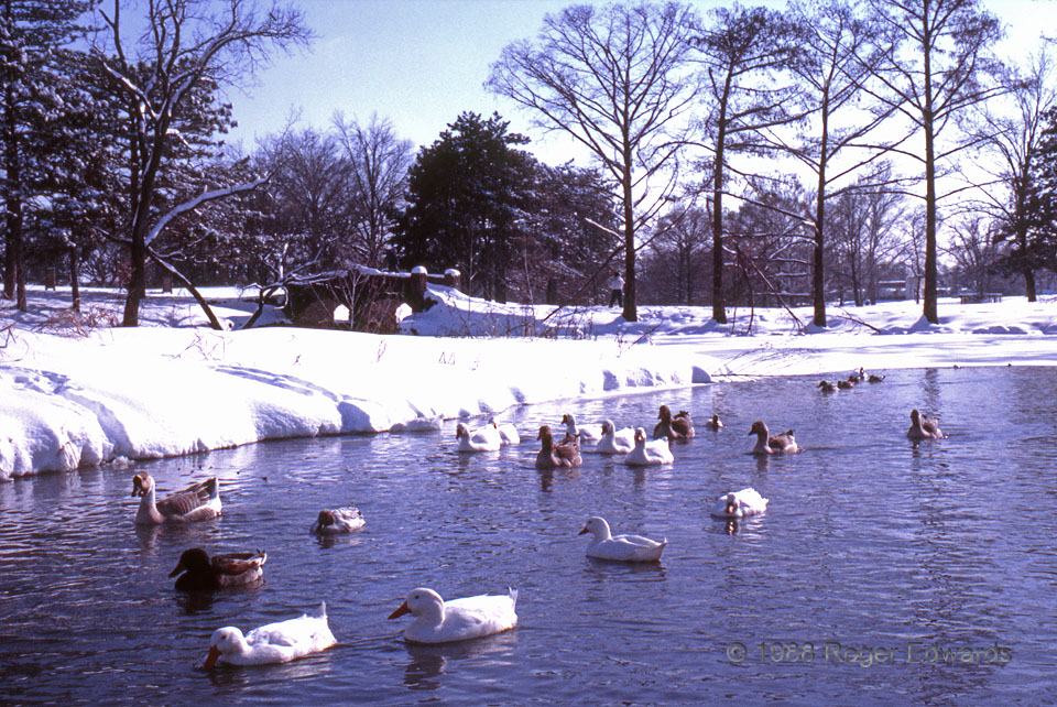
Ducks and Snow
Another peaceful winter scene graces the duck pond on the OU campus. Between 12 and 14 inches of snow blanketed the shoreline. Despite the chilled waters, the ducks seemed quite pleased to be there, instead of trudging through that thick blanket of icy white powder ashore. Norman OK (Jan 88) Looking SSE 35.2069, -97.4364 … [Read more...]
- « Previous Page
- 1
- …
- 260
- 261
- 262
- 263
- 264
- …
- 386
- Next Page »