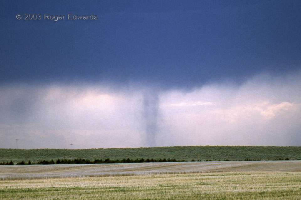
A "landspout" is storm-observer slang for a non-supercell tornado, most often seen in relatively dry environments with weak wind shear and high-based thunderstorms. On this day, vertical shear favored supercells, and one did develop farther south; however, the process behind this tornado (shot on slide film) was not that of a mesocyclone. Such tornadoes typically move slowly and take shape as a … [Read more...]
Mammatus Crawler
This scene blends two of my favorite elements of thunderstorms: mammatus and lightning. After experiencing a sublime stormy sunset to the WNW, we turned our backs to the fading light as the electrical show ramped up in the eastern sky. Just a hint of indigo twilight filtered through the thin spots in the cloud deck. Meanwhile the fuzzy mammatus bags were subtly cast in a greenish hue -- the … [Read more...]
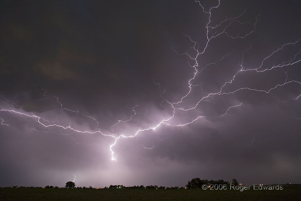
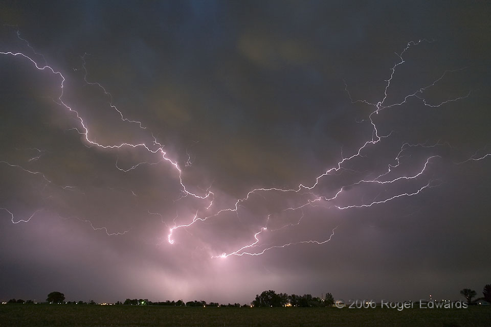
Colorado Crawlers
As night fell across the Great Plains of eastern Colorado, what had been a fairly amorphous, high-based band of thunderstorms latched onto a moist low level jet and organized quickly. Lightning filaments began flying every which way under the trailing rain and anvil canopy of the thunderstorm cluster, putting forth a show of "crawler" lightning that rivaled that of many larger, better-organized … [Read more...]
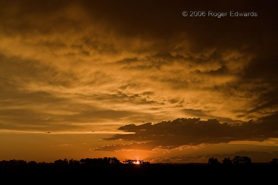
Illuminalia
Those (things or events) that illuminate—that's how the title would translate from Latin. How simply fitting it is, then, to describe this sunset scene which blessed us at the end of what had been a fairly underperforming storm day in the Great Plains of eastern Colorado. More was yet to come, too, in the form of a wonderful electrical display in the opposite half of the sky. 3 ESE Ft. Morgan … [Read more...]
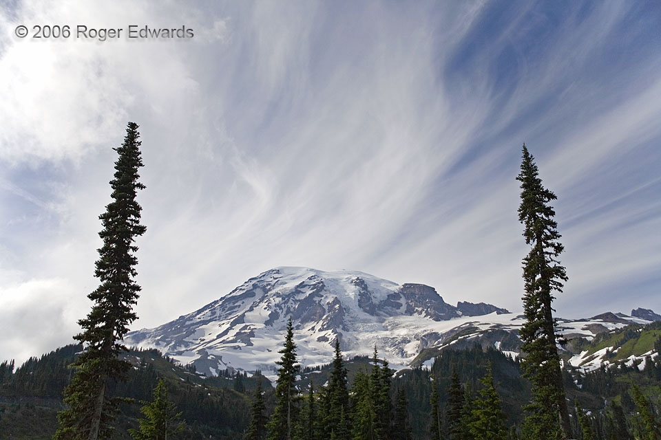
Cirrus Blend over Mt. Rainier
Two tall conifers and a sky densely feathered with cirrus clouds frame the massive, ice-capped bulk of America's loftiest volcano. The cirrus streaming overhead could be classified as a mix of uncinus (mare's tail), spissatus (sun obscuring, thick) and fibratus (fibrous tufts). As in many hybrid cloud categories, the transition or delineation between them isn't razor sharp, and can be argued. … [Read more...]
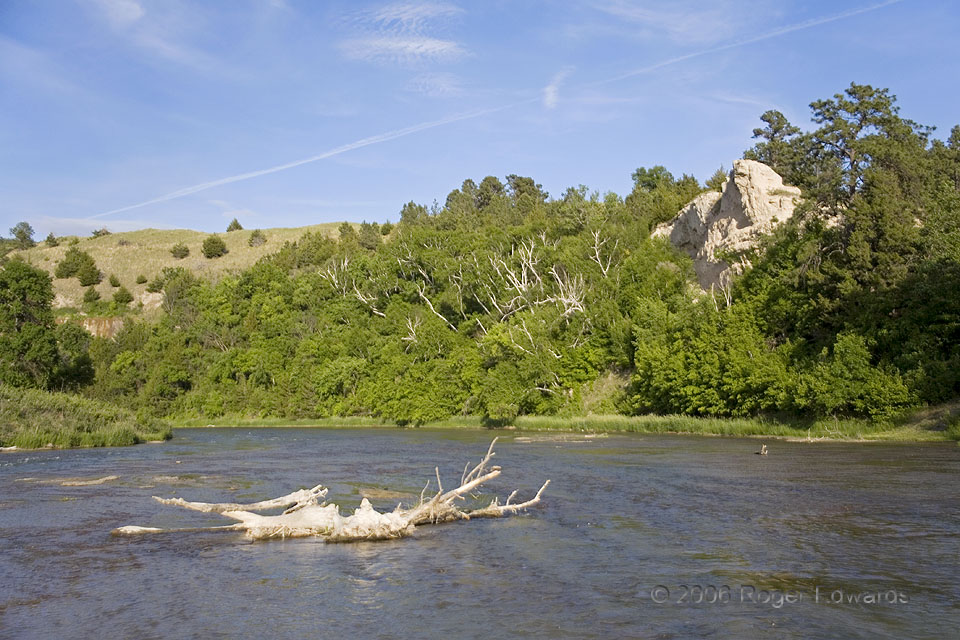
Streamwise
One of my favorite Great Plains watercourses is the Niobrara, winding east from the volcanic ash beds of eastern Wyoming across most of northern Nebraska before its swampy union with the mighty Missouri River. The stretch through the Nebraska Sandhills and the Fort Niobrara National Wildlife Refuge, the Niobrara National Scenic River, regionally draws recreational interest for tubing and … [Read more...]
- « Previous Page
- 1
- …
- 241
- 242
- 243
- 244
- 245
- …
- 413
- Next Page »