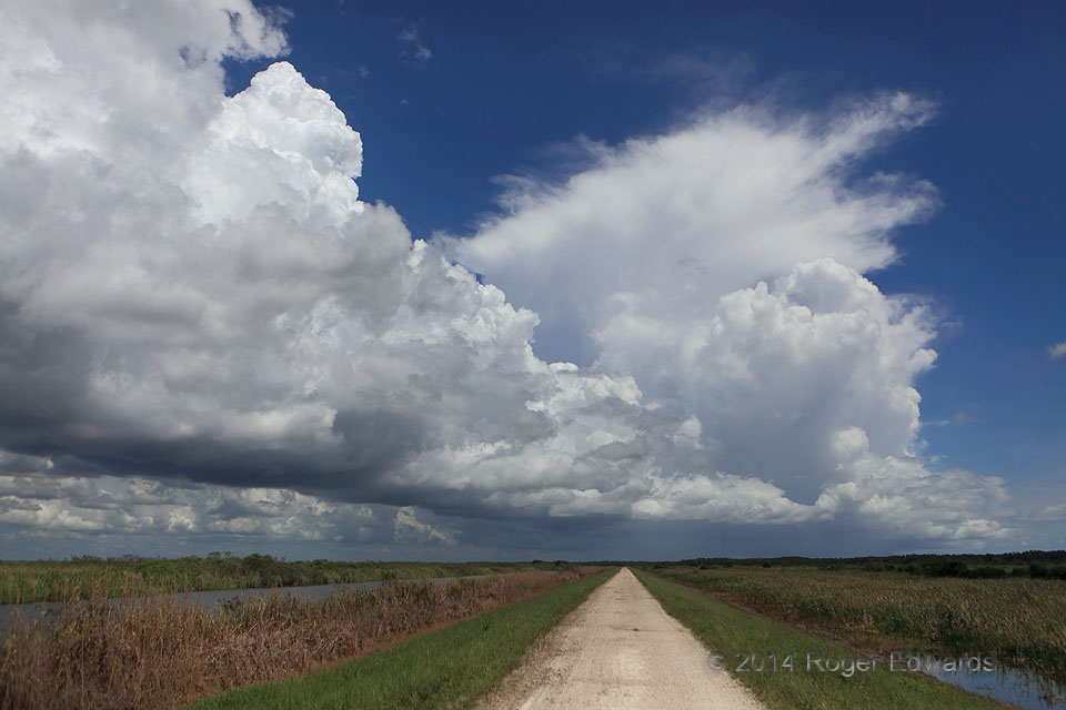
Almost daily during summertime, a rampart of convective towers forms along the sea-breeze fronts over Florida—one near the Gulf Coast, one near the Atlantic Coast. Here is a splendid example of the latter, with a cumulonimbus to the distant north and a neat row of towering cumuli extending southward to very near my location: the Loxahatchee National Wildlife Refuge, along the northeastern … [Read more...]
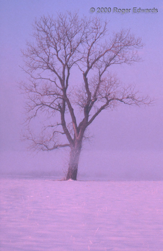
Lone Tree
A single, weather-worn old elm tree stood tall: a lonely sentinel amidst the desolate chill of the snowy prairie. The ground fog of sunrise hung low over winter's blanket, casting a hint of eerie mystery across frigid stillness. What if the tree could talk? Its stories would put to shame those of even the most grizzled old human weather observer. A violent tornado passed over this spot in … [Read more...]

Cathedral Domes in the Rain
A cool, misty day offered a somber yet captivating viewing experience of wettened cathedral domes in Salzburg's Altstadt (Old City), with the northern fringes of the Alps rising a few miles away into the low stratus deck. Salzburg, Austria (20 Jun 15) Looking SE 47.8008, 13.0389 … [Read more...]
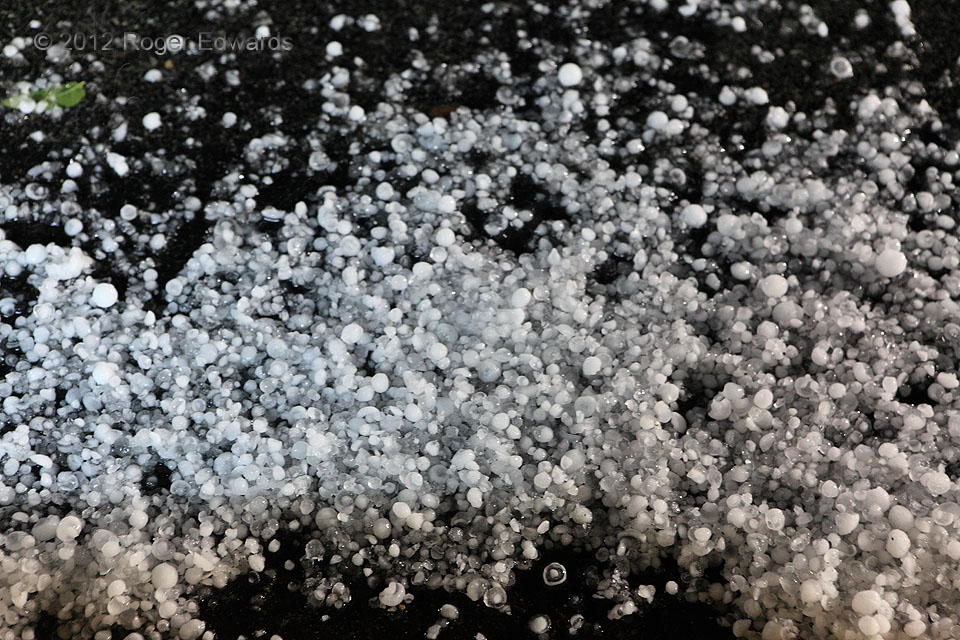
Nocturnal Hail Drift
Runoff from heavy rain carried hail to this spot near a curb, where it floated into drifts. The largest stones were about an inch in diameter—barely severe by official standards, and not damaging to cars or windows we saw. A fascinating variety of hail opacity appeared here despite the lack of variation in size. Also, the color shift between the white hail in most of the photo and the tan hue … [Read more...]
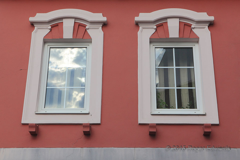
Stratocumulus in Austrian Architecture
Eastern Austrian architecture is interesting on its own merit. When partly decorated in the form of cloud and sunlight reflections, it becomes magical: aged and static, yet ephemeral and fluid. Slowly moving, quickly evolving, the interplay of light and shadow around stratocumulus clouds and off the left window offered an endless variety of scenes played across a small glass panel. Wiener … [Read more...]
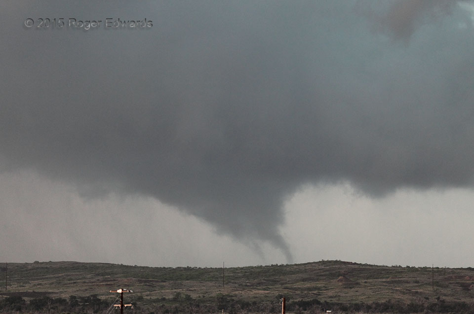
Multiple Vortices in the Hills
After an initial, apparently single-vortex phase, the third tornado from the Canadian supercell complex broke down into two, sometimes three visible subvortices swirling individually, whilst orbiting the parent tornado's lower reaches. After a couple minutes of this sort of action, the slowly southward-moving tornado dissipated in the loess hills overlooking town. Delicately vaporous, yet … [Read more...]
- « Previous Page
- 1
- …
- 218
- 219
- 220
- 221
- 222
- …
- 413
- Next Page »