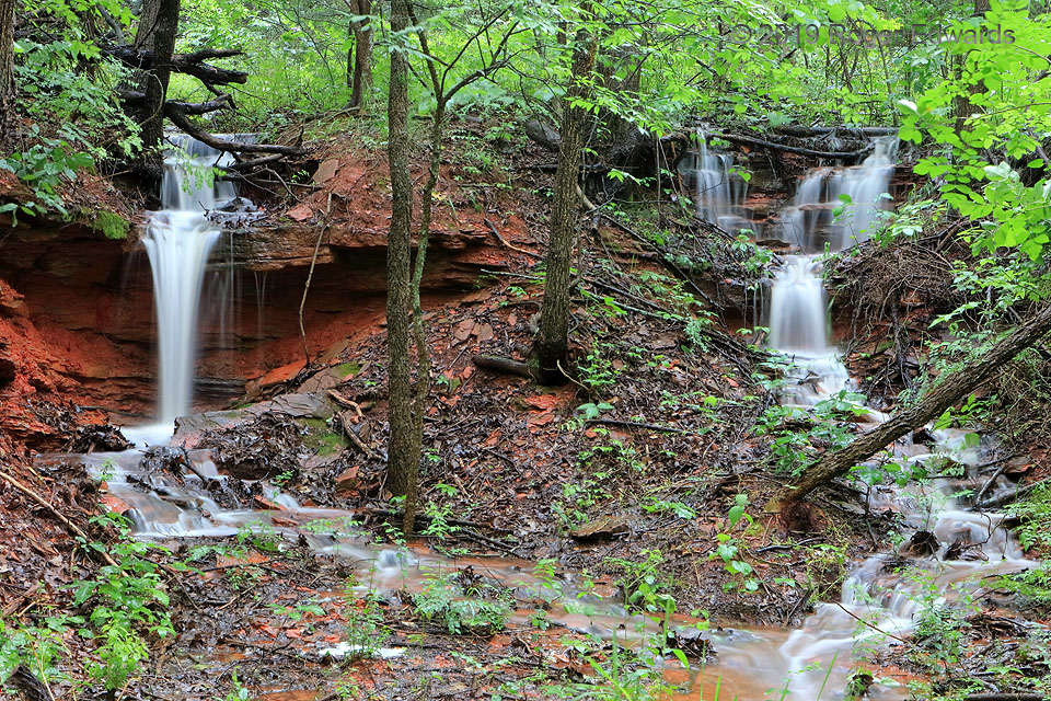
When thinking of waterfalls, what places come to mind? Certainly, among many, one considers the beautiful cascades of Iceland, Hawaii, Yellowstone, other places in the Rockies and across the West, the Pacific Northwest, the Great Lakes, or Appalachian New England. How about Norman? Right here in central Oklahoma, I've found a wonderful, secluded spot on private land to which I have permissible … [Read more...]
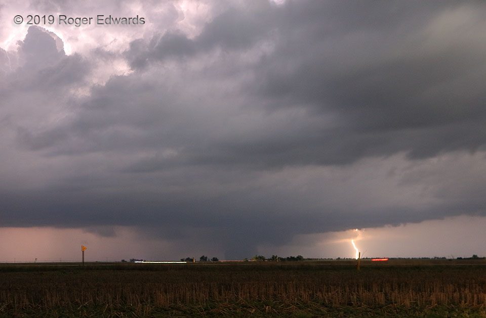
Night Like Day: Tornado and Lightning
Following the unseen dissipation stage of the Minneola "Kansas Sunset" tornado, this larger vortex formed northeast of Ford and trucked along deeper into the dark of night, with a maximum surveyed width of 875 yards. Fortunately it missed population centers. Despite the late hour, this photo's brightness can be attributed to high ISO offsetting short exposure time, with lightning as an … [Read more...]
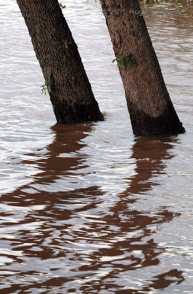
Tilted Trees Abstraction
Flooding of Lake Thunderbird, east of Norman, offered both this arboreal abstraction and a rather unsanitary one. Water rising into uncommon places presents the dichotomy of muddy, often polluted messes with hazards to people, and peculiar photographic compositions to depict the flooding in ways seldom seen otherwise.2 NW Little Axe OK (10 May 15) Looking ESE 35.2483, -97.2379 … [Read more...]
Supercell Surfing Supercell
This wild formation had origins worthy of a swashbuckling meteorological adventure tale. A young, small supercell formed as a surface-based storm and quickly began rotating, in the moist, helicity-enhanced inflow region of a larger, older, established supercell. The newer storm produced some severe hail as it merged northward into the forward flank of the older one, while an unrelated outflow … [Read more...]
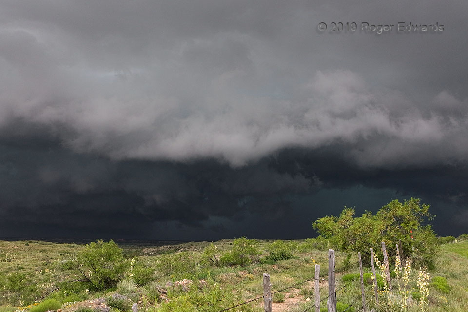
Supercell with Asperatus
This extraordinary cloudscape assembled from an extraordinary recipe: the merger of a newer, smaller supercell into the forward flank of an older, larger one, at the same time an outflow boundary from a separate area of storms crashed the party from the east. This updraft, region, which still rotated rather obviously, represented what was left of the original supercell's mesocyclone area after … [Read more...]
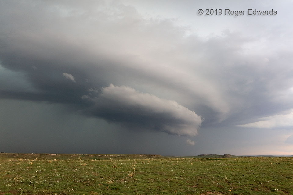
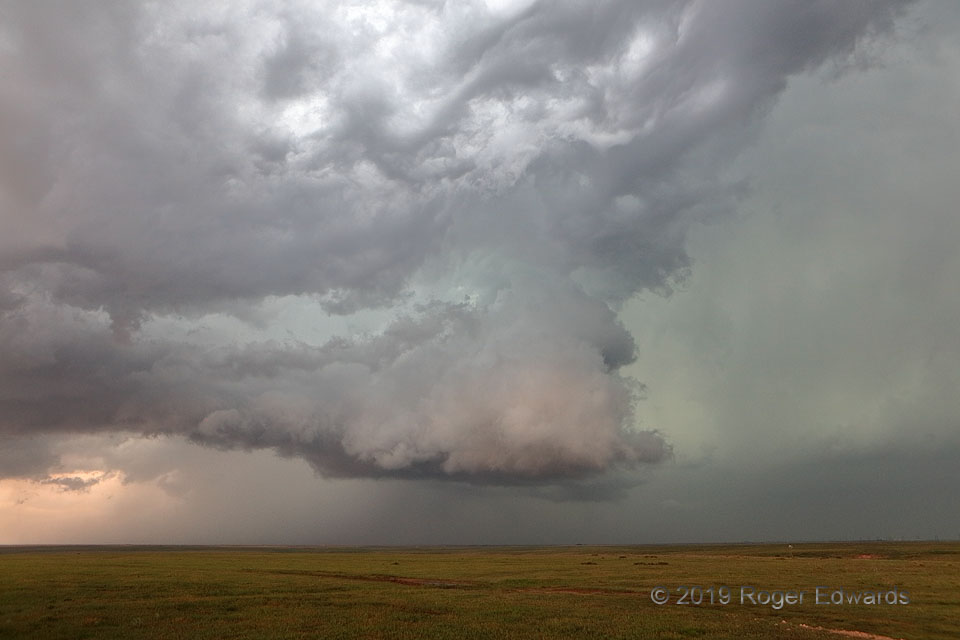
Daylight Darkens the High Plains
When beholding an imposing scene such as this, and pondering the relative paucity of meteorological understanding of the era, it's easy to understand how early Great Plains settlers may have considered the world's end as a fate not much more alarming than the biggest, loudest, most ominously stygian storms rampaging uncontrollably toward their homesteads. Even then, this churning maelstrom—a … [Read more...]
- « Previous Page
- 1
- …
- 211
- 212
- 213
- 214
- 215
- …
- 413
- Next Page »