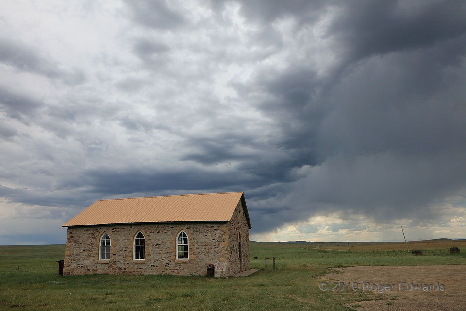
A high-based, multicell thunderstorm, spawned off the Sangre de Cristo Mountains (distant right horizon) casts its broad shadow across Johnson Mesa in extreme northern New Mexico. At over 8,000 feet in elevation, this very high piece of High Plains formed when lava filled the valley of an ancestral version of the Cimarron River (now to its north and east), then the softer surrounding bedrock … [Read more...]
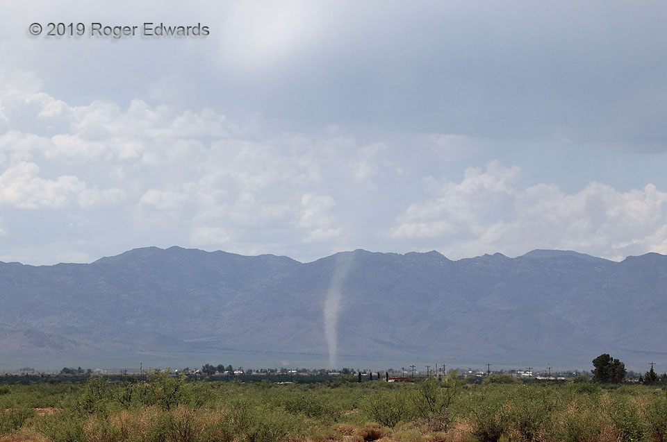
Deceptive Dust Devil
From the title, you've already surmised that this isn't a "landspout" tornado. Still, without good observational context, or advanced notice in the form of a web-page title, one might see the apparent superposition of a rotating dust column with convective cloud bases and background, and mistake this for one. Instead, the dust devil spun across the high desert of southeastern Arizona a few miles … [Read more...]
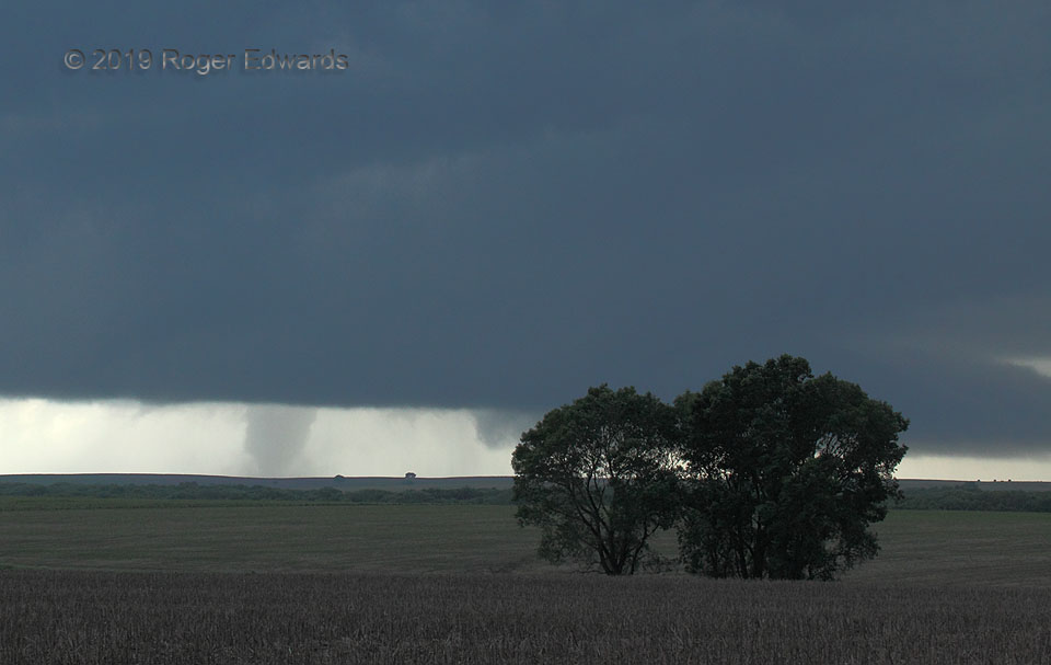
Deeply Occluded Tornadic Mesocyclone
The final minute of the 2019 Tipton, KS tornado found it still robust, but nearly completely shed from the rest of the storm in a common process. Within less than another few clicks of the camera shutter, the tornado was gone—not in a more-typical rope-out, but instead, simply vanished. The condensation disappeared in seconds, and the remaining dust settled irrotationally. That was an unusual … [Read more...]
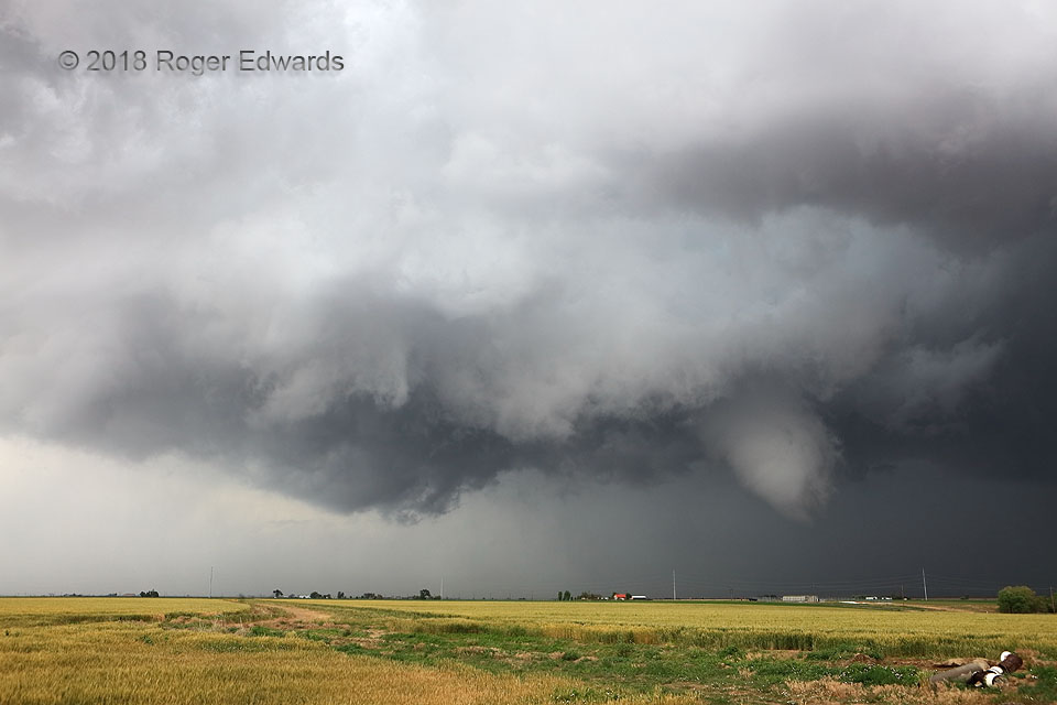
Suspicions
Closing in on this cyclic supercell from the south, I had noticed each new mesocyclonic wrap-up render a lower cloud base, as the storm moved into greater moisture from both the environment and its own outflow. While a newer mesocyclone began to the east, I stayed here to witness whatever would happen with a gradually and very suspiciously tightening area of rotation in this "bent-back" … [Read more...]
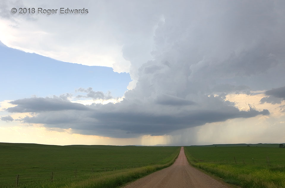
Rolling past Red Shirt
As the "Black Hills supercell" peeled further southeastward away from its formative zone in the northern part of the now-distant hills, it got a little less organized, the cloud tails and overall base structure elongating along its own forward-flank outflow, while maintaining a remarkably erect updraft structure. Soon, additional updrafts would develop atop the eastward extension toward us, and … [Read more...]
Courses Change
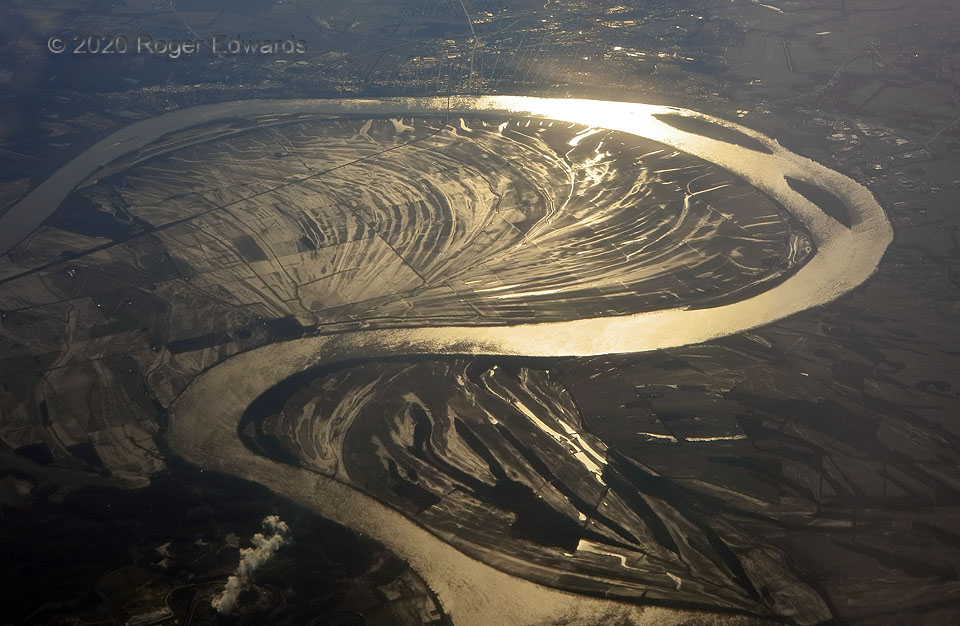
Flying over the Ohio River below Evansville, along the border of Indiana (left) and Kentucky (right and top), reveals truths of geology and a metaphor for life. As the newly risen, golden sunlight reflects off the river and riparian wetlands, we see prior courses and old banks marked in the arcs: the closer they are to the current stream, the newer the curving sediment deposits. Left to its own … [Read more...]
- « Previous Page
- 1
- …
- 180
- 181
- 182
- 183
- 184
- …
- 413
- Next Page »