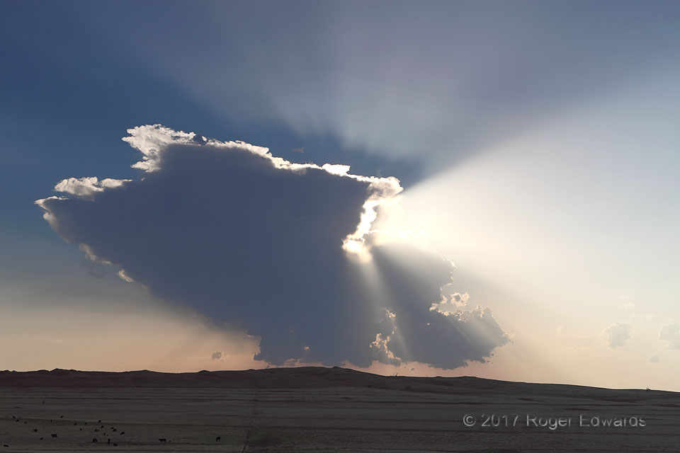
We had zigzagged up the dryline from the Texas Panhandle, observing one potentially promising area of convective towers after another form, deepen, then wither from dry entertainment. This was no exception, but did occur late enough to offer this delightful spray pattern of crepuscular rays, along with a partial cloud shadow around the small anvil. Had this been the end of the chase day, we … [Read more...]
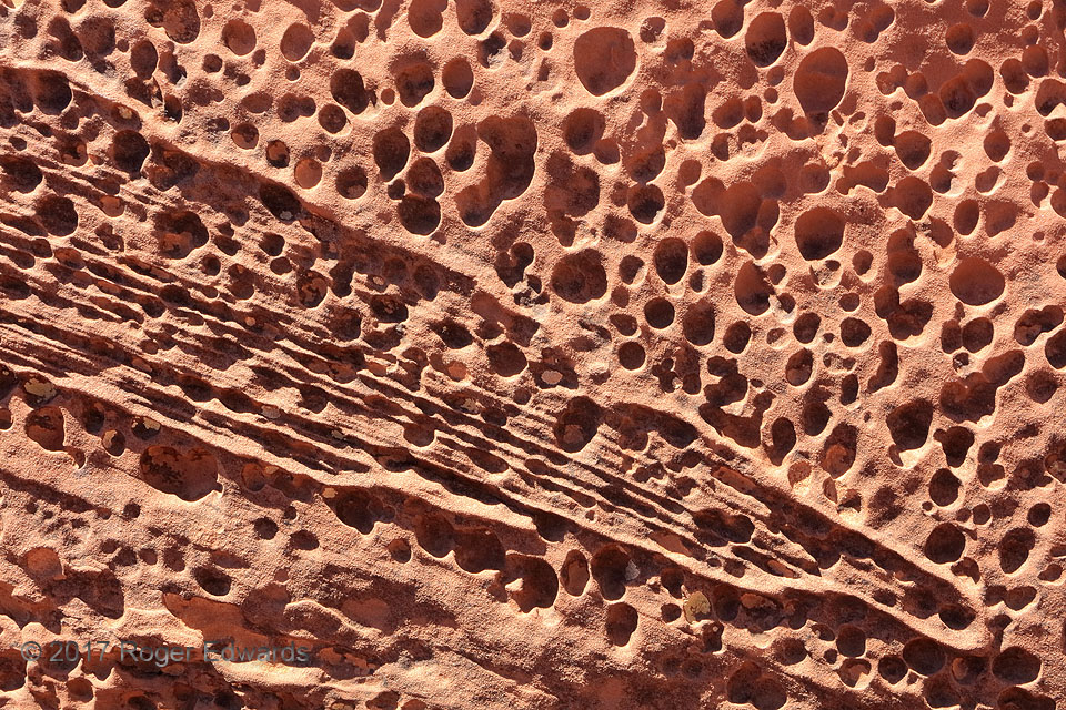
Honeycomb Weathering, Capitol Reef
While enjoying the sweeping vistas of the famous Goosenecks on a warm midday hike, I couldn't help but also notice small things, such as this fascinating pattern of what appears to be buckshot holes in the hard, late Triassic Wingate sandstone of Capitol Reef National Park. No, I found no spent shot inside! Instead, this rock formation commonly hosts nearly circular pits of varying sizes, most … [Read more...]
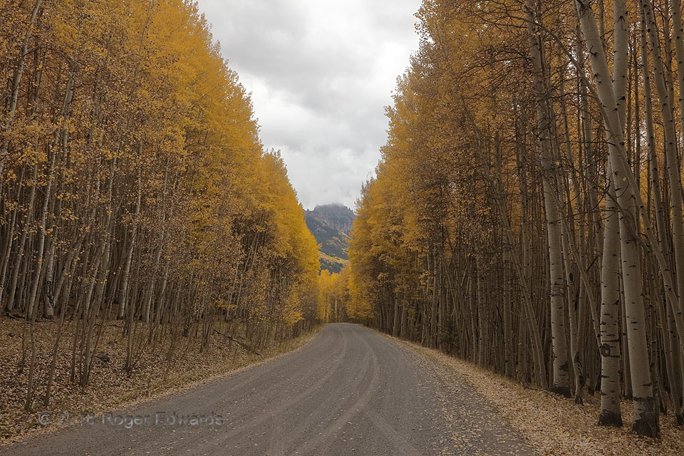
Aspen Road
In the Uncompahgre National Forest, a large aspen grove forms a canyon of brilliant autumn color, alongside one remote mountain road. Cloudy days, here featuring fractocumulus and stratocumulus, help to even the light throughout the forest and impart a contemplative, peaceful ambience. On this day, earlier light rain had wettened parts of the forest floor, releasing the wondrous aroma of moist … [Read more...]
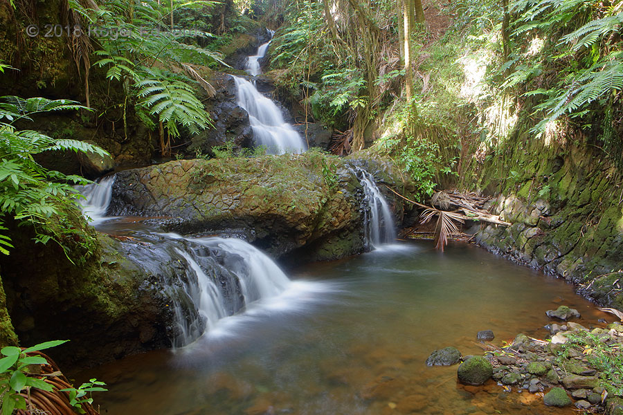
Onomea Falls: Quintessential Hawaii
Epitomizing paradise, these marvelous little falls help to drain the rainier east side of the Big Island, cutting past ferns and palms in a tropical botanical garden that was developed around them. The water reaches the Pacific Ocean just a few minutes afterward. Now picture, eyes closed, the soothing, steady sound of this cascade, under a cacophony of chirps, trills and squawks from many … [Read more...]
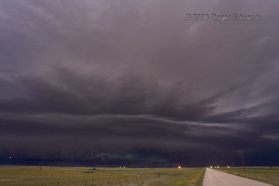
Eerie Stormscape
Only good fortune and a well-timed opening of the camera shutter allowed me to capture this bizarre juxtaposition of bright ground light, spooky dark sky and strange cloud formations of an approaching severe storm. Yes, this is a nighttime photo. During the exposure, faint lightning within the storm silhouetted the cloud features throughout. Meanwhile, a brilliant eruption of lightning high … [Read more...]
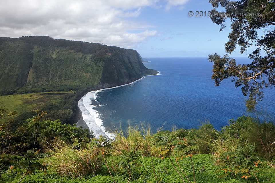
Orographic Stratocumulus: Waipio Valley and Beach
Easily lost in the resplendent, stunning grandeur of the Big Island's Waipio Valley overlook is a meteorological lesson—at least, amidst the northeasterly (right to left) flow so common to this area. The ragged deck of stratocumulus thickens just inland, with an edge very near the coast, for good reason: sharp uplift of the marine boundary layer over the steep terrain on either side of the … [Read more...]
- « Previous Page
- 1
- …
- 178
- 179
- 180
- 181
- 182
- …
- 413
- Next Page »