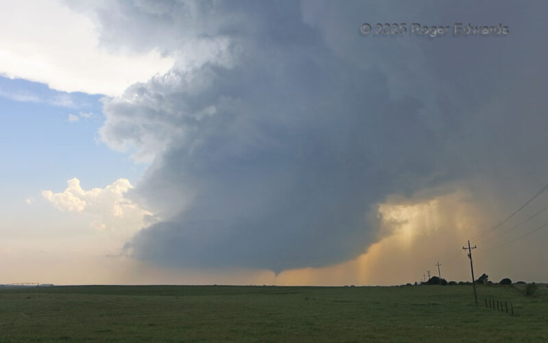
Within a minute or less after this tornado started, this obviously was shaping up to be an epic scene, a fulfillment of a storm observer's dream, with an organizing tornado beneath a well-defined, High Plains supercell. Contrary to some social -media claims, it was not a true low-precipitation (LP) storm at any point during this tornado! Just because one can see all the structure doesn't mean it … [Read more...]
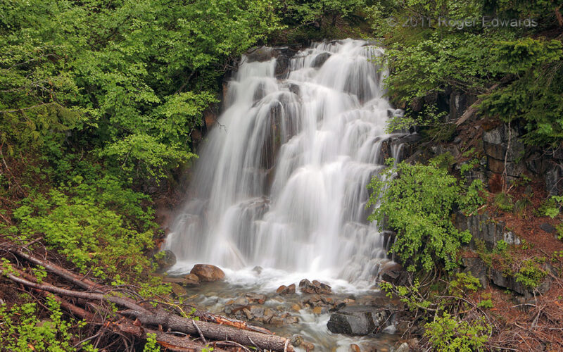
Temporary Falls, Mt. Rainier
One of our most photogenic Mount Rainier-area waterfalls was unplanned, unexpected...and unnamed! Some ad-hoc exploration on a damp, sporadically rainy afternoon led us up a side road and hiking trail as far as the road would go, and right past this waterfall with no name on a small, intermittent brook feeding into Fish and Tahoma Creeks (and ultimately, the Nisqually River). A couple days of … [Read more...]
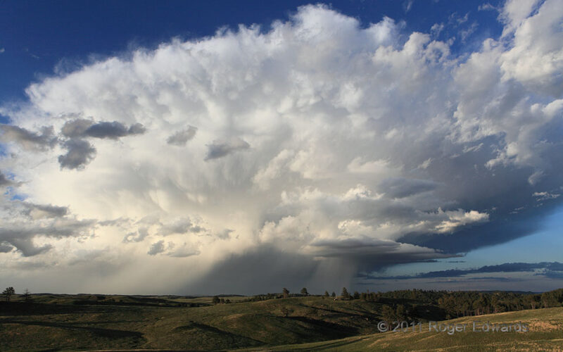
Thunderhead over Wind Cave National Park
Where Great Plains merge into Black Hills, Wind Cave National Park is a little-appreciated treasure well south of all the tourist attractions, but loaded with natural beauty above ground as well as beneath. That included the sky on this pleasant evening; a gorgeous cumulonimbus with rainshafts, hailshafts, and a splash of mammatus raced past, while both storm and landscape bathed in the lovely … [Read more...]
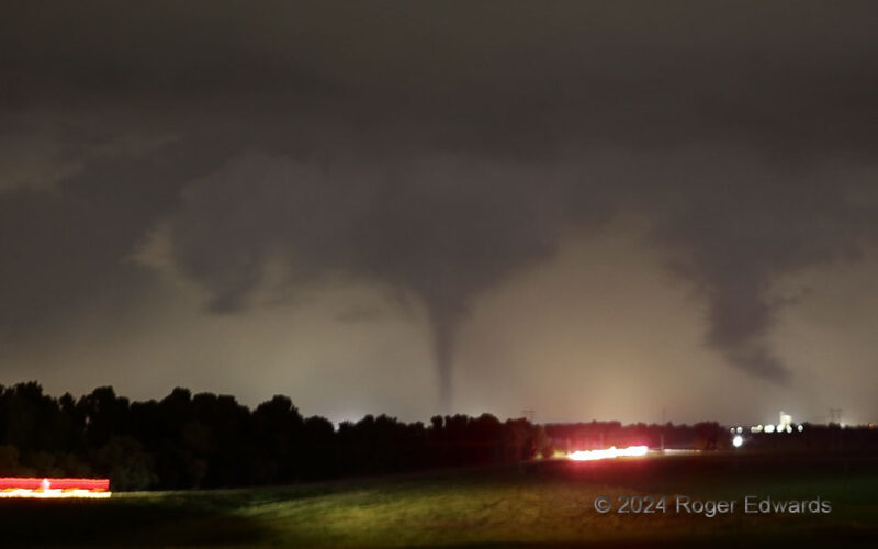
Westward Tornadic Retreat
After two other nighttime tornadoes between Union City and Yukon spun into oblivion (dissipation and/or rain), the Union City cone emerged from rain in an older mesocyclone, and began retrograding westward (leftward). If someone looks only at a map of the tornado tracks, this one may appear to have translated opposite reality. Why such a peculiar path direction in an eastward-moving parent … [Read more...]
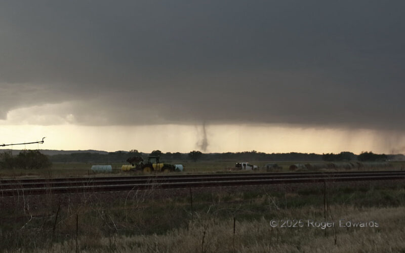
Second North Platte “Spout”
The second of a series of nonmesocyclonic "landspout" tornadoes, from a big-based multicell thunderstorm that later evolved into a supercell, appeared a couple minutes after the first one dissipated, and slightly farther northwest. This was a classic "spout" form, with a dust tube concentrated inside thinner dust centrifuged out of the vortex earlier. A very thin, diffuse tube to the right (N) … [Read more...]
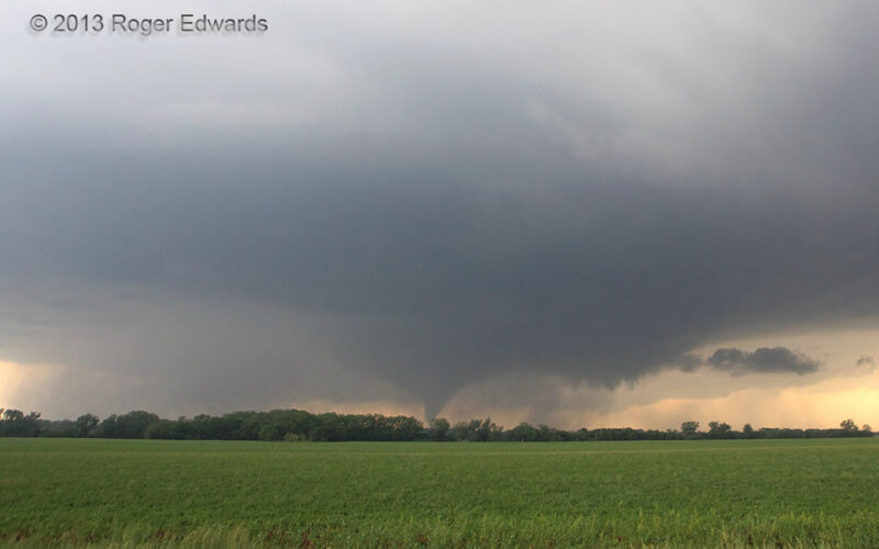
Bennington Cone Stage
The legendary Bennington vortex of 2013 started with a classical condensation cone under a wall cloud, with active, fast-moving and scuddy inflow tail pointing toward the forward flank, as I've seen with many significant tornadoes. All of that was happening under a heavy-looking, wet, low, somewhat hazy ambient supercell base, unsurprising for a high-CAPE, high-dewpoint supercell latched into a … [Read more...]
- « Previous Page
- 1
- …
- 16
- 17
- 18
- 19
- 20
- …
- 413
- Next Page »