Ghostly in form, deadly in electrical threat, a High Plains supercell that gave me one of the most spectacular skies I've ever seen continued to dazzle through early twilight in extreme eastern New Mexico. The tornado risk on this day was fairly close to zero, but after the show this storm put on, lasting even deeper into the evening as it moved into the giant road void of nearby Oldham County, … [Read more...]
Etowah Night Wedge
One of a long series of erratically moving tornadoes produced by the "Cole-Shawnee" supercell, this fourth of the surveyed "Etowah" tornadoes was briefly one of the best-defined visually, manifesting as a genuine wedge in the deep woods of extreme eastern Cleveland County. Given the wobbly and often strongly deviant motions of this storm's mesocyclones and accompanying tornadoes, I kept good … [Read more...]
St. Onge Arcus
Don't get fixated on the mesocyclone region, even if it is worth intense attention as this storm's was, and ignore strikingly beautiful formations in other directions! Fortunately that advice is a little easier to follow when the other spectacular part of the storm is directly connected. This sharply layered, tiered arcus extended southwestward as part of the rear-flank downdraft, making a … [Read more...]
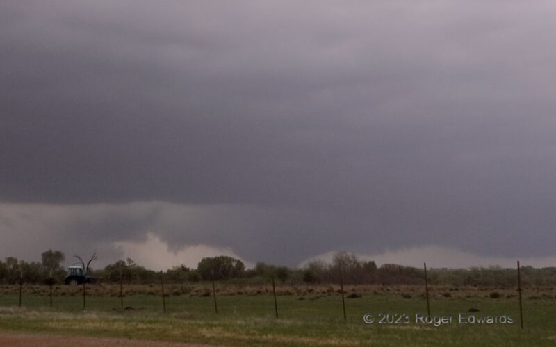
Roaring Bowl
The first tornado from the future London, KY supercell formed just to our WNW in southeastern Missouri, whereupon we got out of the way and let it cross the road behind us. The roar continued, as did the hook rain and unavoidable few more drops on the lens filter, as it sped eastward through somewhat wet, somewhat dusty fields, remarkably refusing to condense a funnel below the cloud-base … [Read more...]
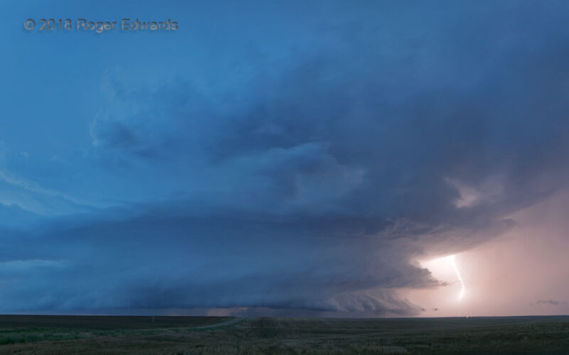
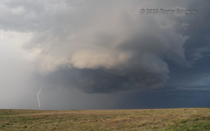
Evening on the High Plains
Twilight's "blue hour" on the High Plains can be special for photography, especially when the sky is involved, and a big ol' supercell dominates much of said sky, tossing blasts of lightning from the vault region. This was the sixth and most well-structured of a series of supercells that rolled NE from the Boulder area up I-76 corridor on the same afternoon and evening. 12 SSW Wiggins CO (18 … [Read more...]
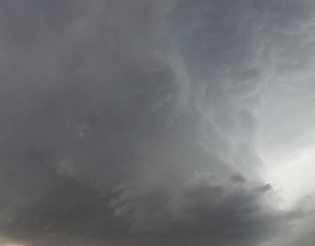
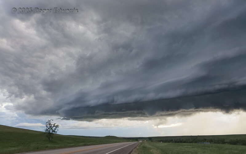
Vault Wall
My final view of this supercell was a mighty fine one, with distance revealing a tall, nearly vertical updraft tower above the main updraft base. That erectness in the face of favorable shear for tilted storms indicates strong instability and buoyancy. Most often on the High Plains, one can see the structure of the clouds above the vault region. When that reveals a tall wall of cloud on the … [Read more...]
- « Previous Page
- 1
- …
- 15
- 16
- 17
- 18
- 19
- …
- 413
- Next Page »