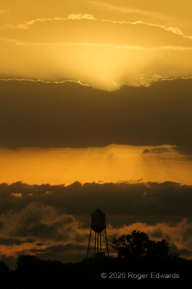
A fluid melange of clouds in low, middle and upper levels decorated the sunset sky over a small town in southeastern Nebraska. This was the finale of a multi-day chase trip, and at the time, I thought it might be the last chase day of the year. [I was glad to be wrong!] Regardless, in the moment, it was yet another sunset blessing to end a series of days on the road, among many I've … [Read more...]
Circulatory Sky
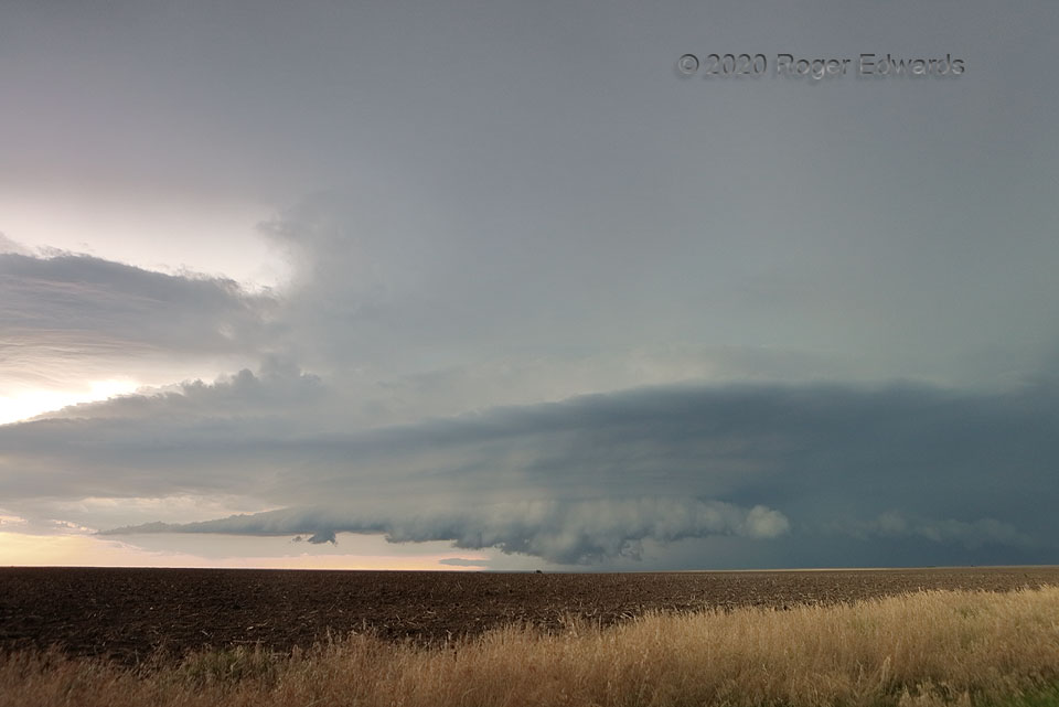
A cluster of thunderstorms in a marginal-shear environment nonetheless evolved into a couple of nice daytime supercells, this being the first. The second was younger and organizing in the background. This nearer, older storm sported a weakly rotating wall cloud off and on, which in this view is being undercut by both forward- and rear-flank outflow. All of that was happening beneath a series … [Read more...]
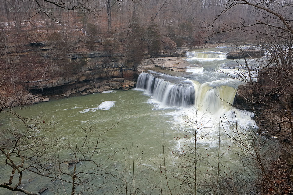
Late Winter at Upper Cataract Falls
The winter of 2020 wasn't cold enough to keep these waterfalls frozen into late February, offering a nicely hydrodynamic scene that was most welcomed after a morning spent on airplanes. Light snow was falling at this time, accumulations gathering in the background forest floor, with intermittent heavier bursts from a passing "clipper" disturbance. Yet for the snowfall, conditions were … [Read more...]
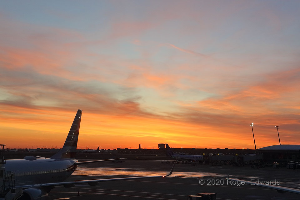
Aviation Sunrise
The purpose of the trip was to celebrate the career and retirement of an old friend and colleague. Yet one never knows every time a beautiful sky will present itself, even from the passenger terminal of an airport. This delicately textured, intricately woven sunrise scene was a welcomed sight for sleepy eyes, as I cracked the joints and stretched the muscles for several times, in preparation for … [Read more...]
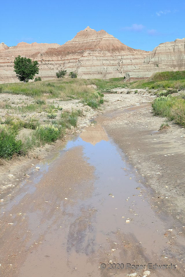
Badlands Reflections
Puddles left over from the previous evening's and overnight rains reflected a jagged ridge of eroded, soft sediments in Badlands National Park. Every year, a few more millimeters to inches of clay and sand wash downriver from all the Badlands slopes, ultimately delivered to the bottoms of the big reservoirs of central South Dakota. Before the lakes here and elsewhere were built, this material … [Read more...]
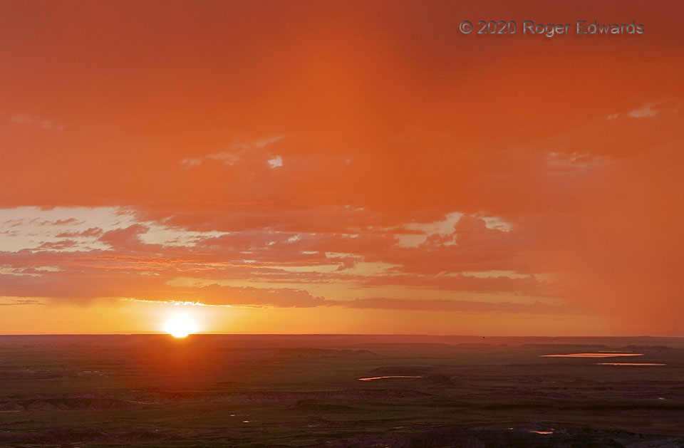
Sunrise through the Rain
Sunrises on the High Plains can be wondrous experiences, even more so when the vista includes part of South Dakota's Badlands. As a night person, I seldom indulge in sunrise due to usually being fast asleep at this hour, after a day and evening of storm observing. In this case, I awoke too soon while car camping, to the early northern-latitude daybreak and the pitter-patter of raindrops on the … [Read more...]
- « Previous Page
- 1
- …
- 164
- 165
- 166
- 167
- 168
- …
- 413
- Next Page »