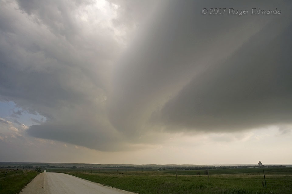
On this fine northern Kansas afternoon, we had observed towering cumulus building gradually into a full fledged supercell. Before the storm matured enough to produce large hail or heavy rain, we crossed beneath in order to get ahead of its projected path. During that trek, a ghostly set of cloud bands or striations streaked across the elongated base of this storm, a version of natural abstract … [Read more...]
Flashes over the Short Border
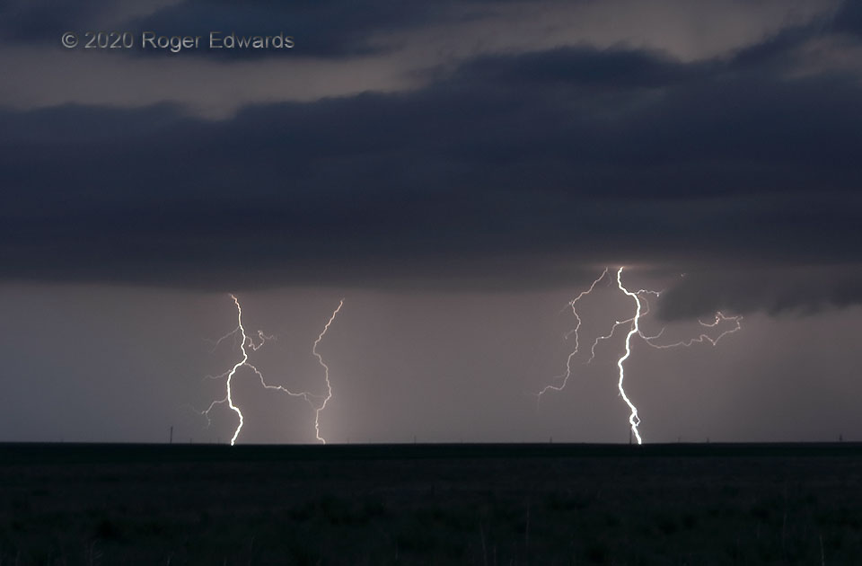
Much like a nice blend of teas or herbs at the table, a variety of cloud-to-ground lightning forms renders a feast on the atmospheric smorgasbord more pleasing and palatable. In this roughly 15-second exposure, two CGs were forked, one rather elegantly, while a third shyly but futilely tried to hide in-core. These strokes danced around the shortest state border on the Great Plains: that between … [Read more...]
Contrails over the Keys
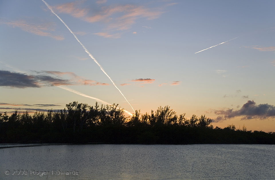
Here, several layers of cloud texturized the scene over the lower Florida Keys, the lowest being fractocumulus, lit orange in the setting sun's rays, then pale-orange tufts of altocumulus, then a few thin cirrus patches and these contrails: highest and whitest, catching the rays least filtered by intervening atmosphere. Back before flight-tracking smartphone apps, I only could guess the … [Read more...]
Solar-Powered Wind Power
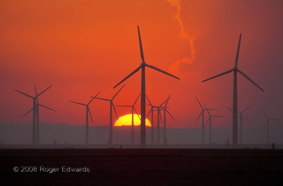
One of the facets of storm observing that I treasure most is the mystery of where the wind will deposit me at the end of the chase day. Even with a good forecast, one only can guess the part of a state or region where the trip will finish, and even then, special surprises often await. On this day, after a photographically bountiful jaunt through the Permian Basin and Big Country, the breezes … [Read more...]

Vault Forks
Developing as a late-day "tail-end Charlie" on the Palmer Divide, the Ordway supercell would spin on through twilight and into the deepening dark of night, here expressing a brilliant, forked cloud-to-ground discharge from its visual-vault region. As it closed in, this storm would continue rotation aloft and pulsate with electricity in nice variety. 2 N Ordway CO (4 Aug 20) Looking NNW 38.2559, … [Read more...]
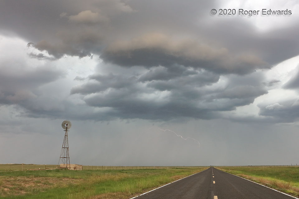
New Mexico High Plains Storm
After a weirdly lit and shaped stage, a relatively young, but outflow-elevated updraft shifted south-southeastward away from the highway, faint filaments of lightning flickering in the distant rain core. In the "monsoon" season, this scene epitomizes summertime on the High Plains of New Mexico. 2 NNE Hayden NM (2 Aug 20) Looking WSW 35.9987, -103.2561 … [Read more...]
- « Previous Page
- 1
- …
- 158
- 159
- 160
- 161
- 162
- …
- 413
- Next Page »