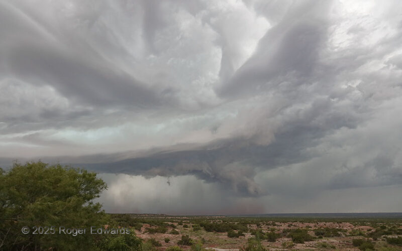
Despite obviously being somewhat high-based and outflow-dominant, this long-lived storm wasn't ready to give up yet. A strong low/middle-level mesocyclone still drove the bulk of its updraft behind the dirt-pushing gust front and shelf cloud evident here. The storm was moving quite fast to the southeast, and keeping ahead of it on widely spaced paved roads of this part of northwest Texas was … [Read more...]
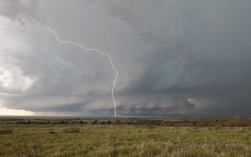
Big Supercell and Anvil CG
This broad, deep supercell formed over my head at Buc-Ee's in east Amarillo, then went hiding in terrain for awhile. It was content to make me go way out ahead and wait for it to leave the relative road void of the Palo Duro Canyon, while it charged southeastward right down said canyon unrestrained by road concerns, and while electrically bombarding the area around this spot. One among dozens of … [Read more...]
Third North Platte “Spout”
In a series of nonmesocyclonic "landspout" tornadoes from the same multicell storm's large base, this third (distant center) for-sure one was the faintest, and nowhere nearly as dusty as the second or broad as the first. Nonetheless, it sported a needle-like condensation funnel and narrow, wispy dust tube. Except for the foreground's being Platte Valley lowland on the Great Plains, this event … [Read more...]
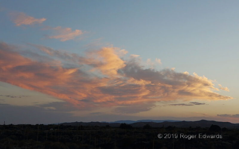
Flaming Malpais Sundown
Headed back home on a 2-day drive from some southern Arizona and New Mexico monsoon shooting, I found a great sunset view from upon the Malpais of Valley of Fires, before heading into Vaughn for the night on a memorable, moonlit drive. The next day would be a long trek back, but a satisfied one, for a good trip capped off by this fine desert sky. 4 NW Carrizozo NM (18 Jul 19) Looking … [Read more...]
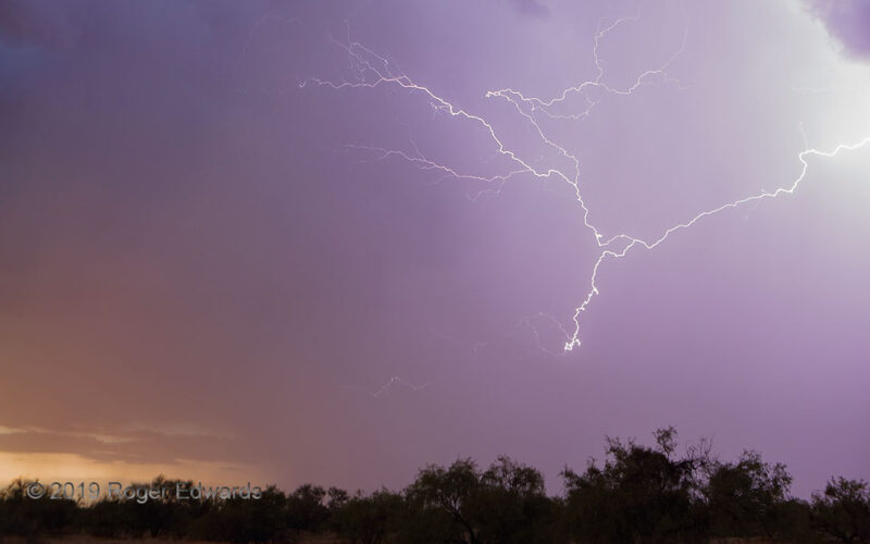
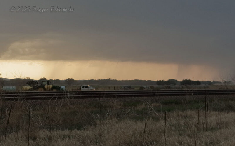
Crawler in Closing Core
Following a little bit of productive daytime lightning action, right before sunset, the storms kept producing sparks intermittently, as they closed in from multiple directions. By this time I actually was in the car for safety, controlling the camera remotely, as a wild flash of crawler lightning stabbed jaggedly through the northeastern sky. Within a couple minutes, rain started falling, which … [Read more...]
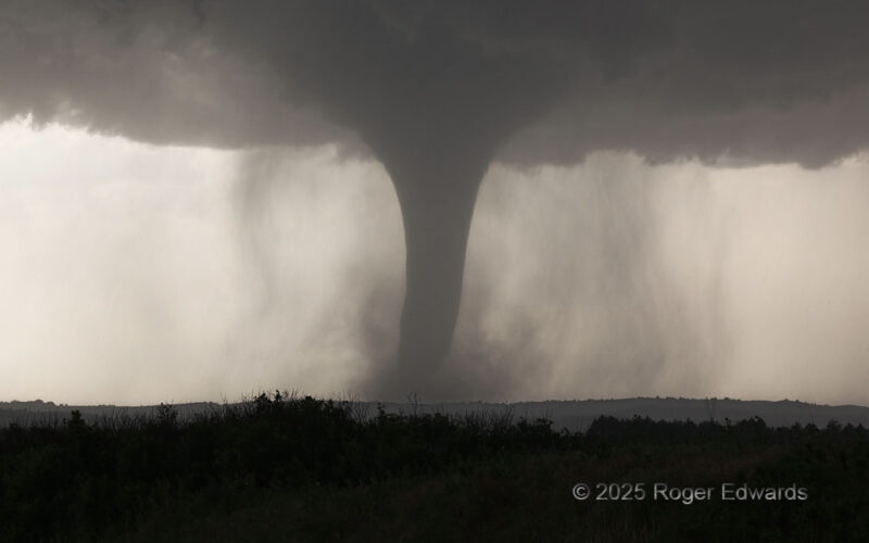
Wellfleet Stovepipe
Condensation of the long-lived and high-contrast "Wellfleet tornado" widened from a classical elephant-trunk shape to near its greatest apparent breadth during this stage, curiously, soon before dissipation. What had been very little precipitation around the low-level mesocyclone increased visibly, wrapping mainly northwest to southwest of the vortex in graceful-looking, curvy shafts, as the … [Read more...]
- « Previous Page
- 1
- …
- 14
- 15
- 16
- 17
- 18
- …
- 413
- Next Page »