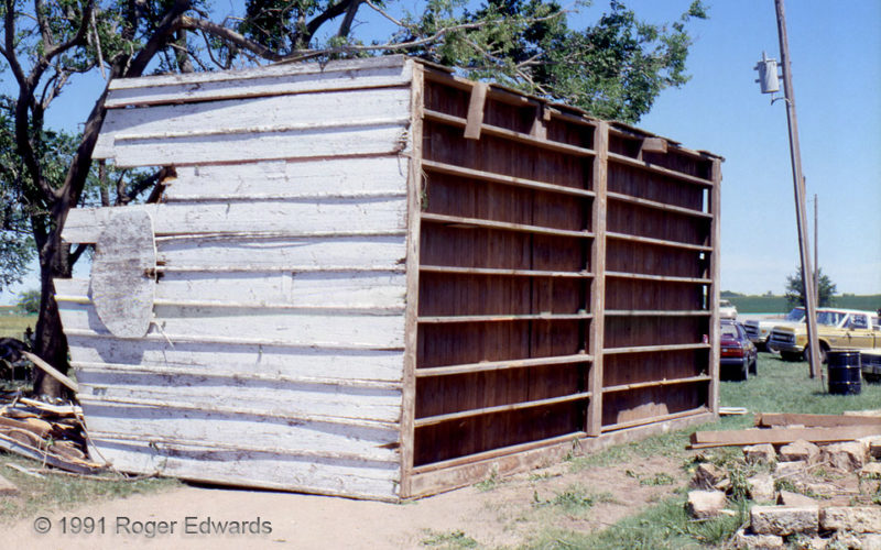
Across the Great Plains, many small structures are built sturdily, but are either poorly attached to their foundations or utterly unanchored. Then a severe wind hits, and all that good workmanship which went into the building is wasted! This is a great example from the north side of the Haysville-Wichita tornado of 16 May 1991, which I had witnessed. Although parts of one wall and the roof … [Read more...]
Tempestuous Direction
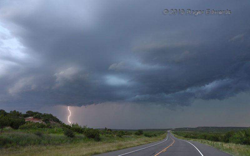
An electrically prolific squall line, evolved from a Caprock supercell, continued to spark as its gust front rolled over the Low Rolling Plains of northwest Texas. Soon darkness would set in, and the northern part of this convection would become a severe wind-producing complex over western and central Oklahoma—on my way home, of course. That made for an adventuresome return in the dust, wind and … [Read more...]
Nimbostratus
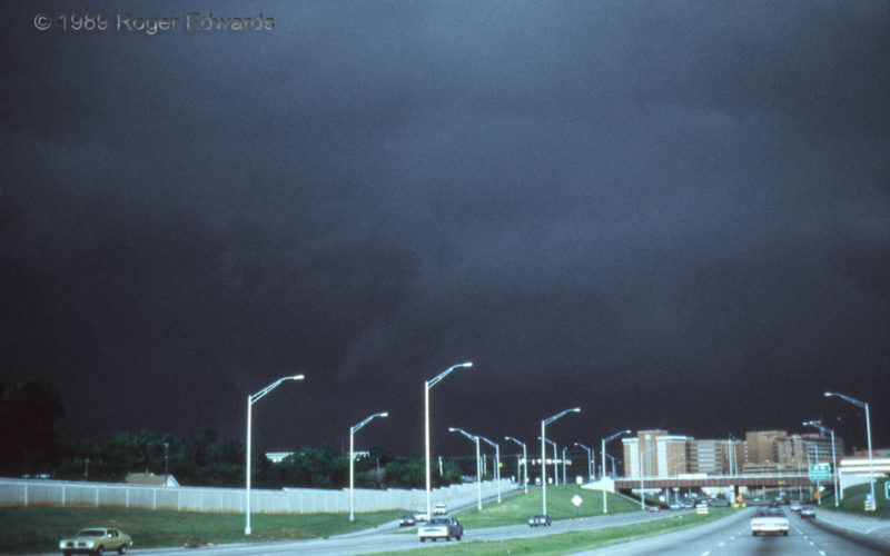
I have seen many dark stormscapes in my hundreds of storm intercepts during adulthood, and as a child in Dallas with eyes attracted to atmospheric violence. Wicked skies always have mesmerized and energized me; but this scene was so menacing, so ominous, that it rates in the top two or three of a lifetime. We were fortunate enough to be in just the right place and time to photograph it, on I-44 … [Read more...]
Hailstone Structure Assortment
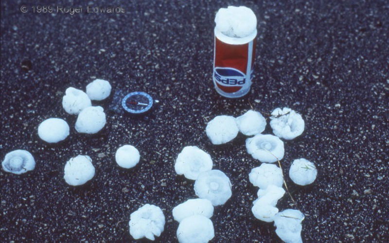
An assortment of hailstone sizes and shapes, as well as internal structures, could be gathered quickly from adjoining grass, immediately following the passage of a rain-wrapped, embedded supercell at this location. Unlike the pavement upon which the hail sits, the grass insulated the hail to some extent, slowing the melting process. Concentric rings of different opacities reveal growth layers as … [Read more...]
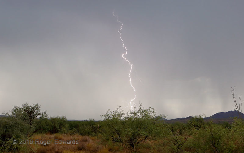
Booming across the Borderlands
While following storms and their outflow boundaries in anticipation of some sunset-hour lightning, why not shoot the day lightning too? That was my mindset here, as some cells fired over outflow from earlier mountain storms to my east, created a charged atmosphere, then started sparking profusely themselves. The earth to the west, all the way into the next mountain range and not far north of the … [Read more...]
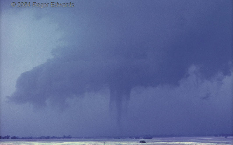
Deuel Vortex
Concentric tubes—inner and outer vortex components—are evident in this film slide of a tornado from Deuel County of the southeastern Nebraska Panhandle. If viewed in a cross-section, or a mobile Doppler radar image, it may have looked like two concentric rings with a "moat" or annulus between. This idea is much like the eyewall replacement cycle of a hurricane, and actually, that's how this … [Read more...]
- « Previous Page
- 1
- …
- 148
- 149
- 150
- 151
- 152
- …
- 413
- Next Page »