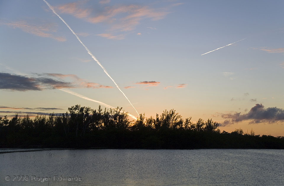
Here, several layers of cloud texturized the scene over the lower Florida Keys, the lowest being fractocumulus, lit orange in the setting sun's rays, then pale-orange tufts of altocumulus, then a few thin cirrus patches and these contrails: highest and whitest, catching the rays least filtered by intervening atmosphere. Back before flight-tracking smartphone apps, I only could guess the … [Read more...]
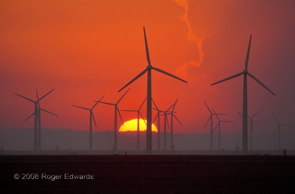
Solar-Powered Wind Power
One of the facets of storm observing that I treasure most is the mystery of where the wind will deposit me at the end of the chase day. Even with a good forecast, one only can guess the part of a state or region where the trip will finish, and even then, special surprises often await. On this day, after a photographically bountiful jaunt through the Permian Basin and Big Country, the breezes … [Read more...]

Vault Forks
Developing as a late-day "tail-end Charlie" on the Palmer Divide, the Ordway supercell would spin on through twilight and into the deepening dark of night, here expressing a brilliant, forked cloud-to-ground discharge from its visual-vault region. As it closed in, this storm would continue rotation aloft and pulsate with electricity in nice variety. 2 N Ordway CO (4 Aug 20) Looking … [Read more...]
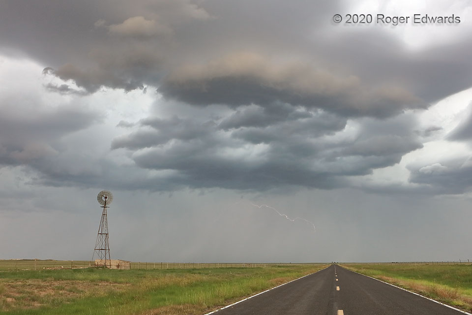
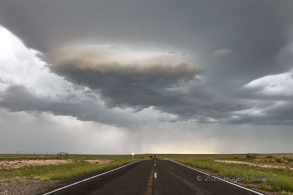
New Mexico High Plains Storm
After a weirdly lit and shaped stage, a relatively young, but outflow-elevated updraft shifted south-southeastward away from the highway, faint filaments of lightning flickering in the distant rain core. In the "monsoon" season, this scene epitomizes summertime on the High Plains of New Mexico. 2 NNE Hayden NM (2 Aug 20) Looking WSW 35.9987, -103.2561 … [Read more...]
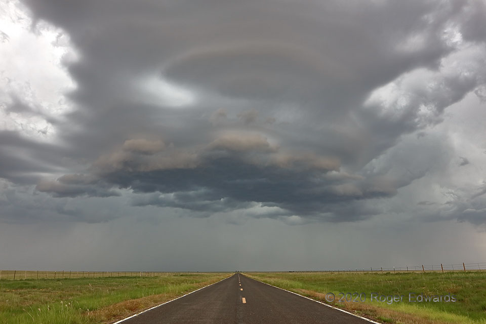
Ghostly Updraft over Highway
A cold pool from the distant cores built upon itself, sending a steady push of outflow eastward across the High Plains of northeastern New Mexico. After precipitation ultimately doused an oddly tinted updraft area farther west, this one developed and likewise moved southward across the road where I just had cruised. Above the shelfy, somewhat convective and somewhat laminar base hovered a … [Read more...]
Oddly Lit Updraft Base
A high-based updraft, with a small based fronted by a blended convective and laminar, shelf-like formation, formed fairly rapidly over the road and over me, then moved southward. Its curious presentation in the rear-view mirror compelled me to pull off this sparsely traveled New Mexico two-lane and shoot. The updraft also was elevated, given the cool outflow from its location nearly to mine, and … [Read more...]
- « Previous Page
- 1
- …
- 132
- 133
- 134
- 135
- 136
- …
- 386
- Next Page »