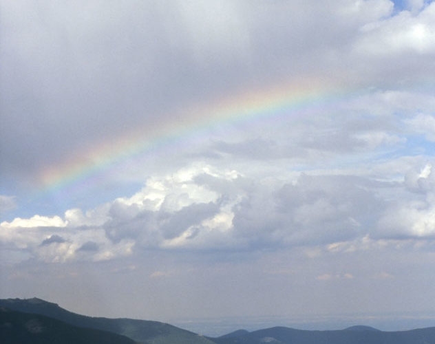
Without ground contact, this rainbow segment seems to levitate freely beneath the high-based shower—a striking addition to an already wondrous vista along the Mt. Evans highway. The edges of the sun's rays can be seen reflected above and refracted through the rainbow segment, then traced down to the shadows on the mountainsides. In the distance to the east: the Great Plains—where the supercells … [Read more...]
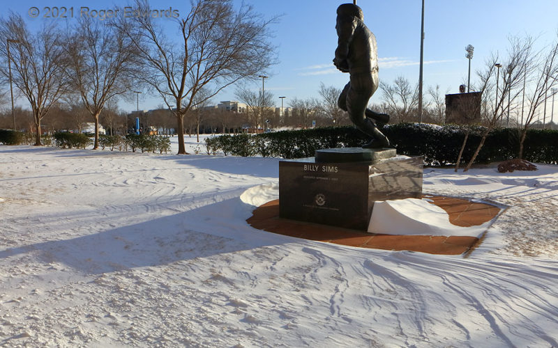
Sastrugi Surrounding Sims
On a bitterly cold, rare subzero morning in Norman, the Heisman Park statue of great OU running back Billy Sims stands surrounded by snow containing sastrugi. Obstacle effects related to bow and wake flow rendered areas immediately around the statue's rectangular base clear of snow, but for the deposition zone on its south side (in a north wind). Fortunately, native Texan Billy didn't have to … [Read more...]
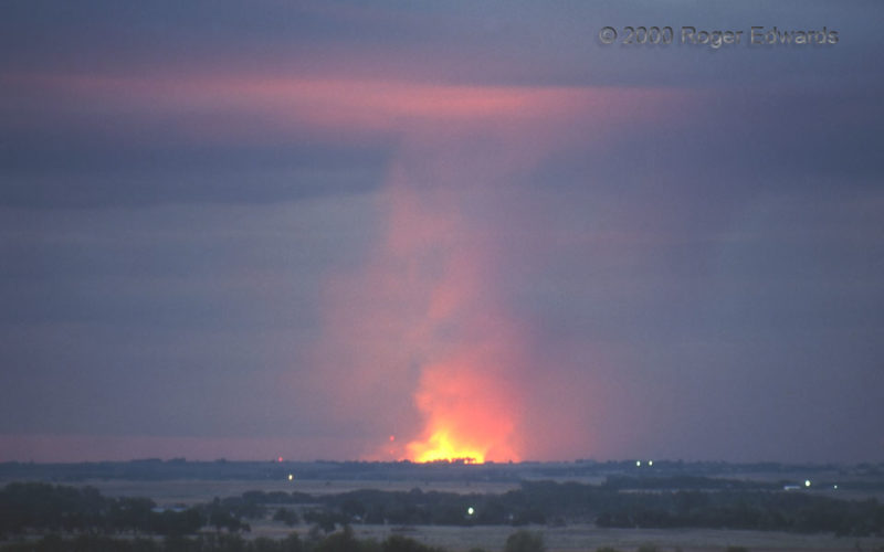
Cloud-Base Fire Glow
The glow of a grass and cedar fire reflects off the cloud base in the late moments of twilight, as smoke ascends into a nascent thunderstorm's updraft region. Lightning strikes from a developing squall line set several big wildfires in a virtual tinderbox cured by micro-drought in northern Oklahoma. The area had gone several weeks with scant rainfall—despite rains to the north and … [Read more...]
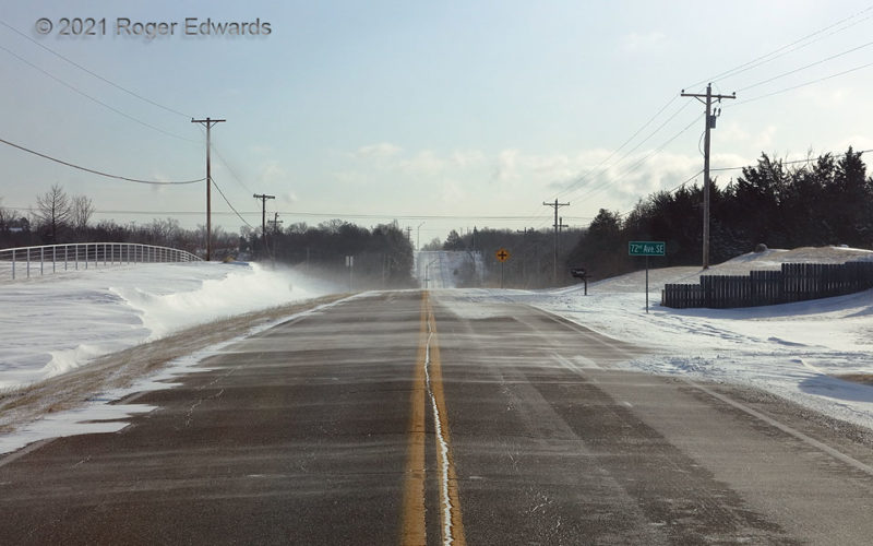
Sunny Subzero Streamers
Ordinary in the northern Plains or upper Midwest, a scene like this, with snow streamers zipping across the road on a sunny, subzero morning, is extraordinarily rare in central Oklahoma. The snow peeled off the crest of dune-like drifts on the north (left) side of the road and dispersed into the grass and woods on the south side. This was not comfortable. I was wishing to be in a much-warmer … [Read more...]
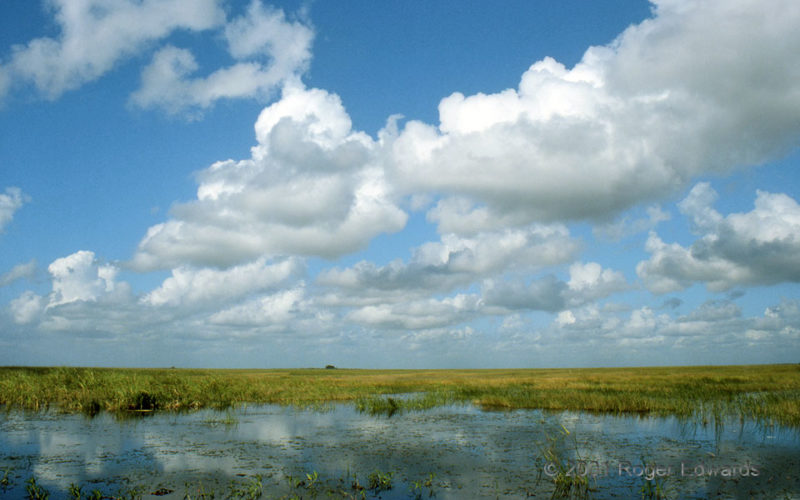
Cumulus Humilis, Everglades
Benign but mildly sheared cumulus humilis clouds drift placidly over the Everglades—Florida's little estuarine version of the Great Plains. While living in Miami, I made many short trips westward into the River of Grass, finding a large element of the same solace and immersion in the spaciousness of sky as I would during springtime sojourns to the High Plains. It became a sort of home away from … [Read more...]
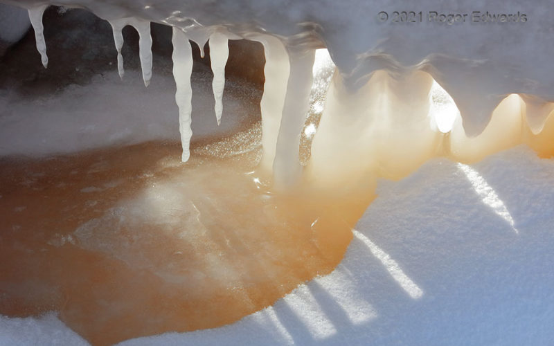
Stages of Lakeshore Ice
Icicles of lake water, in various stages of growth, line up under a tilted shoreline log. The lower the log, the more thoroughly the waves splashed it before the lake froze, and the thicker the icicles and columns. The wave action also stirred up the muddy bottom as it washed against the log, coloring the water reddish from the embedded sediment, but brought up only a small amount of fine clay … [Read more...]
- « Previous Page
- 1
- …
- 128
- 129
- 130
- 131
- 132
- …
- 413
- Next Page »