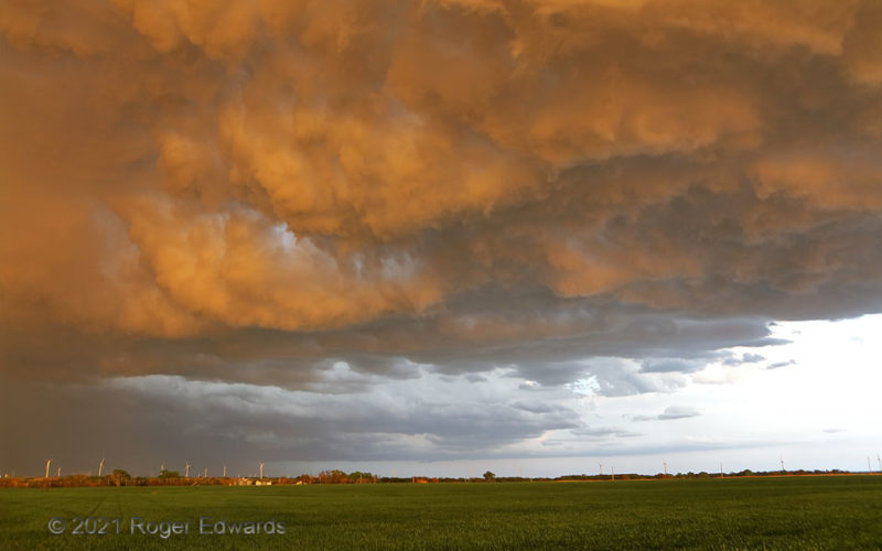
Outflow layered upon outflow as a newer, elevated storm (with core at left) developed over the cold pool left behind a messy supercell, whose flanking base can be see above the horizon. For just a minute or two, as the last of the sun's daily rays streamed through an unseen western cloud break, the turbulent cloud base of the nearer storm caught the light and used it to texture the eastern sky … [Read more...]

Spiked Glacier
You could say this tidal glacier "spiked the drink" whenever it calved into the bay. Sharp prongs of ice, tens of feet high, told tales of buckling, shearing and erosion as the mass descended from the high Fairweather Range of coastal southeastern Alaska. 76 NW Hoonah AK (31 Jul 3) Looking S 59.0453, -137.054 … [Read more...]
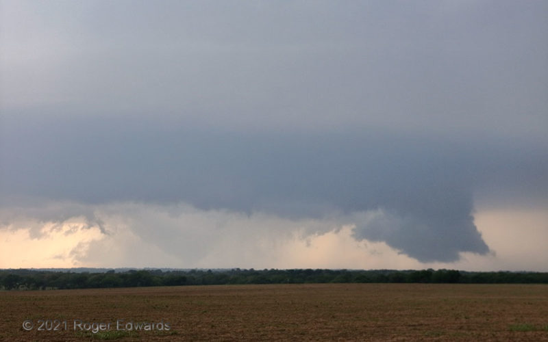
Tornado Spotting the Old Mesocyclone
This view offers a classic storm-spotting lesson. Paying close attention to radar and NWS warnings upshear, and being in a tornado watch, the diligent spotter knows a supercell is approaching from the west, has prepared for this, and immediately springs into duty. Upon emerging from the low, wooded area of Hill Country to the north and west to occupy a good, high vantage, the spotter sees the … [Read more...]
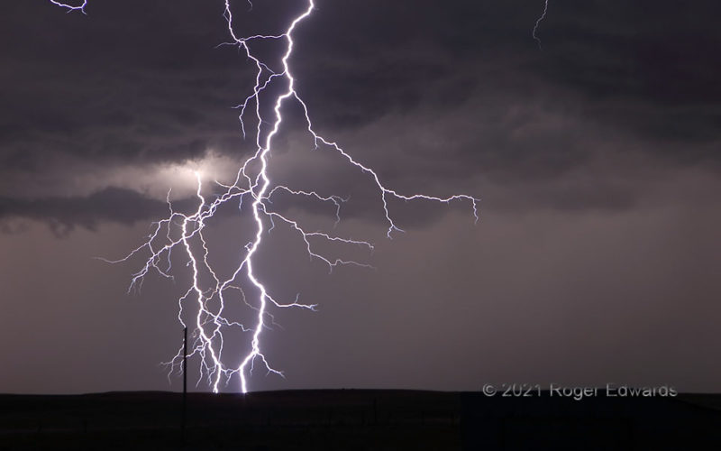
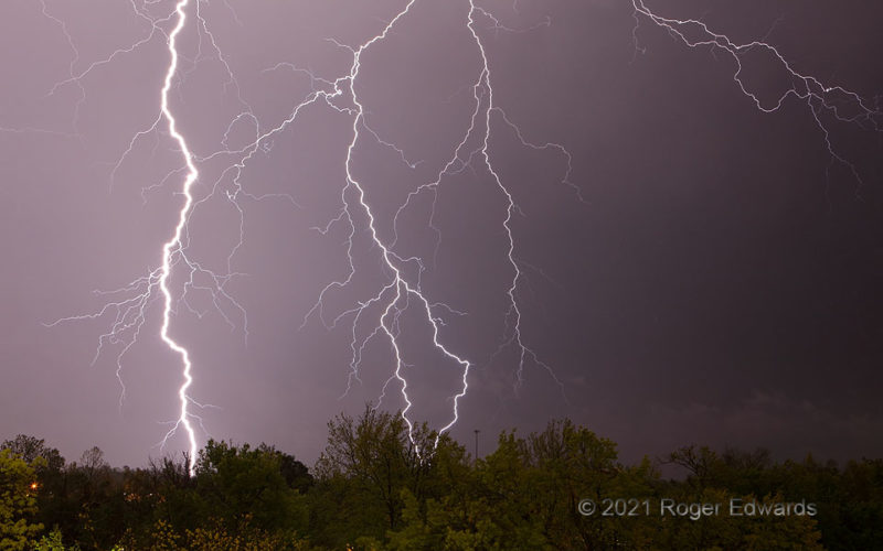
Big Bolts by Brookville
While photographing more-distant lightning (see the bolt at left rear?) a bright flash blasted through the sky beneath a base higher than the field of view, around two miles away. This was unambiguous evidence that it was time to toss the tripodded camera into the back and evacuate the area, fast. Unlike a similarly close discharge a couple weeks before in Norman, I wasn't within any sort of … [Read more...]
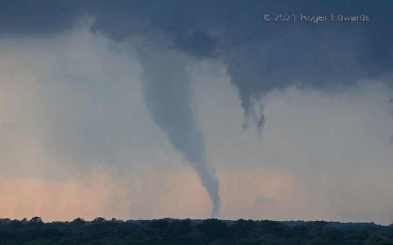
Blum Trunk
Dangerous and delicate at the same time, a tornado depends on a narrow but still incompletely understood balance of storm-scale conditions to form and persist. This one spun near Blum, TX, for almost 10 minutes within a deeply occluded mesocyclone, evolving from a rain-wrapped bowl shape to a lumpy elephant-trunk formation here—and later, a tapering, pointed tube that destroyed a wedding venue. … [Read more...]
Explosive Intricacy
This is a wide-angle view—so yes, it was nearby, and loud. [Worry not, I was in shelter of a well-grounded structure with good outside view.] A single source, connected somewhere high in the trailing precipitation region of a squall line, triggered an instant, multichannel cloud-to-ground discharge. At such close range, with high origin and no obscuring by clouds, the deeply detailed, … [Read more...]
- « Previous Page
- 1
- …
- 121
- 122
- 123
- 124
- 125
- …
- 413
- Next Page »