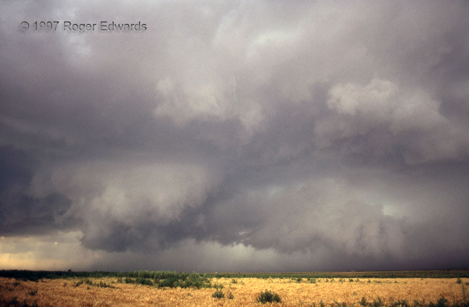
 The big, horseshoe shaped wall cloud was rotating fast, with a growing dust pall beneath. I later got within 1/4 mile of its rim. By then, there was clearly an intense mesocyclone on the ground, causing a broad wheel of rotating dust; but I could see no certain tornado within. Lubbock NWS had just issued a tornado warning based on a tornado vortex signature (TVS) on their Doppler radar. [The TVS alarm activated whenever the mesocyclone aloft met certain thresholds for strength, tightness, duration and depth. Being in 1997, this was long before “super-res” and dual polarization.] At the time of this slide, rain and hail were wrapping behind the portion above the long clump of bushes, at left-center. Rapid right–left (N–S) motion was also present in the tail cloud curving NNE from there toward the forward flank core at right. This was a separate supercell from the Anton/Shallowater storm featured earlier in this gallery, and developed along that storm’s outflow boundary. Sources of low level vorticity abounded, and the storm was moving 60-80 degrees rightward of mean flow. With all these things going for it, a sure tornado never appeared!
3 N Needmore TX (9 Jun 97) Looking NW
33.3704, -102.327
The big, horseshoe shaped wall cloud was rotating fast, with a growing dust pall beneath. I later got within 1/4 mile of its rim. By then, there was clearly an intense mesocyclone on the ground, causing a broad wheel of rotating dust; but I could see no certain tornado within. Lubbock NWS had just issued a tornado warning based on a tornado vortex signature (TVS) on their Doppler radar. [The TVS alarm activated whenever the mesocyclone aloft met certain thresholds for strength, tightness, duration and depth. Being in 1997, this was long before “super-res” and dual polarization.] At the time of this slide, rain and hail were wrapping behind the portion above the long clump of bushes, at left-center. Rapid right–left (N–S) motion was also present in the tail cloud curving NNE from there toward the forward flank core at right. This was a separate supercell from the Anton/Shallowater storm featured earlier in this gallery, and developed along that storm’s outflow boundary. Sources of low level vorticity abounded, and the storm was moving 60-80 degrees rightward of mean flow. With all these things going for it, a sure tornado never appeared!
3 N Needmore TX (9 Jun 97) Looking NW
33.3704, -102.327Needmore Rotation!
 The big, horseshoe shaped wall cloud was rotating fast, with a growing dust pall beneath. I later got within 1/4 mile of its rim. By then, there was clearly an intense mesocyclone on the ground, causing a broad wheel of rotating dust; but I could see no certain tornado within. Lubbock NWS had just issued a tornado warning based on a tornado vortex signature (TVS) on their Doppler radar. [The TVS alarm activated whenever the mesocyclone aloft met certain thresholds for strength, tightness, duration and depth. Being in 1997, this was long before “super-res” and dual polarization.] At the time of this slide, rain and hail were wrapping behind the portion above the long clump of bushes, at left-center. Rapid right–left (N–S) motion was also present in the tail cloud curving NNE from there toward the forward flank core at right. This was a separate supercell from the Anton/Shallowater storm featured earlier in this gallery, and developed along that storm’s outflow boundary. Sources of low level vorticity abounded, and the storm was moving 60-80 degrees rightward of mean flow. With all these things going for it, a sure tornado never appeared!
3 N Needmore TX (9 Jun 97) Looking NW
33.3704, -102.327