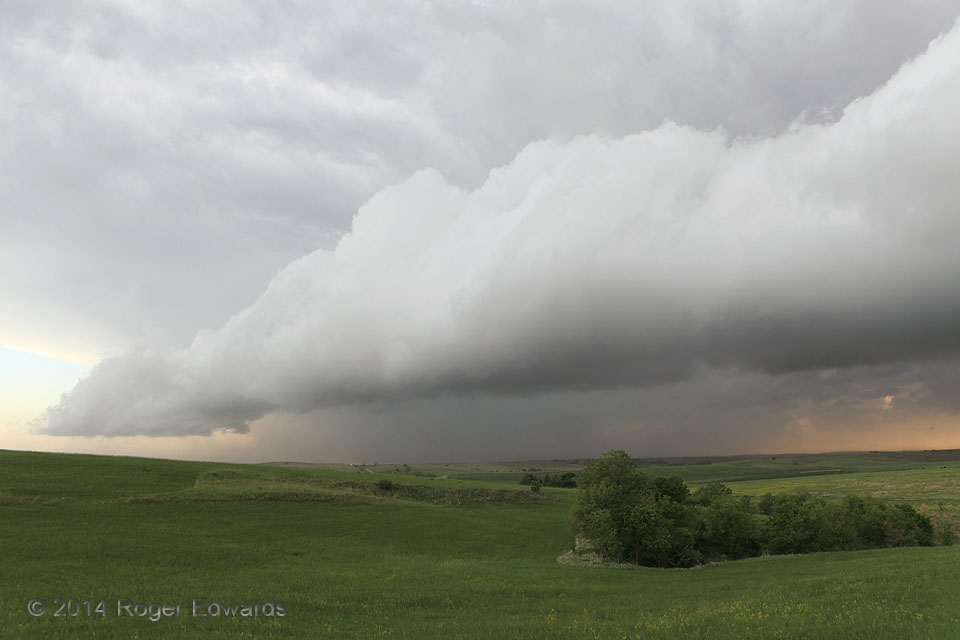
 Some arcus or shelf clouds have laminar, smooth banding that occurs when the cold pool forces upward a layer of relatively stable air at that level. Others, such as this one, are more convective, or bubbly and rolling in character, the lifted air being unstable. [Here is a view of the east side of the same formation.] Scientifically and aesthetically, this was a marvelous process to behold. While admittedly not as exciting as a tornadic situation, I don’t share other storm observers’ grievous disdain for outflow of this sort; it offers fascinating cloud formations and motions, and refreshing, cool air. The gust front would keep roaring southward for another hour or two into somewhat drier, more deeply mixed boundary layer, but still with just enough lift and moisture for some interesting cloud features.
12 S Ansley NE (3 Jun 14) Looking WNW
41.103, -99.3965
Some arcus or shelf clouds have laminar, smooth banding that occurs when the cold pool forces upward a layer of relatively stable air at that level. Others, such as this one, are more convective, or bubbly and rolling in character, the lifted air being unstable. [Here is a view of the east side of the same formation.] Scientifically and aesthetically, this was a marvelous process to behold. While admittedly not as exciting as a tornadic situation, I don’t share other storm observers’ grievous disdain for outflow of this sort; it offers fascinating cloud formations and motions, and refreshing, cool air. The gust front would keep roaring southward for another hour or two into somewhat drier, more deeply mixed boundary layer, but still with just enough lift and moisture for some interesting cloud features.
12 S Ansley NE (3 Jun 14) Looking WNW
41.103, -99.3965Nebraska Arcus: West
 Some arcus or shelf clouds have laminar, smooth banding that occurs when the cold pool forces upward a layer of relatively stable air at that level. Others, such as this one, are more convective, or bubbly and rolling in character, the lifted air being unstable. [Here is a view of the east side of the same formation.] Scientifically and aesthetically, this was a marvelous process to behold. While admittedly not as exciting as a tornadic situation, I don’t share other storm observers’ grievous disdain for outflow of this sort; it offers fascinating cloud formations and motions, and refreshing, cool air. The gust front would keep roaring southward for another hour or two into somewhat drier, more deeply mixed boundary layer, but still with just enough lift and moisture for some interesting cloud features.
12 S Ansley NE (3 Jun 14) Looking WNW
41.103, -99.3965