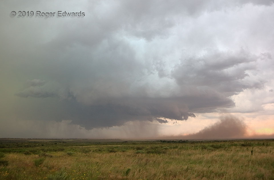
 By the time I had finished with this supercell, it felt like a cantankerous and temperamental old friend. How appropriate it was behaving this way in Motley County! I had chased, or been chased by, this storm since its earliest dryline towers near the New Mexico line, its struggle to emerge from a cluster of storms well west of Plainview, organization and reorganization across the remaining High Plains east of I-27, through a bizarre winged-spacecraft stage, and over the Caprock, whereupon the storm emerged over conditions more suitable for tremendous outflow winds. In doing so, it hoisted countless thousands of tons of dust thousands of feet skyward. Richer moisture awaited around 60 miles to the east, but thanks to the landscape’s “dropping down” from under the storm, with similar inflow-layer moisture content, the greater resultant mixed-layer depth off the Caprock invited such a blast. This outflow soon merged with that from convection to the north and south, leaving what was left of the supercell buried somewhere in an extensive and scenic band of severe thunderstorms with winds locally over hurricane force.
3 NW Matador TX (15 Jun 19) Looking NNE
34.0505, -100.8577
By the time I had finished with this supercell, it felt like a cantankerous and temperamental old friend. How appropriate it was behaving this way in Motley County! I had chased, or been chased by, this storm since its earliest dryline towers near the New Mexico line, its struggle to emerge from a cluster of storms well west of Plainview, organization and reorganization across the remaining High Plains east of I-27, through a bizarre winged-spacecraft stage, and over the Caprock, whereupon the storm emerged over conditions more suitable for tremendous outflow winds. In doing so, it hoisted countless thousands of tons of dust thousands of feet skyward. Richer moisture awaited around 60 miles to the east, but thanks to the landscape’s “dropping down” from under the storm, with similar inflow-layer moisture content, the greater resultant mixed-layer depth off the Caprock invited such a blast. This outflow soon merged with that from convection to the north and south, leaving what was left of the supercell buried somewhere in an extensive and scenic band of severe thunderstorms with winds locally over hurricane force.
3 NW Matador TX (15 Jun 19) Looking NNE
34.0505, -100.8577Motley Dust Bomb
 By the time I had finished with this supercell, it felt like a cantankerous and temperamental old friend. How appropriate it was behaving this way in Motley County! I had chased, or been chased by, this storm since its earliest dryline towers near the New Mexico line, its struggle to emerge from a cluster of storms well west of Plainview, organization and reorganization across the remaining High Plains east of I-27, through a bizarre winged-spacecraft stage, and over the Caprock, whereupon the storm emerged over conditions more suitable for tremendous outflow winds. In doing so, it hoisted countless thousands of tons of dust thousands of feet skyward. Richer moisture awaited around 60 miles to the east, but thanks to the landscape’s “dropping down” from under the storm, with similar inflow-layer moisture content, the greater resultant mixed-layer depth off the Caprock invited such a blast. This outflow soon merged with that from convection to the north and south, leaving what was left of the supercell buried somewhere in an extensive and scenic band of severe thunderstorms with winds locally over hurricane force.
3 NW Matador TX (15 Jun 19) Looking NNE
34.0505, -100.8577