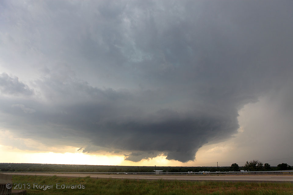
 The Millsap supercell organized even further, tightening its rotation at all levels while forming two wall clouds with two occlusions in rapid sequence. Here, the decayed remains of the older wall cloud can be seen in the middle, while at slightly nearer right, a bigger and lower one protrudes, soon to wrap in rain, become tornadic, and unwrap again. Looking at the big picture (literally!) the striking storm structure stands out—something seldom seen this far east in North Texas. Quite often, by the time supercells get to this area, they’re either enshrouded in low clouds or are heavy-precipitation (HP) in character, masking many of their features above and under the main cloud base.
2 NW Brock TX (15 May 13) Looking WNW
32.7004, -97.9611
The Millsap supercell organized even further, tightening its rotation at all levels while forming two wall clouds with two occlusions in rapid sequence. Here, the decayed remains of the older wall cloud can be seen in the middle, while at slightly nearer right, a bigger and lower one protrudes, soon to wrap in rain, become tornadic, and unwrap again. Looking at the big picture (literally!) the striking storm structure stands out—something seldom seen this far east in North Texas. Quite often, by the time supercells get to this area, they’re either enshrouded in low clouds or are heavy-precipitation (HP) in character, masking many of their features above and under the main cloud base.
2 NW Brock TX (15 May 13) Looking WNW
32.7004, -97.9611Millsap Supercell 2
 The Millsap supercell organized even further, tightening its rotation at all levels while forming two wall clouds with two occlusions in rapid sequence. Here, the decayed remains of the older wall cloud can be seen in the middle, while at slightly nearer right, a bigger and lower one protrudes, soon to wrap in rain, become tornadic, and unwrap again. Looking at the big picture (literally!) the striking storm structure stands out—something seldom seen this far east in North Texas. Quite often, by the time supercells get to this area, they’re either enshrouded in low clouds or are heavy-precipitation (HP) in character, masking many of their features above and under the main cloud base.
2 NW Brock TX (15 May 13) Looking WNW
32.7004, -97.9611