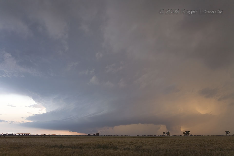
 This wide-angle view encompasses most of a large, complex storm, known in storm intercept and V.O.R.T.EX.-2 circles as the “Lamar supercell”. It actually was the large, heavy-precipitation spawn of a merger between initially distinct northern and southern supercells. The northern storm took over, its mesocyclonic cycling continuing as manifest by the large, low-hanging wall clouds that it kept forming at right (northern side). The southern storm provided gigatons of precipitation to the remainder of the complex S and SW of the mesocyclone, along with a wonderful array of middle level cloud striations, much to the pleasure of this observer! Soon, it would be dark, and time to let the storm slide on down the Arkansas River valley into Kansas. We would bunk down for the night in Lamar, after eating a good dinner with several folks we knew from the big field project.
4 WNW Lamar CO (11 Jun 9) Looking WSW
38.1067, -102.691
This wide-angle view encompasses most of a large, complex storm, known in storm intercept and V.O.R.T.EX.-2 circles as the “Lamar supercell”. It actually was the large, heavy-precipitation spawn of a merger between initially distinct northern and southern supercells. The northern storm took over, its mesocyclonic cycling continuing as manifest by the large, low-hanging wall clouds that it kept forming at right (northern side). The southern storm provided gigatons of precipitation to the remainder of the complex S and SW of the mesocyclone, along with a wonderful array of middle level cloud striations, much to the pleasure of this observer! Soon, it would be dark, and time to let the storm slide on down the Arkansas River valley into Kansas. We would bunk down for the night in Lamar, after eating a good dinner with several folks we knew from the big field project.
4 WNW Lamar CO (11 Jun 9) Looking WSW
38.1067, -102.691Merged Pair at Sunset
 This wide-angle view encompasses most of a large, complex storm, known in storm intercept and V.O.R.T.EX.-2 circles as the “Lamar supercell”. It actually was the large, heavy-precipitation spawn of a merger between initially distinct northern and southern supercells. The northern storm took over, its mesocyclonic cycling continuing as manifest by the large, low-hanging wall clouds that it kept forming at right (northern side). The southern storm provided gigatons of precipitation to the remainder of the complex S and SW of the mesocyclone, along with a wonderful array of middle level cloud striations, much to the pleasure of this observer! Soon, it would be dark, and time to let the storm slide on down the Arkansas River valley into Kansas. We would bunk down for the night in Lamar, after eating a good dinner with several folks we knew from the big field project.
4 WNW Lamar CO (11 Jun 9) Looking WSW
38.1067, -102.691