[Click Image to Enlarge]
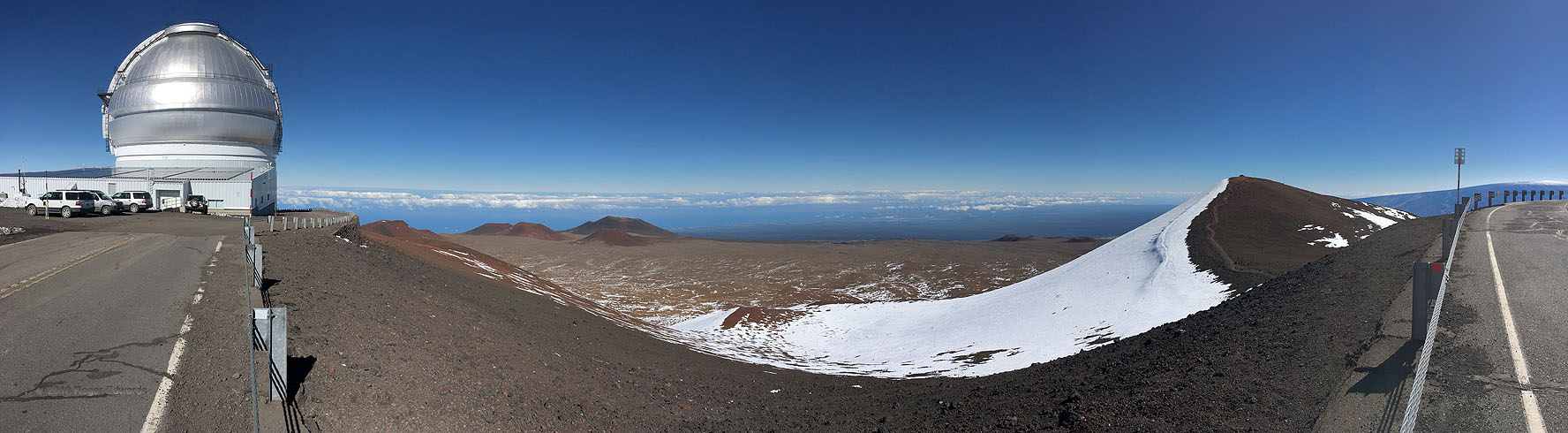
On the Big Island of Hawaii (Hawaii Island), volcanic Mauna Kea reaches 13,803 feet above sea level and 30,610 feet from its deep, mid-Pacific underwater bottom, the highest base-to-top measure of any mountain in the world. The altitude above sea level here would be the highest of any mountain in the U.S. outside Alaska, if it weren’t for the fact that the tremendous weight of the island presses the surrounding seafloor downward a few thousand feet. A rare clear, calm day for this altitude allowed a reasonably comfortable panoramic view extending from one of several astronomical observatories near its summit, across several lower cinder cones flanking the top, to the peak itself at the end of the dirt trail (yes, I strolled over there, but didn’t think to do a pano until later, here). Partly snow-capped Mauna Loa — much larger in volume but not quite as tall as Kea — looms at distant far right. Snow, deposited by a cold-core, mid/upper-level cyclone over a week before, lingered mainly in crevices and north-facing slopes.
2 SW Umikoa, HI (4 Jan 18) Looking N-E-S
19.8225, -155.4697