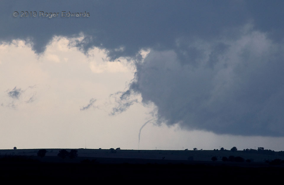
 We arrived at a known high spot with unfettered western view (Waconda Lake dam) to observe a much-closer, nontornadic, yet tornado-warned supercell moving along a warm front toward Glen Elder. Then in the distant southwest, we noticed this end-stage tornado dangling desperately, and in ultimate futility, from the rear of the trailing supercell’s main updraft near Tipton. This turns out to have been the final minute of a 23-mile-long “Luray” tornado path. It also represents one reason I bring a long zoom lens on every storm-observing trip! Sometimes the observer is tracking one storm and sees a tornado beneath another. Every bit of that functionality was needed here, to be able to capture the rope stage in clear focus, along with foreground shards of scud racing northward in the broader-scale inflow region. Unknown to me, a quick mesocyclonic handoff stage, involving two more tornadoes, was just beginning!
1 S Glen Elder KS (28 May 19) Looking SW
39.4702, -98.3123
RADAR
We arrived at a known high spot with unfettered western view (Waconda Lake dam) to observe a much-closer, nontornadic, yet tornado-warned supercell moving along a warm front toward Glen Elder. Then in the distant southwest, we noticed this end-stage tornado dangling desperately, and in ultimate futility, from the rear of the trailing supercell’s main updraft near Tipton. This turns out to have been the final minute of a 23-mile-long “Luray” tornado path. It also represents one reason I bring a long zoom lens on every storm-observing trip! Sometimes the observer is tracking one storm and sees a tornado beneath another. Every bit of that functionality was needed here, to be able to capture the rope stage in clear focus, along with foreground shards of scud racing northward in the broader-scale inflow region. Unknown to me, a quick mesocyclonic handoff stage, involving two more tornadoes, was just beginning!
1 S Glen Elder KS (28 May 19) Looking SW
39.4702, -98.3123
RADARLuray Tornado’s Demise
 We arrived at a known high spot with unfettered western view (Waconda Lake dam) to observe a much-closer, nontornadic, yet tornado-warned supercell moving along a warm front toward Glen Elder. Then in the distant southwest, we noticed this end-stage tornado dangling desperately, and in ultimate futility, from the rear of the trailing supercell’s main updraft near Tipton. This turns out to have been the final minute of a 23-mile-long “Luray” tornado path. It also represents one reason I bring a long zoom lens on every storm-observing trip! Sometimes the observer is tracking one storm and sees a tornado beneath another. Every bit of that functionality was needed here, to be able to capture the rope stage in clear focus, along with foreground shards of scud racing northward in the broader-scale inflow region. Unknown to me, a quick mesocyclonic handoff stage, involving two more tornadoes, was just beginning!
1 S Glen Elder KS (28 May 19) Looking SW
39.4702, -98.3123
RADAR