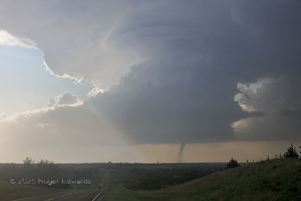
Uncommonly yet spectacularly, a marvelously formed, low-precipitation (LP) supercell spun up a tornado, and one at least temporarily fully condensed from ground to cloud. This was one of two distinct tornadoes the storm produced from the same cloud-base circulation, which according to closer observers and the NWS survey, temporarily disconnected from apparent ground contact for a few minutes about 1/5 of the way through the tornadic cycle, then spun up to a growing funnel again. The supercell soon would fill in with more precipitation, making it more classic in character, though the tornadoes remained visible from every direction throughout their lifetimes. This is the second dream-shot view I’ve had in the same year of a tornado under a well-structured supercell!
2 SE Maywood NE (16 Jun 25) Looking NW
40.6335, -100.5888