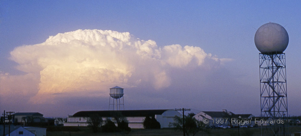
 A near-sunset, low-precipitation (LP) supercell shined in the northeastern sky, with an experimental NEXRAD radar dome I had employed in another favorite image, but shot from the roof of the former NSSL/SPC building. I scanned this wide-angle slide at high resolution and cropped it into an effective panoramic. That backshearing collar of ice-crystal clouds below its top, at a decidedly lower level than the downshear anvil, was a persistent feature for over an hour, as the storm raced ENE from just north of Norman toward Tulsa. At this point, the storm was near Chandler—60–70 miles away—but its high cloud base still was visible.
Norman, OK (27 Mar 97) Looking NE
35.2376, -97.4619
A near-sunset, low-precipitation (LP) supercell shined in the northeastern sky, with an experimental NEXRAD radar dome I had employed in another favorite image, but shot from the roof of the former NSSL/SPC building. I scanned this wide-angle slide at high resolution and cropped it into an effective panoramic. That backshearing collar of ice-crystal clouds below its top, at a decidedly lower level than the downshear anvil, was a persistent feature for over an hour, as the storm raced ENE from just north of Norman toward Tulsa. At this point, the storm was near Chandler—60–70 miles away—but its high cloud base still was visible.
Norman, OK (27 Mar 97) Looking NE
35.2376, -97.4619LP Supercell and Radome
 A near-sunset, low-precipitation (LP) supercell shined in the northeastern sky, with an experimental NEXRAD radar dome I had employed in another favorite image, but shot from the roof of the former NSSL/SPC building. I scanned this wide-angle slide at high resolution and cropped it into an effective panoramic. That backshearing collar of ice-crystal clouds below its top, at a decidedly lower level than the downshear anvil, was a persistent feature for over an hour, as the storm raced ENE from just north of Norman toward Tulsa. At this point, the storm was near Chandler—60–70 miles away—but its high cloud base still was visible.
Norman, OK (27 Mar 97) Looking NE
35.2376, -97.4619