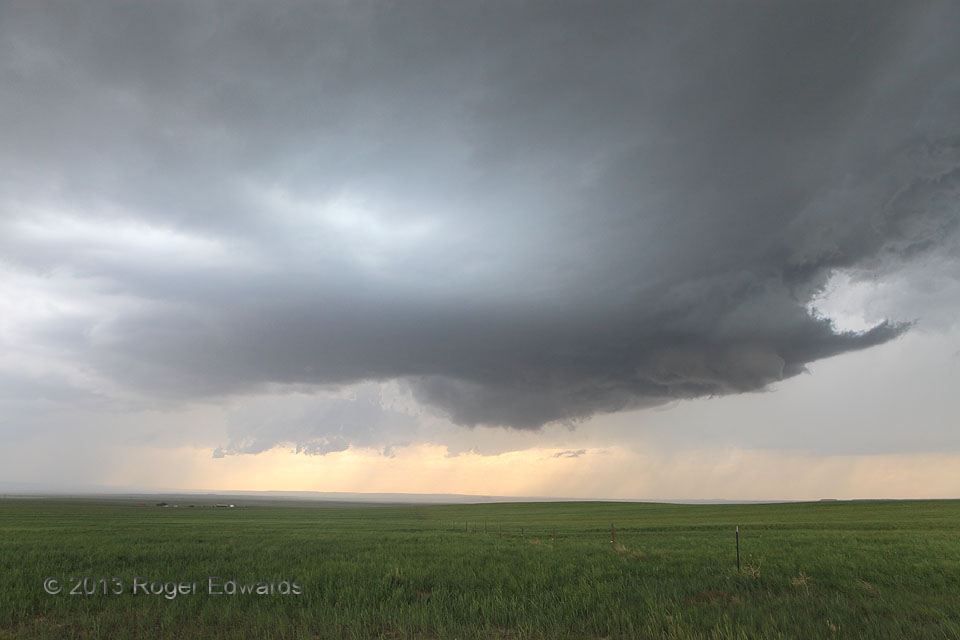
 This well-curved Wyoming supercell, with a small forward-flank tail cloud, wrapped part of its a rear-flank downdraft nicely around the front side of its mesocyclone, as manifest by the clear slot cutting partly across the front side of the shallow wall cloud. Meanwhile, a few wispy, short-lived funnel attempts came and went, with no discernible ground-level contact. This pretty storm saved its tightest cloud-base rotation for this stage, when it was higher-based and ingesting somewhat lower-humidity air than it had been at higher elevations to the west. Though the supercell would shrivel and die in short order, a moist axis, still located 30-40 miles to the south, strongly would benefit the next storm organizing to the southwest. We wouldn’t linger near Lingle much longer! The newer cell’s farthest forward-flank precipitation can be seen at distant left, compelling a southward re-positioning to intercept a most memorable, eventually tornadic supercell.
5 N Veteran WY (22 Jun 13) Looking NW
42.0312, -104.3823
This well-curved Wyoming supercell, with a small forward-flank tail cloud, wrapped part of its a rear-flank downdraft nicely around the front side of its mesocyclone, as manifest by the clear slot cutting partly across the front side of the shallow wall cloud. Meanwhile, a few wispy, short-lived funnel attempts came and went, with no discernible ground-level contact. This pretty storm saved its tightest cloud-base rotation for this stage, when it was higher-based and ingesting somewhat lower-humidity air than it had been at higher elevations to the west. Though the supercell would shrivel and die in short order, a moist axis, still located 30-40 miles to the south, strongly would benefit the next storm organizing to the southwest. We wouldn’t linger near Lingle much longer! The newer cell’s farthest forward-flank precipitation can be seen at distant left, compelling a southward re-positioning to intercept a most memorable, eventually tornadic supercell.
5 N Veteran WY (22 Jun 13) Looking NW
42.0312, -104.3823Lingering near Lingle
 This well-curved Wyoming supercell, with a small forward-flank tail cloud, wrapped part of its a rear-flank downdraft nicely around the front side of its mesocyclone, as manifest by the clear slot cutting partly across the front side of the shallow wall cloud. Meanwhile, a few wispy, short-lived funnel attempts came and went, with no discernible ground-level contact. This pretty storm saved its tightest cloud-base rotation for this stage, when it was higher-based and ingesting somewhat lower-humidity air than it had been at higher elevations to the west. Though the supercell would shrivel and die in short order, a moist axis, still located 30-40 miles to the south, strongly would benefit the next storm organizing to the southwest. We wouldn’t linger near Lingle much longer! The newer cell’s farthest forward-flank precipitation can be seen at distant left, compelling a southward re-positioning to intercept a most memorable, eventually tornadic supercell.
5 N Veteran WY (22 Jun 13) Looking NW
42.0312, -104.3823