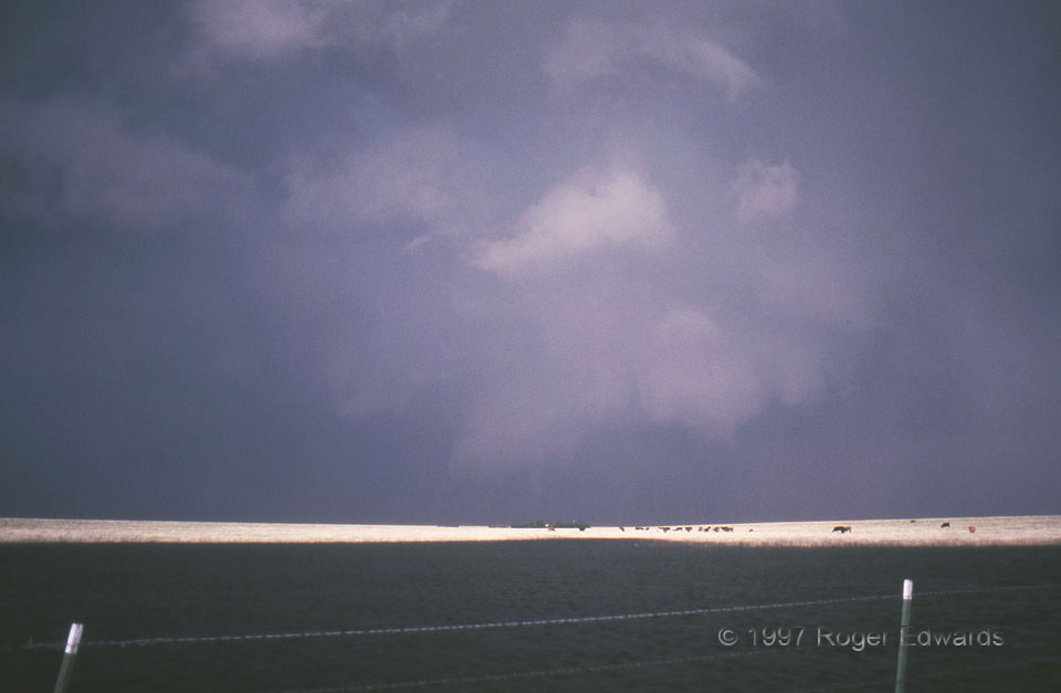
 I’ve shot more distant, low-contrast tornado photos than I care to count or admit or display in SkyPix, but will include this scan as a spotting lesson. Darkness and low contrast are common impediments to photography under severe storms, especially with relatively unforgiving 1990s-era slide film. Can you identify the tornado? It produced F0 damage to fences and utility equipment. We saw it only briefly, and I was lucky to get even this view, given its remoteness and distance from suitable roads near the Caprock. We had been watching the wall cloud rotate and produce brief funnels for at least half an hour prior to this small tornado. The water in the foreground is part of a playa, one of thousands of such shallow and often dry basins that dot the Texas High Plains. They fill up after rains, providing water for wildlife and habitat for migrating waterfowl before they slowly evaporate to crusty mud flats. Playas are major water recharge sources for the underlying Ogallala aquifer in this area, without which a lot of Great Plains farming would be practically impossible.
11 SW Lefors TX (7 May 97) Looking NE
35.2851, -100.972
RADAR
I’ve shot more distant, low-contrast tornado photos than I care to count or admit or display in SkyPix, but will include this scan as a spotting lesson. Darkness and low contrast are common impediments to photography under severe storms, especially with relatively unforgiving 1990s-era slide film. Can you identify the tornado? It produced F0 damage to fences and utility equipment. We saw it only briefly, and I was lucky to get even this view, given its remoteness and distance from suitable roads near the Caprock. We had been watching the wall cloud rotate and produce brief funnels for at least half an hour prior to this small tornado. The water in the foreground is part of a playa, one of thousands of such shallow and often dry basins that dot the Texas High Plains. They fill up after rains, providing water for wildlife and habitat for migrating waterfowl before they slowly evaporate to crusty mud flats. Playas are major water recharge sources for the underlying Ogallala aquifer in this area, without which a lot of Great Plains farming would be practically impossible.
11 SW Lefors TX (7 May 97) Looking NE
35.2851, -100.972
RADARLefors Wall Cloud and Tornado
 I’ve shot more distant, low-contrast tornado photos than I care to count or admit or display in SkyPix, but will include this scan as a spotting lesson. Darkness and low contrast are common impediments to photography under severe storms, especially with relatively unforgiving 1990s-era slide film. Can you identify the tornado? It produced F0 damage to fences and utility equipment. We saw it only briefly, and I was lucky to get even this view, given its remoteness and distance from suitable roads near the Caprock. We had been watching the wall cloud rotate and produce brief funnels for at least half an hour prior to this small tornado. The water in the foreground is part of a playa, one of thousands of such shallow and often dry basins that dot the Texas High Plains. They fill up after rains, providing water for wildlife and habitat for migrating waterfowl before they slowly evaporate to crusty mud flats. Playas are major water recharge sources for the underlying Ogallala aquifer in this area, without which a lot of Great Plains farming would be practically impossible.
11 SW Lefors TX (7 May 97) Looking NE
35.2851, -100.972
RADAR